See Derwenthorpe, Osbaldwick, on the map
Directions to Derwenthorpe (Osbaldwick) with public transport
The following transport lines have routes that pass near Derwenthorpe
 Bus:
Bus: - Train:
How to get to Derwenthorpe by bus?
Click on the bus route to see step by step directions with maps, line arrival times and updated time schedules.
Bus stations near Derwenthorpe in Osbaldwick
- Moorlands Close,3 min walk,
- Derwenthorpe,10 min walk,
- Badger Hill Shops,12 min walk,
Train stations near Derwenthorpe in Osbaldwick
- York,10 min walk,
Bus lines to Derwenthorpe in Osbaldwick
- 6,Clifton Moor,
- 20,Rawcliffe,
- 25,Fulford,
- 8,Dunnington,
- 10,Stamford Bridge - Nether Poppleton,
- 10L,Nether Poppleton - Stamford Bridge,
- X46,Hull - York,
- X47,York - Hull,
- 196,York - Allerthorpe,
- 747,Pocklington - York,
- 822,Grassington - Ripon,
What are the nearest stations to Derwenthorpe?
The nearest stations to Derwenthorpe are:
- Moorlands Close is 207 meters away, 3 min walk.
- Derwenthorpe is 744 meters away, 10 min walk.
- York is 756 meters away, 10 min walk.
- Badger Hill Shops is 896 meters away, 12 min walk.
Which bus lines stop near Derwenthorpe?
These bus lines stop near Derwenthorpe: 10, 6, 843.
What’s the nearest train station to Derwenthorpe in Osbaldwick?
The nearest train station to Derwenthorpe in Osbaldwick is York. It’s a 10 min walk away.
What’s the nearest bus stop to Derwenthorpe in Osbaldwick?
The nearest bus stop to Derwenthorpe in Osbaldwick is Moorlands Close. It’s a 3 min walk away.
What time is the first train to Derwenthorpe in Osbaldwick?
The LONDON NORTH EASTERN RAILWAY is the first train that goes to Derwenthorpe in Osbaldwick. It stops nearby at 04:40.
What time is the last train to Derwenthorpe in Osbaldwick?
The TRANSPENNINE EXPRESS is the last train that goes to Derwenthorpe in Osbaldwick. It stops nearby at 03:13.
What time is the first bus to Derwenthorpe in Osbaldwick?
The 8 is the first bus that goes to Derwenthorpe in Osbaldwick. It stops nearby at 05:03.
What time is the last bus to Derwenthorpe in Osbaldwick?
The NORTHERN is the last bus that goes to Derwenthorpe in Osbaldwick. It stops nearby at 01:20.
How much is the train fare to Derwenthorpe?
The train fare to Derwenthorpe costs about £3.80 - £16.30.
See Derwenthorpe, Osbaldwick, on the map
Public Transit to Derwenthorpe in Osbaldwick
Wondering how to get to Derwenthorpe in Osbaldwick, United Kingdom? Moovit helps you find the best way to get to Derwenthorpe with step-by-step directions from the nearest public transit station.
Moovit provides free maps and live directions to help you navigate through your city. View schedules, routes, timetables, and find out how long does it take to get to Derwenthorpe in real time.
Looking for the nearest stop or station to Derwenthorpe? Check out this list of stops closest to your destination: Moorlands Close; Derwenthorpe; York; Badger Hill Shops.
Bus:Train:
Want to see if there’s another route that gets you there at an earlier time? Moovit helps you find alternative routes or times. Get directions from and directions to Derwenthorpe easily from the Moovit App or Website.
We make riding to Derwenthorpe easy, which is why over 1.5 million users, including users in Osbaldwick, trust Moovit as the best app for public transit. You don’t need to download an individual bus app or train app, Moovit is your all-in-one transit app that helps you find the best bus time or train time available.
For information on prices of bus and train, costs and ride fares to Derwenthorpe, please check the Moovit app.
Use the app to navigate to popular places including to the airport, hospital, stadium, grocery store, mall, coffee shop, school, college, and university.
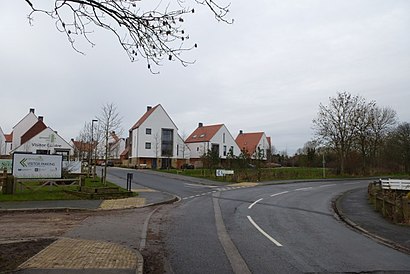
Derwenthorpe Address: Derwenthorpe, York YO10 3NS, UK street in Osbaldwick
Attractions near Derwenthorpe
Osbaldwick Lane,Derwenthorpe Super Sustainable Centre,Meadlands Mews,Derwenthorpe, York,Fifth Avenue (Yor),Badger Hill Shops, York,Archbishop Holgate's School, York,Tang Hall Explore Library,Tang Hall Lane,Tang Hall Clinic, York,Osbaldwick Link Road, York,Burnholme Sports Centre,No137,The Black Bull,David Lloyd,Tang Hall Library,Sizzling Pubs (The Black Bull),York Teaching Hospital NHS Foundation Trust,Amazon Counter-Post Office Bad Bargain Lane,Mossdale ResidenceHow to get to popular attractions in Osbaldwick with public transportation
The Green, Cottingham,Moor Allerton, Leeds,Parson Cross, Sheffield,Albion Street, Leeds,Asos, Little Houghton,The Cherry Tree (Wetherspoon), Huddersfield,Harehills, Leeds,Cottingley Towers, Leeds,Brighouse Bus Station, Halifax,B&Q Doncaster Distribution Centre (Redhouse), Brodsworth,Chapel Allerton Hospital, Leeds,Clifton Green, York,Thirsk Railway Station (THI), Thirsk,Valley Centertainment Tram Stop, Sheffield,Wadsley Bridge, Sheffield,Wetherby, Wetherby,Leeds Bradford Airport Industrial Estate,Hyde Park Corner, Leeds,Tesco, Hull,Calderdale Royal Hospital, HalifaxGet around Osbaldwick by public transport!
Travelling around Osbaldwick has never been so easy. See step by step directions as you travel to any attraction, street or major public transport station. View bus and train timetables, arrival times, service alerts and detailed routes on a map, so you know exactly how to get to anywhere in Osbaldwick.
When travelling to any destination around Osbaldwick use Moovit's Live Directions with Get Off Notifications to know exactly where and how far to walk, how long to wait for your line , and how many stops are left. Moovit will alert you when it’s time to get off — no need to constantly re-check whether yours is the next stop.
Wondering how to use public transport in Osbaldwick or how to pay for public transport in Osbaldwick? Moovit public transport app can help you navigate your way with public transport easily, and at minimum cost. It includes public transport fees, ticket prices, and costs. Looking for a map of Osbaldwick public transport lines? Moovit public transport app shows all public transport maps in Osbaldwick with all bus or train routes and stops on an interactive map.
Osbaldwick has 2 transport type(s), including: bus or train, operated by several transport agencies, including First Leeds, First South Yorkshire, First York, First West Yorkshire Ltd, Arriva Yorkshire, Stagecoach Yorkshire, National Rail, First Bradford, First Halifax, Calder Valley & Huddersfield, East Yorkshire, The Keighley Bus Company, South Yorkshire Future Tram, The Harrogate Bus Company, National Rail and TM Travel