Directions to Doolandella with public transportation
The following transport lines have routes that pass near Doolandella
How to get to Doolandella by bus?
Click on the bus route to see step by step directions with maps, line arrival times and updated time schedules.
Bus stations near Doolandella
- Skylark St Near Bittern St,2 min walk,
Train stations near Doolandella
- Richlands Station,43 min walk,
Bus routes to Doolandella
- 101,Richlands,
What are the nearest stations to Doolandella?
The nearest stations to Doolandella are:
- Skylark St Near Bittern St is 80 meters away, 2 min walk.
- Richlands Station is 3343 meters away, 43 min walk.
Which bus lines stop near Doolandella?
These bus lines stop near Doolandella: 100, 101.
What’s the nearest bus stop to Doolandella?
The nearest bus stop to Doolandella is Skylark St Near Bittern St. It’s a 2 min walk away.
What time is the first train to Doolandella?
The SPIP is the first train that goes to Doolandella. It stops nearby at 07:03.
What time is the last train to Doolandella?
The SPIP is the last train that goes to Doolandella. It stops nearby at 22:48.
What time is the first bus to Doolandella?
The 101 is the first bus that goes to Doolandella. It stops nearby at 07:37.
What time is the last bus to Doolandella?
The 101 is the last bus that goes to Doolandella. It stops nearby at 18:41.
See Doolandella on the map
Public Transportation to Doolandella
Wondering how to get to Doolandella, Australia? Moovit helps you find the best way to get to Doolandella with step-by-step directions from the nearest public transit station.
Moovit provides free maps and live directions to help you navigate through your city. View schedules, routes, timetables, and find out how long does it take to get to Doolandella in real time.
Looking for the nearest stop or station to Doolandella? Check out this list of stops closest to your destination: Skylark St Near Bittern St; Richlands Station.
Bus:100101Train:CABOREDCSPRISUNS
Want to see if there’s another route that gets you there at an earlier time? Moovit helps you find alternative routes or times. Get directions from and directions to Doolandella easily from the Moovit App or Website.
We make riding to Doolandella easy, which is why over 1.5 million users, including users in Brisbane, trust Moovit as the best app for public transit. You don’t need to download an individual bus app or train app, Moovit is your all-in-one transit app that helps you find the best bus time or train time available.
For information on prices of bus, costs and ride fares to Doolandella, please check the Moovit app.
Use the app to navigate to popular places including to the airport, hospital, stadium, grocery store, mall, coffee shop, school, college, and university.
Location: Brisbane
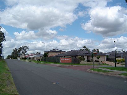
Doolandella is an outer western suburb in the City of Brisbane, Queensland, Australia. In the 2021 census, Doolandella had a population of 7,123 people.Wiki
Popular routes to Doolandella
Popular routes from Doolandella
Attractions near Doolandella
Blunder Rd Near Wallaroo Wy,Greenbelt Landscape Maintenance,Blunder Rd Near Crossacres St,Aplus Affordable Driving Lessons / Driving School,Pacific Fashion,Inala Vape Tobacco,Topsham,Innovate Mental Arithmetic Inala,Ingenia Rental Durack,Mary Chantal Mukarwe,Durack Musalla,Vouloir Lingerie,Avinotab African Food and Beauty Products,Durack State School,Harrison's Health & Beauty Pharmacy,Russell MacArthur Taekwondo & Hapkido,Inala X Ray,Australian International Islamic College,Inala Plaza Fast Photos,Department of Housinginala Housing Service CentreHow to get to popular attractions in Brisbane with public transportation
Toombul Shopping Centre, Nundah,Elanora State High School, Elanora,Griffith University Mount Gravatt Campus (Queensland Institute Of Business And Technology), Mount Gravatt,The Pines Shopping Centre, Elanora,Cultural Centre Platform 2, South Brisbane,Garden City Bus Depot, Upper Mount Gravatt,Brisbane, City,UQ Chancellors's Place, St Lucia,Peregian Beach,Logan Hyperdome, Shailer Park,Toombul Interchange, Nundah,Brisbane City Hall, City,Carindale Library, Carindale,Stafford Heights, Stafford Heights,Princess Alexandra Hospital, Woolloongabba,Kelvin Grove, Kelvin Grove,New Farm Park Ferry Terminal,Indooroopilly Library, Indooroopilly,Wynnum Plaza, Wynnum West,Queen Street, CityGet around Brisbane by public transport!
Travelling around Brisbane has never been so easy. See step by step directions as you travel to any attraction, street or major public transport station. View bus and train timetables, arrival times, service alerts and detailed routes on a map, so you know exactly how to get to anywhere in Brisbane.
When travelling to any destination around Brisbane use Moovit's Live Directions with Get Off Notifications to know exactly where and how far to walk, how long to wait for your line , and how many stops are left. Moovit will alert you when it’s time to get off — no need to constantly re-check whether yours is the next stop.
Wondering how to use public transport in Brisbane or how to pay for public transport in Brisbane? Moovit public transport app can help you navigate your way with public transport easily, and at minimum cost. It includes public transport fees, ticket prices, and costs. Looking for a map of Brisbane public transport lines? Moovit public transport app shows all public transport maps in Brisbane with all bus routes and stops on an interactive map.
Brisbane has 1 transport type(s), including: bus, operated by several transport agencies, including TransLink SEQ, TransLink, TransLink, TransLink, Christensens Bus and Coach, North Stradbroke Island Buses and Griffith Uni Intercampus bus