Dorking stop - Saturday schedule
| Line | Direction | Time |
|---|---|---|
| MILDMAY LINE | London Victoria | 06:44 |
| MILDMAY LINE | Dorking | 07:07 |
| SOUTH WESTERN RAILWAY | Dorking | 07:15 |
| MILDMAY LINE | London Victoria | 07:17 |
| SOUTH WESTERN RAILWAY | London Waterloo | 07:30 |
| MILDMAY LINE | Dorking | 07:39 |
| MILDMAY LINE | London Victoria | 07:44 |
| MILDMAY LINE | Dorking | 08:07 |
| SOUTH WESTERN RAILWAY | Dorking | 08:14 |
| MILDMAY LINE | London Victoria | 08:17 |
| SOUTH WESTERN RAILWAY | London Waterloo | 08:32 |
| MILDMAY LINE | Horsham | 08:40 |
| MILDMAY LINE | London Victoria | 08:43 |
| MILDMAY LINE | Dorking | 09:07 |
| SOUTH WESTERN RAILWAY | Dorking | 09:14 |
| MILDMAY LINE | London Victoria | 09:17 |
| SOUTH WESTERN RAILWAY | London Waterloo | 09:32 |
| MILDMAY LINE | Horsham | 09:40 |
| MILDMAY LINE | London Victoria | 09:43 |
| MILDMAY LINE | Dorking | 10:07 |
| SOUTH WESTERN RAILWAY | Dorking | 10:14 |
| MILDMAY LINE | London Victoria | 10:17 |
| SOUTH WESTERN RAILWAY | London Waterloo | 10:32 |
| MILDMAY LINE | Horsham | 10:40 |
| MILDMAY LINE | London Victoria | 10:43 |
Directions to Dorking stop with public transport
The following transport lines have routes that pass near Dorking
How to get to Dorking stop by bus?
Click on the bus route to see step by step directions with maps, line arrival times and updated time schedules.
How to get to Dorking stop by train?
Click on the train route to see step by step directions with maps, line arrival times and updated time schedules.
Bus stops near Dorking stop
- Dorking Railway Station, Dorking, 1 min walk,
- Dorking Railway Station (3), 1 min walk,
- Dorking Railway Station (B), 3 min walk,
- Dorking Deepdene, 4 min walk,
- Spital Heath, Pippbrook, 10 min walk,
Bus lines to Dorking stop
- 93, Horsham,
- 32, Strood Green,
- 32, Redhill,
- 22, Shere,
- 522, Newdigate,
- 465, Kingston,
- 21, Crawley,
- GREAT WESTERN RAILWAY, Bus Replacement: Guildford,
- GREAT WESTERN RAILWAY, Reading,
- 50, Strood Green,
- 433, Redhill,
What are the nearest stations to Dorking?
The nearest stations to Dorking are:
- Dorking Railway Station, Dorking is 4 meters away, 1 min walk.
- Dorking Railway Station (3) is 15 meters away, 1 min walk.
- Dorking Railway Station (B) is 151 meters away, 3 min walk.
- Dorking Deepdene is 251 meters away, 4 min walk.
- Spital Heath, Pippbrook is 726 meters away, 10 min walk.
Which bus lines stop near Dorking?
These bus lines stop near Dorking: 21, 32, 465.
Which train lines stop near Dorking?
These train lines stop near Dorking: GREAT WESTERN RAILWAY, MILDMAY LINE, SOUTH WESTERN RAILWAY.
What’s the nearest bus station to Dorking?
The nearest bus stations to Dorking are Dorking Railway Station, Dorking and Dorking Railway Station (3). The closest one is a 1 min walk away.
What time is the first train to Dorking?
The GREAT WESTERN RAILWAY is the first train that goes to Dorking. It stops nearby at 05:37.
What time is the last train to Dorking?
The GREAT WESTERN RAILWAY is the last train that goes to Dorking. It stops nearby at 00:37.
What time is the first bus to Dorking?
The 465 is the first bus that goes to Dorking. It stops nearby at 05:23.
What time is the last bus to Dorking?
The GREAT WESTERN RAILWAY is the last bus that goes to Dorking. It stops nearby at 01:20.
Dorking station
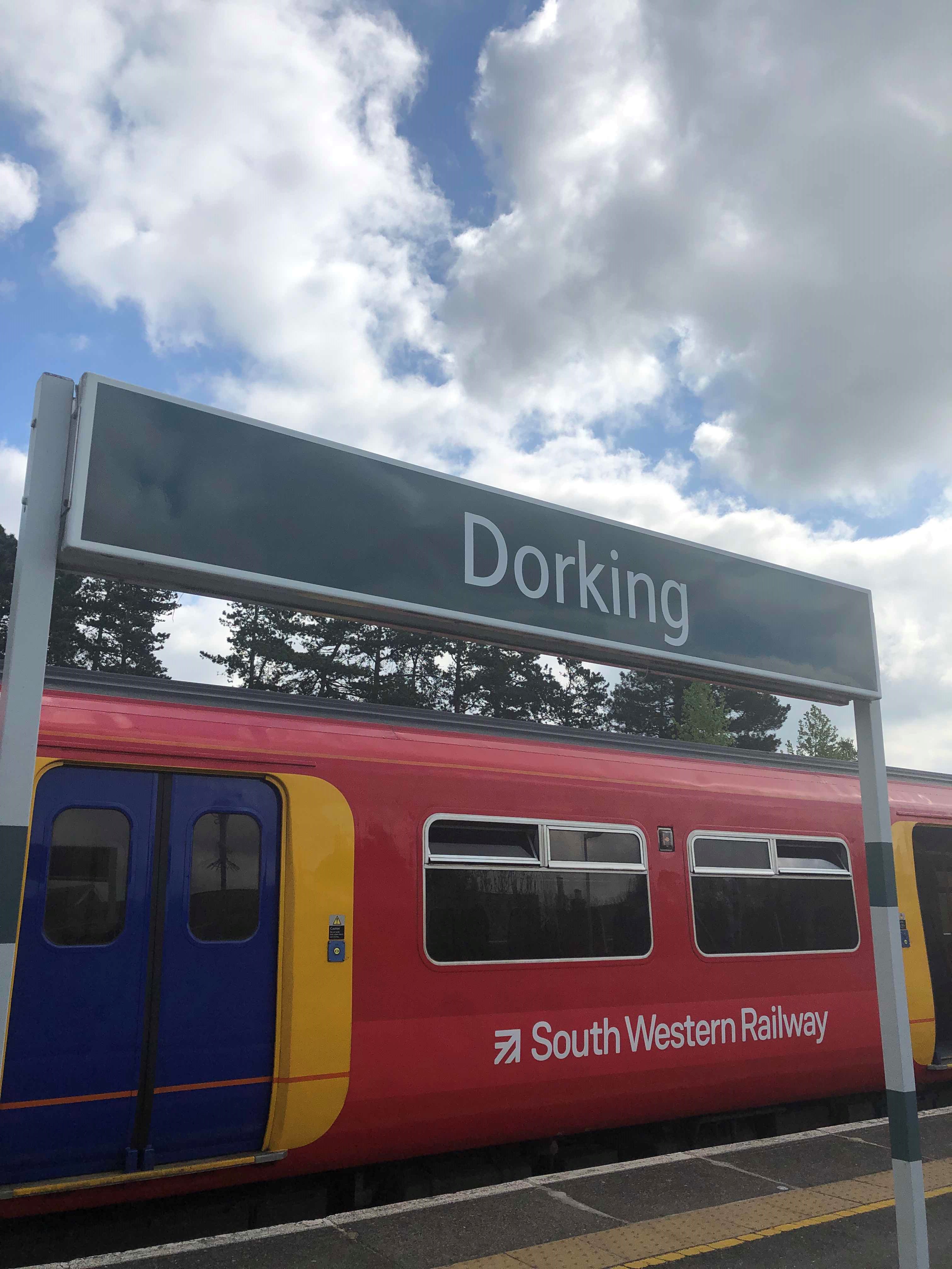 Taken by Anonymous
See Dorking stop on the map
Public transport to Dorking stop
Looking for directions to Dorking in Dorking, United Kingdom?
Download the Moovit App to find the current schedule and step-by-step directions for Bus or Train routes that pass through Dorking.
Looking for the nearest stops closest to Dorking ? Check out this list of closest stops to your destination: Dorking Railway Station; Dorking Railway Station (3); Dorking Railway Station (B); Dorking Deepdene; Spital Heath.
Bus: 21, 32, 465, 93, 22, 522, GREAT WESTERN RAILWAY, GREAT WESTERN RAILWAY, 50, 433.Train: GREAT WESTERN RAILWAY, MILDMAY LINE, SOUTH WESTERN RAILWAY.
We make riding on public transit to Dorking easy, which is why over 1.5 million users, including users in Dorking trust Moovit as the best app for public transit.
Use the app to navigate to popular places including to the airport, hospital, stadium, grocery store, mall, coffee shop, school, college, and university.
The stop has the following entrances: Parking Lot and Station Approach
The first line to this stop is MILDMAY LINE, at 06:44, and the last line is SOUTH WESTERN RAILWAY at 01:31.
station concourse, England, United Kingdom
This stop serves National Rail and National Rail’s lines
Popular routes from Dorking stop
Bus stops near Dorking stop
Popular public transport stations in Dorking
Get around Dorking by public transport!
Travelling around Dorking has never been so easy. See step by step directions as you travel to any attraction, street or major public transport station. View bus and train timetables, arrival times, service alerts and detailed routes on a map, so you know exactly how to get to anywhere in Dorking.
When travelling to any destination around Dorking use Moovit's Live Directions with Get Off Notifications to know exactly where and how far to walk, how long to wait for your line , and how many stops are left. Moovit will alert you when it’s time to get off — no need to constantly re-check whether yours is the next stop.
Wondering how to use public transport in Dorking or how to pay for public transport in Dorking? Moovit public transport app can help you navigate your way with public transport easily, and at minimum cost. It includes public transport fees, ticket prices, and costs. Looking for a map of Dorking public transport lines? Moovit public transport app shows all public transport maps in Dorking with all Bus, Train, Tube, Tramlink, River Bus and DLR routes and stops on an interactive map.
London has 6 transport type(s), including: Bus, Train, Tube, Tramlink, River Bus and DLR, operated by several transport agencies, including London Underground, London Buses, Transport for London, London Tramlink, National Rail, Bluestar, Berry's Coaches, Oxford Bus Company, Stagecoach West, Community First Wessex, Cresta Coaches, First Portsmouth, Fareham & Gosport, IFS Cloud Cable Car, FYTbus and Gosport-Portsmouth Ferry