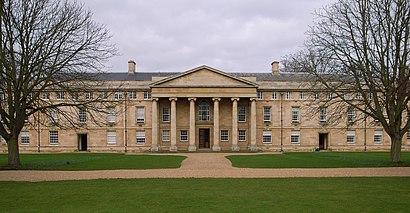
Downing College, Cambridge stop - Wednesday schedule
| Line | Direction | Time |
|---|---|---|
| 13A | Cambridge | 06:01 |
| 1 | Kings Hedges | 06:03 |
| 1 | Kings Hedges | 06:18 |
| A | St Ives | 06:29 |
| 1 | Kings Hedges | 06:33 |
| 3 | Cambridge | 06:42 |
| X3 | Huntingdon | 06:48 |
| A | St Ives | 06:49 |
| 1 | Kings Hedges | 06:50 |
| 3 | Cambridge | 06:57 |
| 13 | Cambridge | 07:02 |
| 7 | Cambridge | 07:07 |
| 7 | Cambridge | 07:07 |
| 7 | Cambridge | 07:07 |
| 1 | Kings Hedges | 07:08 |
| A | St Ives | 07:09 |
| 3 | Cambridge | 07:12 |
| 18 | Cambridge | 07:18 |
| 1 | Kings Hedges | 07:21 |
| 3 | Cambridge | 07:31 |
| 7 | Cambridge | 07:32 |
| 7 | Cambridge | 07:32 |
| 7 | Cambridge | 07:32 |
| A | St Ives | 07:33 |
| 1 | Kings Hedges | 07:34 |
Directions to Downing College, Cambridge stop (East Anglia) with public transport
The following transport lines have routes that pass near Downing College, Cambridge
How to get to Downing College, Cambridge stop by bus?
Click on the bus route to see step by step directions with maps, line arrival times and updated time schedules.
How to get to Downing College, Cambridge stop by train?
Click on the train route to see step by step directions with maps, line arrival times and updated time schedules.
Bus stops near Downing College, Cambridge stop in East Anglia
- Downing College, Cambridge, 1 min walk,
- Emmanuel Street, Cambridge, 1 min walk,
- St Andrew's Street, Cambridge, 2 min walk,
- The Busway Regent Street, Cambridge, 4 min walk,
- St Paul's Road, Cambridge, 5 min walk,
- The Busway Parkside, Cambridge, 10 min walk,
Bus lines to Downing College, Cambridge stop in East Anglia
- 1, Arbury - Fulbourn,
- X2, Huntingdon - Papworth Everard - Cambridge Biomedical Campus,
- 3, Fison Road - Cherry Hinton,
- PR3, Cambridge City Centre - Trumpington park&ride,
- X3, Cambridge - Papworth Everard - Huntingdon,
- PR4, Cambridge City Centre - Babraham Road park&ride,
- 7, Saffron Walden - Cambridge,
- 18, Cambridge - Cambourne - St Neots,
- 18A, Cambridge - Lower Cambourne,
- 26, Cambridge - Royston,
- 31, Cambridge - Fowlmere - Barley,
- 75, Cambridge - Orwell - Wrestlingworth,
- X75, Cambridge - Orwell,
- 132, Cambridge - Duxford - Saffron Walden,
- U1, Addenbrookes,
- U2, Girton,
- TOUR, Cambridge,
- A, Trumpington,
- B, Addenbrookes,
- 13, Little Wratting,
What are the nearest stations to Downing College, Cambridge?
The nearest stations to Downing College, Cambridge are:
- Downing College, Cambridge is 28 meters away, 1 min walk.
- Emmanuel Street, Cambridge is 55 meters away, 1 min walk.
- St Andrew's Street, Cambridge is 72 meters away, 2 min walk.
- The Busway Regent Street, Cambridge is 265 meters away, 4 min walk.
- St Paul's Road, Cambridge is 324 meters away, 5 min walk.
- The Busway Parkside, Cambridge is 704 meters away, 10 min walk.
Which bus lines stop near Downing College, Cambridge?
These bus lines stop near Downing College, Cambridge: 18, 3, 7, 75, A, PR5, X3.
Which train lines stop near Downing College, Cambridge?
These train lines stop near Downing College, Cambridge: GREAT NORTHERN, GREATER ANGLIA.
What’s the nearest bus station to Downing College, Cambridge in East Anglia?
The nearest bus stations to Downing College, Cambridge in East Anglia are Downing College, Cambridge and Emmanuel Street, Cambridge. The closest one is a 1 min walk away.
What time is the first bus to Downing College, Cambridge in East Anglia?
The A is the first bus that goes to Downing College, Cambridge in East Anglia. It stops nearby at 05:12.
What time is the last bus to Downing College, Cambridge in East Anglia?
The 1 is the last bus that goes to Downing College, Cambridge in East Anglia. It stops nearby at 00:32.
See Downing College, Cambridge stop, East Anglia, on the map
Public transport to Downing College, Cambridge stop (ID: CMBDAWJD) in East Anglia
Looking for directions to Downing College, Cambridge in East Anglia, United Kingdom?
Download the Moovit App to find the current schedule and step-by-step directions for Bus or Train routes that pass through Downing College, Cambridge.
Looking for the nearest stops closest to Downing College, Cambridge ? Check out this list of closest stops to your destination: Downing College; Emmanuel Street; St Andrew's Street; The Busway Regent Street; St Paul's Road; The Busway Parkside.
Bus: 18, 3, 7, 75, A, PR5, X3, 1, X2, PR3, U1, U2, TOUR, B, 13, 13A, X13, 16A, 2.Train: GREAT NORTHERN, GREATER ANGLIA.
We make riding on public transit to Downing College, Cambridge easy, which is why over 1.5 million users, including users in East Anglia trust Moovit as the best app for public transit.
Use the app to navigate to popular places including to the airport, hospital, stadium, grocery store, mall, coffee shop, school, college, and university.
Downing College, Cambridge stop’s code is CMBDAWJD
The first line to this stop is 13A, at 06:01, and the last line is 1 at 00:15.
70 Regent Street, Cambridge, England, United Kingdom
This stop serves A2B Bus and Coach, Whippet Coaches, Stagecoach East and C G Myall & Son’s lines
Bus stops near Downing College, Cambridge stop
Popular public transport stations in East Anglia
Get around East Anglia by public transport!
Travelling around East Anglia has never been so easy. See step by step directions as you travel to any attraction, street or major public transport station. View bus and train timetables, arrival times, service alerts and detailed routes on a map, so you know exactly how to get to anywhere in East Anglia.
When travelling to any destination around East Anglia use Moovit's Live Directions with Get Off Notifications to know exactly where and how far to walk, how long to wait for your line , and how many stops are left. Moovit will alert you when it’s time to get off — no need to constantly re-check whether yours is the next stop.
Wondering how to use public transport in East Anglia or how to pay for public transport in East Anglia? Moovit public transport app can help you navigate your way with public transport easily, and at minimum cost. It includes public transport fees, ticket prices, and costs. Looking for a map of East Anglia public transport lines? Moovit public transport app shows all public transport maps in East Anglia with all Bus, Train and Ferry routes and stops on an interactive map.
East Anglia has 3 transport type(s), including: Bus, Train and Ferry, operated by several transport agencies, including National Rail, Villager Minibus Sharnbrook, Swift Taxi Cabs, Fareline Bus & Coach Services, Borderbus, Star Cabs, C G Myall & Son, Whippet Coaches, Go Start Community Transport, High Suffolk Community Transport, Stagecoach East, Felix Taxis & Co., Flagfinders, A2B Bus and Coach and Coach Services