See Drill Hall Library, Gillingham, on the map
Directions to Drill Hall Library (Gillingham) with public transport
The following transport lines have routes that pass near Drill Hall Library
 Bus:
Bus: - Train:
How to get to Drill Hall Library by bus?
Click on the bus route to see step by step directions with maps, line arrival times and updated time schedules.
How to get to Drill Hall Library by train?
Click on the train route to see step by step directions with maps, line arrival times and updated time schedules.
Bus stations near Drill Hall Library in Gillingham
- New Kent Road, Chatham,5 min walk,
- St George's Centre, Chatham Maritime,7 min walk,
- Ship And Trades, Chatham Maritime,12 min walk,
- Mid Kent College, Gillingham,14 min walk,
Bus lines to Drill Hall Library in Gillingham
- 1,Gillingham,
- 116,Twydall,
- 2,Chatham Maritime,
- 100,Chatham,
- 100,St Marys Island,
- 151,Ham Hill,
- 170,Medway Valley Park,
- 200A,Chatham,
- 600,Lower Upnor,
- 173,St Marys Island,
- 200C,Chatham,
- 652,Strood,
- 671,Hoo St Werburgh,
- 101,Gillingham,
What are the nearest stations to Drill Hall Library?
The nearest stations to Drill Hall Library are:
- New Kent Road, Chatham is 336 meters away, 5 min walk.
- St George's Centre, Chatham Maritime is 485 meters away, 7 min walk.
- Ship And Trades, Chatham Maritime is 874 meters away, 12 min walk.
- Mid Kent College, Gillingham is 1003 meters away, 14 min walk.
Which bus lines stop near Drill Hall Library?
These bus lines stop near Drill Hall Library: 1, 100, 116, 170, 2, 700.
Which train lines stop near Drill Hall Library?
These train lines stop near Drill Hall Library: SOUTHEASTERN, THAMESLINK.
What’s the nearest bus stop to Drill Hall Library in Gillingham?
The nearest bus stop to Drill Hall Library in Gillingham is New Kent Road, Chatham. It’s a 5 min walk away.
What time is the first bus to Drill Hall Library in Gillingham?
The 100 is the first bus that goes to Drill Hall Library in Gillingham. It stops nearby at 06:48.
What time is the last bus to Drill Hall Library in Gillingham?
The 2 is the last bus that goes to Drill Hall Library in Gillingham. It stops nearby at 23:37.
See Drill Hall Library, Gillingham, on the map
Public Transit to Drill Hall Library in Gillingham
Wondering how to get to Drill Hall Library in Gillingham, United Kingdom? Moovit helps you find the best way to get to Drill Hall Library with step-by-step directions from the nearest public transit station.
Moovit provides free maps and live directions to help you navigate through your city. View schedules, routes, timetables, and find out how long does it take to get to Drill Hall Library in real time.
Looking for the nearest stop or station to Drill Hall Library? Check out this list of stops closest to your destination: New Kent Road; St George's Centre; Ship And Trades; Mid Kent College.
Bus:Train:
Want to see if there’s another route that gets you there at an earlier time? Moovit helps you find alternative routes or times. Get directions from and directions to Drill Hall Library easily from the Moovit App or Website.
We make riding to Drill Hall Library easy, which is why over 1.5 million users, including users in Gillingham, trust Moovit as the best app for public transit. You don’t need to download an individual bus app or train app, Moovit is your all-in-one transit app that helps you find the best bus time or train time available.
For information on prices of bus and train, costs and ride fares to Drill Hall Library, please check the Moovit app.
Use the app to navigate to popular places including to the airport, hospital, stadium, grocery store, mall, coffee shop, school, college, and university.
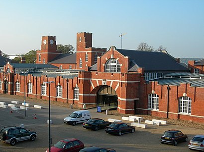
Drill Hall Library Address: North Road street in Gillingham
Attractions near Drill Hall Library
University Of Greenwich / University Of Kent Medway Campus,The Kent Institute of Clinical Hypnosis,Pilkington Building, Universities at Medway,Pilkington Cafe,The Deep End,Canterbury Christ Church University,Baxter Storey LTD (Vanquish Bank),Me4 4el,Central Avenue,ME4 4TB,University of Greenwich, Pembroke Building,Medway school of Pharmacy,University of Greenwich (Medway Campus),University of Kent Medway Campus Bus Stop,Me4 4gw,Central Avenue,University of Kent Medway Campus,Carers Relief Service,Clarke & Carter Kent,Merlin House - University of Greenwich at MedwayHow to get to popular attractions in Gillingham with public transportation
Brookwood Railway Station (BKO), Woking,Cricklewood, Cricklewood,Heathrow Terminal 3, Heathrow,Warner Bros. Studio Tour London - the Making Of Harry Potter, Three Rivers,Lewisham Shopping Centre, Lewisham,Stanmore, Stanmore,Asda, Park Royal,Thorpe Park, Runnymede,Hogwarts School, Abbots Langley,London Hilton Hotel, Mayfair,Brentwood, Brentwood,Westfield Stratford City, Stratford,Nuffield Health Newbury Fitness & Wellbeing Gym, Newbury (W Berks),Stratford Centre, Stratford,ESCP Europe London Campus, West Hampstead,Crouch End, Crouch End,Trafalgar Square, Charing Cross,O2 Academy Brixton, Brixton,Goring-on-Thames, South Oxfordshire,Cineworld, AshfordGet around Gillingham by public transport!
Travelling around Gillingham has never been so easy. See step by step directions as you travel to any attraction, street or major public transport station. View bus and train timetables, arrival times, service alerts and detailed routes on a map, so you know exactly how to get to anywhere in Gillingham.
When travelling to any destination around Gillingham use Moovit's Live Directions with Get Off Notifications to know exactly where and how far to walk, how long to wait for your line , and how many stops are left. Moovit will alert you when it’s time to get off — no need to constantly re-check whether yours is the next stop.
Wondering how to use public transport in Gillingham or how to pay for public transport in Gillingham? Moovit public transport app can help you navigate your way with public transport easily, and at minimum cost. It includes public transport fees, ticket prices, and costs. Looking for a map of Gillingham public transport lines? Moovit public transport app shows all public transport maps in Gillingham with all bus or train routes and stops on an interactive map.
Gillingham has 2 transport type(s), including: bus or train, operated by several transport agencies, including London Underground, London Buses, Transport for London, London Tramlink, Transport for London, National Rail, Bluestar, Berry's Coaches, Oxford Bus Company, Stagecoach West, Community First Wessex, Cresta Coaches, D & P Boat Hire, First Portsmouth, Fareham & Gosport and FYTbus