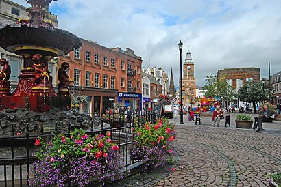
Dumfries stop - Tuesday schedule
| Line | Direction | Time |
|---|---|---|
| SCOTRAIL | Carlisle | 04:57 |
| SCOTRAIL | Carlisle | 06:04 |
| SCOTRAIL | Glasgow Central | 06:47 |
| SCOTRAIL | Carlisle | 07:15 |
| SCOTRAIL | Dumfries | 07:38 |
| SCOTRAIL | Carlisle | 07:58 |
| SCOTRAIL | Glasgow Central | 08:48 |
| SCOTRAIL | Carlisle | 08:59 |
| SCOTRAIL | Dumfries | 09:31 |
| SCOTRAIL | Carlisle | 10:02 |
| SCOTRAIL | Glasgow Central | 10:40 |
| SCOTRAIL | Carlisle | 11:05 |
| SCOTRAIL | Dumfries | 11:48 |
| SCOTRAIL | Carlisle | 11:59 |
| SCOTRAIL | Glasgow Central | 12:53 |
| SCOTRAIL | Carlisle | 13:01 |
| SCOTRAIL | Dumfries | 13:43 |
| SCOTRAIL | Carlisle | 13:58 |
| SCOTRAIL | Glasgow Central | 14:53 |
| SCOTRAIL | Carlisle | 15:03 |
| SCOTRAIL | Dumfries | 15:46 |
| SCOTRAIL | Carlisle | 16:02 |
| SCOTRAIL | Glasgow Central | 16:53 |
| SCOTRAIL | Carlisle | 17:07 |
| SCOTRAIL | Carlisle | 18:01 |
See Dumfries on the map
Directions to Dumfries with public transportation
The following transport lines have routes that pass near Dumfries
Bus:
Train:
How to get to Dumfries by Bus?
Click on the Bus route to see step by step directions with maps, line arrival times and updated time schedules.
How to get to Dumfries by Train?
Click on the Train route to see step by step directions with maps, line arrival times and updated time schedules.
Bus stations near Dumfries
- Lovers Walk, Dumfries,2 min walk,
- St Marys Industrial Estate, Dumfries,2 min walk,
- St Marys Street, Dumfries,3 min walk,
- Railway Station, Dumfries,3 min walk,
- Dg One A, Dumfries,5 min walk,
- Academy Street, Dumfries,7 min walk,
- Woodbank, Dumfries,9 min walk,
{{TRANSIT_TYPE}#Capitalized} routes to Dumfries
- 1,Dumfries, Great King Street - Dumfries, Great King Street,
- 2,Dumfries, Burns Statue - Dumfries, Burns Statue,
- 3,Great King Street, Dumfries - Georgetown, Dumfries,
- 4,Great King Street, Dumfries - Great King Street, Dumfries,
- 4A,Great King Street, Dumfries - Great King Street, Dumfries,
- 4A,Dumfries - Larchfield Barkerland Avenue,
- 6,Kingholm Quay circular - Dumfries,
- 6A,Dumfries - Glencaple and Caerlaverock circular,
- 81,Lockerbie, Industrial Estate - Dumfries, Whitesands,
- 115,Dumfries - Ae,
- 373,Dumfries - Shawhead,
- 14,Dumfries,
- 236,Burnhead,
- 381,Cargenbridge,
- 381,Dumfries,
- 202,Dumfries - Moniave or Thornhill,
- 500,Dumfries - Stranraer,
- 501,Dumfries - Castle Douglas,
- 502,Dumfries - Castle Douglas,
- 503,Dumfries - Castle Douglas,
What are the nearest stations to Dumfries?
The nearest stations to Dumfries are:
- Lovers Walk, Dumfries is 107 meters away, 2 min walk.
- St Marys Industrial Estate, Dumfries is 110 meters away, 2 min walk.
- St Marys Street, Dumfries is 171 meters away, 3 min walk.
- Railway Station, Dumfries is 176 meters away, 3 min walk.
- Dg One A, Dumfries is 371 meters away, 5 min walk.
- Academy Street, Dumfries is 505 meters away, 7 min walk.
- Woodbank, Dumfries is 649 meters away, 9 min walk.
Which Bus lines stop near Dumfries?
These Bus lines stop near Dumfries: 101A, 500, 503, 74, 81, X74
Which Train lines stop near Dumfries?
These Train lines stop near Dumfries: SCOTRAIL
What’s the nearest bus stop to Dumfries?
The nearest bus stops to Dumfries are Lovers Walk, Dumfries and St Marys Industrial Estate, Dumfries. The closest one is a 2 min walk away.
What time is the first Bus to Dumfries?
The 101A is the first Bus that goes to Dumfries. It stops nearby at 05:30.
What time is the last Bus to Dumfries?
The 381 is the last Bus that goes to Dumfries. It stops nearby at 23:37.
See Dumfries on the map

Public transport to Dumfries stop
Looking for directions to Dumfries in Dumfries, United Kingdom?
Download the Moovit App to find the current schedule and step-by-step directions for Bus or Train routes that pass through Dumfries.
Looking for the nearest stops closest to Dumfries ? Check out this list of closest stops to your destination: Lovers Walk; St Marys Industrial Estate; St Marys Street; Railway Station; Dg One A; Academy Street; Woodbank.
Bus:Train:
We make riding on public transit to Dumfries easy, which is why over 1.5 million users, including users in Dumfries trust Moovit as the best app for public transit.
Use the app to navigate to popular places including to the airport, hospital, stadium, grocery store, mall, coffee shop, school, college, and university.
The stop has the following entrances: Lovers Walk and St Mary's St
The first line to this stop is SCOTRAIL, at 04:57, and the last line is SCOTRAIL at 23:50.
Station Road, Dumfries, Scotland, United Kingdom
This stop serves National Rail’s lines
