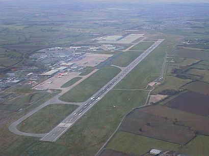
See EGNX, North West Leicestershire, on the map
Directions to EGNX (North West Leicestershire) with public transport
The following transport lines have routes that pass near EGNX
 Bus:
Bus:
How to get to EGNX by bus?
Click on the bus route to see step by step directions with maps, line arrival times and updated time schedules.
Bus stations near EGNX in North West Leicestershire
- Thistle Hotel, East Midlands Airport,6 min walk,
Bus lines to EGNX in North West Leicestershire
- SKYLINK DERBY,Leicester,
- SKYLINK NOTTINGHAM,Nottingham,
- 9,Outwoods,
- MY15,East Mids Airport,
What are the nearest stations to EGNX?
The nearest stations to EGNX are:
- Thistle Hotel, East Midlands Airport is 375 meters away, 6 min walk.
Which bus lines stop near EGNX?
These bus lines stop near EGNX: SKYLINK LEICESTER DERBY, SKYLINK NOTTINGHAM.
What’s the nearest bus stop to EGNX in North West Leicestershire?
The nearest bus stop to EGNX in North West Leicestershire is Thistle Hotel, East Midlands Airport. It’s a 6 min walk away.
See EGNX, North West Leicestershire, on the map
Public Transit to EGNX in North West Leicestershire
Wondering how to get to EGNX in North West Leicestershire, United Kingdom? Moovit helps you find the best way to get to EGNX with step-by-step directions from the nearest public transit station.
Moovit provides free maps and live directions to help you navigate through your city. View schedules, routes, timetables, and find out how long does it take to get to EGNX in real time.
Looking for the nearest stop or station to EGNX? Check out this list of stops closest to your destination: Thistle Hotel.
Bus:
Want to see if there’s another route that gets you there at an earlier time? Moovit helps you find alternative routes or times. Get directions from and directions to EGNX easily from the Moovit App or Website.
We make riding to EGNX easy, which is why over 1.5 million users, including users in North West Leicestershire, trust Moovit as the best app for public transit. You don’t need to download an individual bus app or train app, Moovit is your all-in-one transit app that helps you find the best bus time or train time available.
For information on prices of bus and train, costs and ride fares to EGNX, please check the Moovit app.
Use the app to navigate to popular places including to the airport, hospital, stadium, grocery store, mall, coffee shop, school, college, and university.
Location: North West Leicestershire, East Midlands
Attractions near EGNX
Port lotniczy East Midlands,東密德蘭機場,Aeropuerto de East Midlands,فرودگاه ایست میدلند,Lapangan Terbang East Midlands,Aéroport dEast Midlands,Midlands East,Восточный Мидландс,Αεροδρόμιο του Ιστ Μίντλαντς,1,Bandar Udara East Midlands,EMA,Flughafen East Midlands,Aeroporto delle Midlands Orientali,Фурудгоҳи оист мидлнд,East Midlandsin lentoasema,Sân bay East Midlands,Emergency Gate 4,Emergency Gate 5,Central ApronHow to get to popular attractions in North West Leicestershire with public transportation
The Carlton Centre, Lincoln,Chesterfield College, Chesterfield,Hilton Leicester Hotel, Blaby,Steep Hill, Lincoln,Northampton College, Northampton,Phoenix Park Tram Stop, Nottingham,Gedling, Gedling,Hotel ibis Chesterfield Centre, Chesterfield,Bagworth, Hinckley And Bosworth,Bassett Lowke Halls, Northampton,Caroline Chisholm School, Northampton,Tottle Bakery, Nottingham,Peterborough Marriott Hotel, Peterborough,Queens Medical Centre, Nottingham,Sinfin, Derby,Kettering General Hospital, Kettering,E.ON (Bilborough), Nottingham,Kingsway Hospital, Derby,The Mallard (Beefeater), Derby,The Watermill (Toby Carvery), AshfieldGet around North West Leicestershire by public transport!
Travelling around North West Leicestershire has never been so easy. See step by step directions as you travel to any attraction, street or major public transport station. View bus and train timetables, arrival times, service alerts and detailed routes on a map, so you know exactly how to get to anywhere in North West Leicestershire.
When travelling to any destination around North West Leicestershire use Moovit's Live Directions with Get Off Notifications to know exactly where and how far to walk, how long to wait for your line , and how many stops are left. Moovit will alert you when it’s time to get off — no need to constantly re-check whether yours is the next stop.
Wondering how to use public transport in North West Leicestershire or how to pay for public transport in North West Leicestershire? Moovit public transport app can help you navigate your way with public transport easily, and at minimum cost. It includes public transport fees, ticket prices, and costs. Looking for a map of North West Leicestershire public transport lines? Moovit public transport app shows all public transport maps in North West Leicestershire with all bus or train routes and stops on an interactive map.
North West Leicestershire has 2 transport type(s), including: bus or train, operated by several transport agencies, including National Rail, Ashbourne Community Transport, Delaine Buses, Arriva Midlands, Centrebus, Our Centre, Hulleys of Baslow, D & G Bus, Stagecoach East Midlands, North Lincolnshire Council, National Rail, Roberts Coaches, Lawson's of Corby, Hawkes Coaches and East Yorkshire