East Didsbury stop - Saturday schedule
| Line | Direction | Time |
|---|---|---|
| TRANSPORT FOR WALES | Manchester Airport | 05:01 |
| TRANSPORT FOR WALES | Llandudno | 05:32 |
| NORTHERN | Crewe | 05:35 |
| NORTHERN | Liverpool Lime Street | 05:41 |
| TRANSPORT FOR WALES | Manchester Airport | 06:04 |
| NORTHERN | Manchester Piccadilly | 06:15 |
| TRANSPORT FOR WALES | Llandudno | 06:32 |
| NORTHERN | Liverpool Lime Street | 06:41 |
| NORTHERN | Crewe | 06:47 |
| TRANSPORT FOR WALES | Manchester Airport | 07:03 |
| NORTHERN | Manchester Airport | 07:15 |
| NORTHERN | Manchester Piccadilly | 07:16 |
| TRANSPORT FOR WALES | Llandudno | 07:32 |
| NORTHERN | Liverpool Lime Street | 07:41 |
| NORTHERN | Crewe | 07:47 |
| TRANSPORT FOR WALES | Manchester Airport | 08:03 |
| NORTHERN | Manchester Airport | 08:15 |
| NORTHERN | Manchester Piccadilly | 08:16 |
| TRANSPORT FOR WALES | Llandudno | 08:32 |
| NORTHERN | Liverpool Lime Street | 08:41 |
| NORTHERN | Crewe | 08:47 |
| TRANSPORT FOR WALES | Manchester Airport | 09:02 |
| NORTHERN | Manchester Airport | 09:15 |
| NORTHERN | Manchester Piccadilly | 09:16 |
| TRANSPORT FOR WALES | Holyhead | 09:32 |
Directions to East Didsbury stop (Manchester) with public transport
The following transport lines have routes that pass near East Didsbury
 Bus: 142, 171, 23, 42, 42B.
- Train: NORTHERN, TRANSPORT FOR WALES.
- Light rail: PINK LINE.
How to get to East Didsbury stop by bus?
Click on the bus route to see step by step directions with maps, line arrival times and updated time schedules.
How to get to East Didsbury stop by train?
Click on the train route to see step by step directions with maps, line arrival times and updated time schedules.
How to get to East Didsbury stop by light rail?
Click on the light rail route to see step by step directions with maps, line arrival times and updated time schedules.
Bus stops near East Didsbury stop in Manchester
- East Didsbury Station, 1 min walk,
- Wilmslow Road, 2 min walk,
- Didsbury Cricket Club, 3 min walk,
- Parrs Wood, 3 min walk,
- Kingsway/Parrs Wood (F), 3 min walk,
Light Rail stations near East Didsbury station in Manchester
- East Didsbury (Manchester Metrolink), 49 min walk,
Bus lines to East Didsbury stop in Manchester
- 23, Trafford Park - Stockport,
- 42, Manchester - Stockport,
- 42A, Manchester -,
- 42B, Woodford - Manchester,
- 42C, Manchester - Handforth,
- 142, Manchester,
- 714, Manchester,
- 716, Manchester,
- 767, Manchester - Altrincham,
- 769, Altrincham - Manchester,
- 796, Sale - Manchester,
- 171, Newton Heath Terminus,
- 754, Didsbury Cricket Club,
- 50, Parrs Wood,
- 51, Mediacityuk,
- 371, Stockport Interchange,
- 730, Maida Street,
What are the nearest stations to East Didsbury?
The nearest stations to East Didsbury are:
- East Didsbury Station is 2 meters away, 1 min walk.
- Wilmslow Road is 109 meters away, 2 min walk.
- Didsbury Cricket Club is 183 meters away, 3 min walk.
- Parrs Wood is 206 meters away, 3 min walk.
- Kingsway/Parrs Wood (F) is 214 meters away, 3 min walk.
- East Didsbury (Manchester Metrolink) is 3786 meters away, 49 min walk.
Which bus lines stop near East Didsbury?
These bus lines stop near East Didsbury: 142, 171, 23, 42, 42B, 50.
Which train lines stop near East Didsbury?
These train lines stop near East Didsbury: NORTHERN, TRANSPORT FOR WALES.
Which light rail line stops near East Didsbury?
PINK LINE (East Didsbury (Manchester Metrolink))
What’s the nearest bus station to East Didsbury in Manchester?
The nearest bus station to East Didsbury in Manchester is East Didsbury Station. It’s a 1 min walk away.
What time is the first light rail to East Didsbury in Manchester?
The PINK LINE is the first light rail that goes to East Didsbury in Manchester. It stops nearby at 05:45.
What time is the last light rail to East Didsbury in Manchester?
The PINK LINE is the last light rail that goes to East Didsbury in Manchester. It stops nearby at 00:13.
What time is the first bus to East Didsbury in Manchester?
The 142 is the first bus that goes to East Didsbury in Manchester. It stops nearby at 03:01.
What time is the last bus to East Didsbury in Manchester?
The 142 is the last bus that goes to East Didsbury in Manchester. It stops nearby at 03:21.
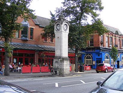
East Didsbury station
 Taken by Anonymous
See East Didsbury stop, Manchester, on the map
Public transport to East Didsbury stop in Manchester
Looking for directions to East Didsbury in Manchester, United Kingdom?
Download the Moovit App to find the current schedule and step-by-step directions for Train, Bus or Light rail routes that pass through East Didsbury.
Looking for the nearest stops closest to East Didsbury ? Check out this list of closest stops to your destination: East Didsbury Station; Wilmslow Road; Didsbury Cricket Club; Parrs Wood; Kingsway/Parrs Wood (F); East Didsbury (Manchester Metrolink).
Bus: 142, 171, 23, 42, 42B, 50, 42A, 42C, 754, 51, 371, 730.Train: NORTHERN, TRANSPORT FOR WALES.Light rail: PINK LINE.
We make riding on public transit to East Didsbury easy, which is why over 1.5 million users, including users in Manchester trust Moovit as the best app for public transit.
Use the app to navigate to popular places including to the airport, hospital, stadium, grocery store, mall, coffee shop, school, college, and university.
The stop has the following entrances: Wilmslow Rd
The first line to this stop is TRANSPORT FOR WALES, at 05:01, and the last line is NORTHERN at 00:35.
This stop serves National Rail and National Rail’s lines
- East Didsbury Station,
- Wilmslow Road,
- Didsbury Cricket Club,
- Parrs Wood,
- Kingsway/Parrs Wood (F)
Bus stops near East Didsbury stop
- East Didsbury (Manchester Metrolink)
Light Rail station near East Didsbury station
- Houldsworth Street,
- Deysbrook Lane,
- Upton Close,
- Bury Old Road,
- Arrowe Park Hospital,
- Comus Street,
- Gordale Garden Centre,
- Wigan Wallgate,
- St Helens Junction,
- Town Green,
- Levenshulme,
- Rock Ferry,
- Barden Lane,
- Hulton Heys Way,
- Brookfield Drive,
- Wharfside (Manchester Metrolink),
- Preston College,
- Penny Lane,
- Pomona (Manchester Metrolink),
- Overpool
Popular public transport stations in Manchester
Get around Manchester by public transport!
Travelling around Manchester has never been so easy. See step by step directions as you travel to any attraction, street or major public transport station. View bus and train timetables, arrival times, service alerts and detailed routes on a map, so you know exactly how to get to anywhere in Manchester.
When travelling to any destination around Manchester use Moovit's Live Directions with Get Off Notifications to know exactly where and how far to walk, how long to wait for your line , and how many stops are left. Moovit will alert you when it’s time to get off — no need to constantly re-check whether yours is the next stop.
Wondering how to use public transport in Manchester or how to pay for public transport in Manchester? Moovit public transport app can help you navigate your way with public transport easily, and at minimum cost. It includes public transport fees, ticket prices, and costs. Looking for a map of Manchester public transport lines? Moovit public transport app shows all public transport maps in Manchester with all Bus, Train, Light rail and Ferry routes and stops on an interactive map.
North West has 4 transport type(s), including: Bus, Train, Light rail and Ferry, operated by several transport agencies, including Arriva North West, Stagecoach Merseyside and South Lancashire, Stagecoach Cumbria and North Lancashire, First Halifax, National Express, Warrington's Own Buses, First Potteries, Rosso, Blackpool Transport, The Blackburn Bus Company, The Burnley Bus Company, Vision Bus, National Rail, Huyton Travel and Stotts Tours