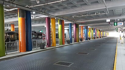
Directions to Elizabeth Quay Bus Station (Perth) with public transport
The following transport lines have routes that pass near Elizabeth Quay Bus Station
How to get to Elizabeth Quay Bus Station by bus?
Click on the bus route to see step by step directions with maps, line arrival times and updated time schedules.
How to get to Elizabeth Quay Bus Station by train?
Click on the train route to see step by step directions with maps, line arrival times and updated time schedules.
Bus stations near Elizabeth Quay Bus Station in Perth
- St Georges Tce Before William St Eastbound,1 min walk,
- William St Stand 7,2 min walk,
- William St Stand 2,3 min walk,
- St Georges Tce Mill Street Cat Id 21,7 min walk,
Train stations near Elizabeth Quay Bus Station in Perth
- Mciver Stn,13 min walk,
- Elizabeth Quay Stn,42 min walk,
- Perth Stn,46 min walk,
Ferry stations near Elizabeth Quay Bus Station in Perth
- Ferry Route Elizabeth Quay Jetty,50 min walk,
Bus lines to Elizabeth Quay Bus Station in Perth
- 24,East Perth,
- 27,East Perth,
- 32,Como,
- 33,Curtin Central Bus Stn,
- 39,Redcliffe Stn,
- 72,Wilson,
- 75,Canning Vale,
- 111,East Perth,
- 160,East Perth,
- 177,Bentley,
- 178,Bull Creek Stn,
- 179,Willetton,
- 270,High Wycombe Stn,
- 282,Kalamunda Bus Stn,
- 283,Kalamunda Bus Stn,
- 910,Fremantle Stn,
- 930,Carousel Shop Ctr / Albany Hwy,
- 935,Redcliffe Stn,
- 940,Redcliffe Stn,
- PERTH RED CAT,Ord St / Havelock St,
What are the nearest stations to Elizabeth Quay Bus Station?
The nearest stations to Elizabeth Quay Bus Station are:
- St Georges Tce Before William St Eastbound is 15 meters away, 1 min walk.
- William St Stand 2 is 115 meters away, 3 min walk.
- William St Stand 7 is 124 meters away, 2 min walk.
- St Georges Tce Mill Street Cat Id 21 is 479 meters away, 7 min walk.
- Mciver Stn is 930 meters away, 13 min walk.
- Elizabeth Quay Stn is 3229 meters away, 42 min walk.
- Perth Stn is 3546 meters away, 46 min walk.
- Ferry Route Elizabeth Quay Jetty is 3812 meters away, 50 min walk.
Which bus lines stop near Elizabeth Quay Bus Station?
These bus lines stop near Elizabeth Quay Bus Station: 111, 114, 115, 30, 950, 995.
Which train lines stop near Elizabeth Quay Bus Station?
These train lines stop near Elizabeth Quay Bus Station: JOONDALUP LINE, MANDURAH LINE.
What’s the nearest train station to Elizabeth Quay Bus Station in Perth?
The nearest train station to Elizabeth Quay Bus Station in Perth is Mciver Stn. It’s a 13 min walk away.
What’s the nearest bus stop to Elizabeth Quay Bus Station in Perth?
The nearest bus stop to Elizabeth Quay Bus Station in Perth is St Georges Tce Before William St Eastbound. It’s a 1 min walk away.
What time is the first train to Elizabeth Quay Bus Station in Perth?
The ARMADALE LINE is the first train that goes to Elizabeth Quay Bus Station in Perth. It stops nearby at 04:40.
What time is the last train to Elizabeth Quay Bus Station in Perth?
The ARMADALE LINE is the last train that goes to Elizabeth Quay Bus Station in Perth. It stops nearby at 00:27.
What time is the first bus to Elizabeth Quay Bus Station in Perth?
The 950 is the first bus that goes to Elizabeth Quay Bus Station in Perth. It stops nearby at 04:48.
What time is the last bus to Elizabeth Quay Bus Station in Perth?
The 950 is the last bus that goes to Elizabeth Quay Bus Station in Perth. It stops nearby at 01:11.
What time is the first ferry to Elizabeth Quay Bus Station in Perth?
The FERRY ROUTE ELIZABETH QUAY JETTY - FERRY ROUTE MENDS ST JETTY is the first ferry that goes to Elizabeth Quay Bus Station in Perth. It stops nearby at 06:30.
What time is the last ferry to Elizabeth Quay Bus Station in Perth?
The FERRY ROUTE ELIZABETH QUAY JETTY - FERRY ROUTE MENDS ST JETTY is the last ferry that goes to Elizabeth Quay Bus Station in Perth. It stops nearby at 21:25.
How much is the bus fare to Elizabeth Quay Bus Station?
The bus fare to Elizabeth Quay Bus Station costs about $2.07 - $4.59.
How much is the train fare to Elizabeth Quay Bus Station?
The train fare to Elizabeth Quay Bus Station costs about $2.07 - $4.59.
See Elizabeth Quay Bus Station, Perth, on the map
Public Transit to Elizabeth Quay Bus Station in Perth
Wondering how to get to Elizabeth Quay Bus Station in Perth, Australia? Moovit helps you find the best way to get to Elizabeth Quay Bus Station with step-by-step directions from the nearest public transit station.
Moovit provides free maps and live directions to help you navigate through your city. View schedules, routes, timetables, and find out how long does it take to get to Elizabeth Quay Bus Station in real time.
Looking for the nearest stop or station to Elizabeth Quay Bus Station? Check out this list of stops closest to your destination: St Georges Tce Before William St Eastbound; William St Stand 2; William St Stand 7; St Georges Tce Mill Street Cat Id 21; Mciver Stn; Elizabeth Quay Stn; Perth Stn; Ferry Route Elizabeth Quay Jetty.
Bus:11111411530950995242732333934Train:JOONDALUP LINEMANDURAH LINEAIRPORT LINEARMADALE LINEMIDLAND LINEYANCHEP LINEFREMANTLE LINEFerry:FERRY ROUTE ELIZABETH QUAY JETTY - FERRY ROUTE MENDS ST JETTY
Want to see if there’s another route that gets you there at an earlier time? Moovit helps you find alternative routes or times. Get directions from and directions to Elizabeth Quay Bus Station easily from the Moovit App or Website.
We make riding to Elizabeth Quay Bus Station easy, which is why over 1.5 million users, including users in Perth, trust Moovit as the best app for public transit. You don’t need to download an individual bus app or train app, Moovit is your all-in-one transit app that helps you find the best bus time or train time available.
For information on prices of bus and train, costs and ride fares to Elizabeth Quay Bus Station, please check the Moovit app.
Use the app to navigate to popular places including to the airport, hospital, stadium, grocery store, mall, coffee shop, school, college, and university.
Elizabeth Quay Bus Station Address: Road C street in Perth
Attractions near Elizabeth Quay Bus Station
C6,The Green Room,C4,Elizabeth Quay Busport,Freechoice Busport,D4,Riverside Theatre,Elizabeth Quay Bus Station B5,A7,Elizabeth Quay Bus Station,A1,Perth Convention & Exhibition Centre,South West Coachlines(SWCL),Busport Lotteries & Newsagency,Perth Convention and Exhibition Centre,Westralia Square,Bellevue Ballroom, Perth Convention & Exhibition Centre,Bellevue Ballroom,Silver Sponge,Lighthouse CapitalHow to get to popular attractions in Perth with public transportation
Miss Maud, Perth,IKEA Restaurant, Innaloo,The Shorehouse, Swanbourne,Northbridge, Northbridge,Balmoral Hotel, East Victoria Park,Durty Nelly's Irish Pub, Perth,119 Vickery House, Bentley,Baldivis, Baldivis,Rosalie Park, Nedlands,Wolf Lane, Perth,Tafe - Thornlie Campus, Thornlie,Glendalough, Glendalough,Comet Bay College, Secret Harbour,Shoalwater Bay, Shoalwater,Albion Hotel, Cottesloe,Matilda Bay Restaurant, Crawley,Coco's Restaurant & Bar, South Perth,Riverton, Riverton,Good Fortune Roast Duck House, East Victoria Park,Waikiki Village Shopping Centre, WaikikiGet around Perth by public transport!
Travelling around Perth has never been so easy. See step by step directions as you travel to any attraction, street or major public transport station. View bus and train timetables, arrival times, service alerts and detailed routes on a map, so you know exactly how to get to anywhere in Perth.
When travelling to any destination around Perth use Moovit's Live Directions with Get Off Notifications to know exactly where and how far to walk, how long to wait for your line , and how many stops are left. Moovit will alert you when it’s time to get off — no need to constantly re-check whether yours is the next stop.
Wondering how to use public transport in Perth or how to pay for public transport in Perth? Moovit public transport app can help you navigate your way with public transport easily, and at minimum cost. It includes public transport fees, ticket prices, and costs. Looking for a map of Perth public transport lines? Moovit public transport app shows all public transport maps in Perth with all bus or train routes and stops on an interactive map.
Perth has 2 transport type(s), including: bus or train, operated by several transport agencies, including Transperth Rail, Transwa, Transperth Ferry, Transperth, TransBusselton, TransAlbany, TransGoldfields, TransEsperance, TransGeraldton, TransCarnarvon, TransHedland, TransKarratha, Transwa, TransBunbury and Mandurah Bus Charter