See Emmanuel United reformed Church, Cambridge, on the map
Directions to Emmanuel United reformed Church (Cambridge) with public transport
The following transport lines have routes that pass near Emmanuel United reformed Church
 Bus:
Bus:
How to get to Emmanuel United reformed Church by bus?
Click on the bus route to see step by step directions with maps, line arrival times and updated time schedules.
Bus stations near Emmanuel United reformed Church in Cambridge
- Brookside, Cambridge,2 min walk,
- Fitzwilliam Museum, Cambridge,5 min walk,
- The Busway Regent Street, Cambridge,8 min walk,
- St Paul's Road, Cambridge,9 min walk,
- Downing College, Cambridge,9 min walk,
Bus lines to Emmanuel United reformed Church in Cambridge
- 18,St Neots,
- 26,Cambridge,
- 75,Orwell,
- TOUR,Silver Street - Silver Street,
- U1,Eddington - West Cambridge - Addenbrookes Hospital,
- U2,Eddington - West Cambridge - Addenbrookes,
- PR3,Cambridge City Centre - Trumpington park&ride,
- A,Trumpington,
- B,Cambridge,
- 1,Arbury - Fulbourn,
- 3,Fison Road - Cherry Hinton,
- X3,Cambridge - Papworth Everard - Huntingdon,
- PR4,Cambridge City Centre - Babraham Road park&ride,
- 7,Saffron Walden - Cambridge,
- 13,Cambridge - Haverhill,
- 13A,Cambridge - Haverhill,
- X13,Cambridge - Haverhill,
- 16A,Gt Thurlow - Cambridge,
- 31,Cambridge - Fowlmere - Barley,
- 132,Cambridge - Duxford - Saffron Walden,
What are the nearest stations to Emmanuel United reformed Church?
The nearest stations to Emmanuel United reformed Church are:
- Brookside, Cambridge is 132 meters away, 2 min walk.
- Fitzwilliam Museum, Cambridge is 279 meters away, 5 min walk.
- The Busway Regent Street, Cambridge is 569 meters away, 8 min walk.
- St Paul's Road, Cambridge is 661 meters away, 9 min walk.
- Downing College, Cambridge is 680 meters away, 9 min walk.
Which bus lines stop near Emmanuel United reformed Church?
These bus lines stop near Emmanuel United reformed Church: 18, 31, X75.
What’s the nearest bus stop to Emmanuel United reformed Church in Cambridge?
The nearest bus stop to Emmanuel United reformed Church in Cambridge is Brookside, Cambridge. It’s a 2 min walk away.
See Emmanuel United reformed Church, Cambridge, on the map
Public Transit to Emmanuel United reformed Church in Cambridge
Wondering how to get to Emmanuel United reformed Church in Cambridge, United Kingdom? Moovit helps you find the best way to get to Emmanuel United reformed Church with step-by-step directions from the nearest public transit station.
Moovit provides free maps and live directions to help you navigate through your city. View schedules, routes, timetables, and find out how long does it take to get to Emmanuel United reformed Church in real time.
Looking for the nearest stop or station to Emmanuel United reformed Church? Check out this list of stops closest to your destination: Brookside; Fitzwilliam Museum; The Busway Regent Street; St Paul's Road; Downing College.
Bus:
Want to see if there’s another route that gets you there at an earlier time? Moovit helps you find alternative routes or times. Get directions from and directions to Emmanuel United reformed Church easily from the Moovit App or Website.
We make riding to Emmanuel United reformed Church easy, which is why over 1.5 million users, including users in Cambridge, trust Moovit as the best app for public transit. You don’t need to download an individual bus app or train app, Moovit is your all-in-one transit app that helps you find the best bus time or train time available.
For information on prices of bus, costs and ride fares to Emmanuel United reformed Church, please check the Moovit app.
Use the app to navigate to popular places including to the airport, hospital, stadium, grocery store, mall, coffee shop, school, college, and university.
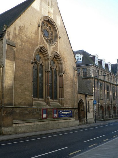
Emmanuel United reformed Church Address: 3 Trumpington Street Cambridge Cambridge CB2 1 street in Cambridge
Attractions near Emmanuel United reformed Church
Zoyan,Trumpington Street Dental Practice,Trumpington Street Post Office,Short Stay Rooms,Cambridge University Eco Racing,Cambridge University Student's Union,Browns Restaurant (Cambridge) Ltd.,East Anglia Property and Garden Maintenance Services,Downing Street Cambridge,Resource Extraction Monitoring Organisation,The Wellcome Trust / Cancer Research Uk Gurdon Institute,James Dyson Building,Swarco eConnect,Cb2 1qq,65 Lensfield Road,Tall Trees,Spread Eagle,Genestack,Old Addenbrooke's Site (University Of Cambridge),Hotel Du Vin & BistroHow to get to popular attractions in Cambridge with public transportation
Newnham College, Cambridge,Banham, Breckland,Breydon Waters Holiday Park, Great Yarmouth,RAF Mildenhall Child Development Programs (CDC), Forest Heath,Premier Inn Kings Lynn, King'S Lynn And West Norfolk,The Waterman, Cambridge,Salthouse Harbour Hotel, Ipswich,Holiday Inn Norwich - North, Norwich,Burwash Manor, South Cambridgeshire,Spire Cambridge Lea Hospital, South Cambridgeshire,One Stop Stores Ltd, Cambridge,Our Lady and the English Martyrs Church, Cambridge,Hunstanton,Holiday Inn Ipswich - Orwell, Ipswich,Lammas Land, Cambridge,Aldi, Norwich,Outwell, King'S Lynn And West Norfolk,Mid Suffolk Leisure Centre, Mid Suffolk,Gislingham, Mid Suffolk,Shrine of Our Lady of Walsingham, North NorfolkGet around Cambridge by public transport!
Travelling around Cambridge has never been so easy. See step by step directions as you travel to any attraction, street or major public transport station. View bus and train timetables, arrival times, service alerts and detailed routes on a map, so you know exactly how to get to anywhere in Cambridge.
When travelling to any destination around Cambridge use Moovit's Live Directions with Get Off Notifications to know exactly where and how far to walk, how long to wait for your line , and how many stops are left. Moovit will alert you when it’s time to get off — no need to constantly re-check whether yours is the next stop.
Wondering how to use public transport in Cambridge or how to pay for public transport in Cambridge? Moovit public transport app can help you navigate your way with public transport easily, and at minimum cost. It includes public transport fees, ticket prices, and costs. Looking for a map of Cambridge public transport lines? Moovit public transport app shows all public transport maps in Cambridge with all bus routes and stops on an interactive map.
Cambridge has 1 transport type(s), including: bus, operated by several transport agencies, including National Rail, Ambassador Travel, Harwich Harbour Ferry, Stephensons of Essex, Villager Minibus Sharnbrook, The Voluntary Network, Dews Coaches, Lord's Travel, Felixstowe Ferry Boat Yard, Hadleigh Community Transport, Beestons, Fenland Association for Community Transport, First Norfolk & Suffolk, National Rail and Mulleys Motorways