Euston Square Station (P) stop - Wednesday schedule
| Line | Direction | Time |
|---|---|---|
| N5 | Trafalgar Square | 03:03 |
| N253 | Tottenham Court Road | 03:11 |
| N20 | Trafalgar Square | 03:15 |
| N73 | Oxford Circus | 03:17 |
| 390 | Victoria | 03:27 |
| N5 | Trafalgar Square | 03:33 |
| N253 | Tottenham Court Road | 03:41 |
| N20 | Trafalgar Square | 03:45 |
| N73 | Oxford Circus | 03:47 |
| 390 | Victoria | 03:57 |
| N5 | Trafalgar Square | 04:03 |
| N253 | Tottenham Court Road | 04:11 |
| N20 | Trafalgar Square | 04:15 |
| N73 | Oxford Circus | 04:17 |
| 390 | Victoria | 04:27 |
| N5 | Trafalgar Square | 04:33 |
| N253 | Tottenham Court Road | 04:41 |
| N20 | Trafalgar Square | 04:45 |
| N73 | Oxford Circus | 04:47 |
| 390 | Victoria | 04:57 |
| N5 | Trafalgar Square | 05:03 |
| N253 | Tottenham Court Road | 05:11 |
| N20 | Trafalgar Square | 05:15 |
| 390 | Victoria | 05:17 |
| N73 | Oxford Circus | 05:17 |
Directions to Euston Square Station (P) (Somers Town) with public transport
The following transport lines have routes that pass near Euston Square Station (P)
How to get to Euston Square Station (P) by bus?
Click on the bus route to see step by step directions with maps, line arrival times and updated time schedules.
How to get to Euston Square Station (P) by train?
Click on the train route to see step by step directions with maps, line arrival times and updated time schedules.
How to get to Euston Square Station (P) by Tube?
Click on the Tube route to see step by step directions with maps, line arrival times and updated time schedules.
Tube stations near Euston Square Station (P) in Somers Town
- Euston Square, 1 min walk,
- Warren Street, 4 min walk,
Bus stops near Euston Square Station (P) in Somers Town
- University Coll Hosp / Warren St Stn (W), 2 min walk,
- University College Hospital / Euston Rd, 2 min walk,
- Euston Square Station (Q), 3 min walk,
- Euston Road, 4 min walk,
- Euston Bus Station (G), 5 min walk,
- Euston Station, 6 min walk,
Train stations near Euston Square Station (P) in Somers Town
- Euston Station, 4 min walk,
Bus lines to Euston Square Station (P) in Somers Town
- N5, Trafalgar Square,
- 18, Euston,
- N20, Barnet Church,
- 30, Hackney Wick,
- 73, Stoke Newington,
- N73, Oxford Circus,
- 205, Paddington,
- 390, Victoria,
- 134, Warren Street,
- N253, Aldgate,
- 24, Hampstead Heath - Pimlico,
- 27, Chalk Farm - Hammersmith Grove,
- N27, Chalk Farm - Hammersmith,
- 29, Trafalgar Square - Wood Green,
- N29, Trafalgar Square - Enfield,
- N279, Trafalgar Square - Waltham Cross,
- 253, Hackney Central,
- 91, Crouch End,
- N91, Cockfosters,
What are the nearest stations to Euston Square Station (P)?
The nearest stations to Euston Square Station (P) are:
- Euston Square is 2 meters away, 1 min walk.
- University Coll Hosp / Warren St Stn (W) is 110 meters away, 2 min walk.
- University College Hospital / Euston Rd is 140 meters away, 2 min walk.
- Euston Square Station (Q) is 198 meters away, 3 min walk.
- Warren Street is 230 meters away, 4 min walk.
- Euston Road is 253 meters away, 4 min walk.
- Euston Station is 259 meters away, 4 min walk.
- Euston Bus Station (G) is 369 meters away, 5 min walk.
Which bus lines stop near Euston Square Station (P)?
These bus lines stop near Euston Square Station (P): 134, 18, 27, 29, 30, 68, 91.
Which train lines stop near Euston Square Station (P)?
These train lines stop near Euston Square Station (P): ELIZABETH, GREAT NORTHERN, OVERGROUND, THAMESLINK.
Which Tube lines stop near Euston Square Station (P)?
These Tube lines stop near Euston Square Station (P): CIRCLE, HAMMERSMITH & CITY, METROPOLITAN, NORTHERN, VICTORIA.
What’s the nearest Tube station to Euston Square Station (P) in Somers Town?
The nearest Tube station to Euston Square Station (P) in Somers Town is Euston Square. It’s a 1 min walk away.
What’s the nearest train station to Euston Square Station (P) in Somers Town?
The nearest train station to Euston Square Station (P) in Somers Town is Euston Station. It’s a 4 min walk away.
What’s the nearest bus stop to Euston Square Station (P) in Somers Town?
The nearest bus stops to Euston Square Station (P) in Somers Town are University Coll Hosp / Warren St Stn (W) and University College Hospital / Euston Rd. The closest one is a 2 min walk away.
What time is the first Tube to Euston Square Station (P) in Somers Town?
The VICTORIA is the first Tube that goes to Euston Square Station (P) in Somers Town. It stops nearby at 03:16.
What time is the last Tube to Euston Square Station (P) in Somers Town?
The CIRCLE is the last Tube that goes to Euston Square Station (P) in Somers Town. It stops nearby at 00:52.
What time is the first train to Euston Square Station (P) in Somers Town?
The OVERGROUND is the first train that goes to Euston Square Station (P) in Somers Town. It stops nearby at 06:45.
What time is the last train to Euston Square Station (P) in Somers Town?
The CALEDONIAN SLEEPER is the last train that goes to Euston Square Station (P) in Somers Town. It stops nearby at 08:00.
What time is the first bus to Euston Square Station (P) in Somers Town?
The 134 is the first bus that goes to Euston Square Station (P) in Somers Town. It stops nearby at 03:00.
What time is the last bus to Euston Square Station (P) in Somers Town?
The N279 is the last bus that goes to Euston Square Station (P) in Somers Town. It stops nearby at 03:59.
See Euston Square Station (P), Somers Town, on the map
Public transport to Euston Square Station (P) stop (ID: P) in Somers Town
Looking for directions to Euston Square Station (P) in Somers Town, United Kingdom?
Download the Moovit App to find the current schedule and step-by-step directions for Tube, Bus, Train or DLR routes that pass through Euston Square Station (P).
Looking for the nearest stops closest to Euston Square Station (P) ? Check out this list of closest stops to your destination: Euston Square; University Coll Hosp / Warren St Stn (W); University College Hospital / Euston Rd; Euston Square Station (Q); Warren Street; Euston Road; Euston Station; Euston Bus Station (G).
Bus: 134, 18, 27, 29, 30, 68, 91, N5, N20, 73, N253.Train: ELIZABETH, GREAT NORTHERN, OVERGROUND, THAMESLINK, AVANTI WEST COAST, CALEDONIAN SLEEPER, WEST MIDLANDS RAILWAY, WEST MIDLANDS RAILWAY.Tube: CIRCLE, HAMMERSMITH & CITY, METROPOLITAN, NORTHERN, VICTORIA.
We make riding on public transit to Euston Square Station (P) easy, which is why over 1.5 million users, including users in Somers Town trust Moovit as the best app for public transit.
Use the app to navigate to popular places including to the airport, hospital, stadium, grocery store, mall, coffee shop, school, college, and university.
Euston Square Station (P) stop’s code is P
The first line to this stop is N5, at 03:03, and the last line is 390 at 02:57.
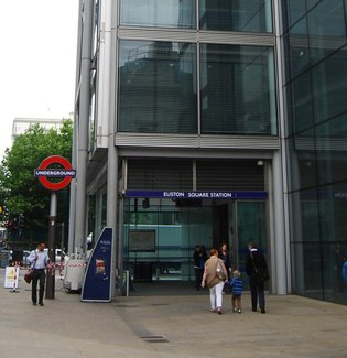
215 Euston Road, London, England, United Kingdom
This stop serves London Buses’s lines
Bus stops near Euston Square Station (P)
University Coll Hosp / Warren St Stn (W),University College Hospital / Euston Rd,Euston Square Station (Q),Euston Road,Euston Bus Station (G),Euston StationTrain station near Euston Square Station (P)
Euston StationPopular public transport stations in Somers Town
Putney Rail Station,Royal Surrey Hospital, Guildford,New Cross,G Live, Guildford,Queensway,Cheshunt,North Harrow,Sydenham,Osterley Station (P),Bayswater,Hatfield,St Richards Hospital Entrance, Chichester,Lord's Cricket Ground (K),Hainault Health Centre (U),Liverpool Street Underground,Loughborough Junction,Stratford Library (R),Wandsworth Town,Gipsy Hill,York StreetGet around London by public transport!
Travelling around London has never been so easy. See step by step directions as you travel to any attraction, street or major public transport station. View bus and train timetables, arrival times, service alerts and detailed routes on a map, so you know exactly how to get to anywhere in London.
When travelling to any destination around London use Moovit's Live Directions with Get Off Notifications to know exactly where and how far to walk, how long to wait for your line , and how many stops are left. Moovit will alert you when it’s time to get off — no need to constantly re-check whether yours is the next stop.
Wondering how to use public transport in London or how to pay for public transport in London? Moovit public transport app can help you navigate your way with public transport easily, and at minimum cost. It includes public transport fees, ticket prices, and costs. Looking for a map of London public transport lines? Moovit public transport app shows all public transport maps in London with all Bus, Train, Tube, Tramlink, River Bus and DLR routes and stops on an interactive map.
London has 6 transport type(s), including: Bus, Train, Tube, Tramlink, River Bus and DLR, operated by several transport agencies, including London Underground, London Buses, Transport for London, London Tramlink, National Rail, Bluestar, Berry's Coaches, Oxford Bus Company, Stagecoach West, Community First Wessex, Cresta Coaches, D & P Boat Hire, First Portsmouth, Fareham & Gosport, FYTbus, IFS Cloud Cable Car