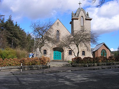
See Fairmilehead, Edinburgh, on the map
Directions to Fairmilehead (Edinburgh) with public transport
The following transport lines have routes that pass near Fairmilehead
Bus:
How to get to Fairmilehead by Bus?
Click on the Bus route to see step by step directions with maps, line arrival times and updated time schedules.
Bus stations near Fairmilehead in Edinburgh
- Caiystane Crescent, Fairmilehead,1 min walk,
- Fairmilehead Crossroads, Fairmilehead,5 min walk,
Bus lines to Fairmilehead in Edinburgh
- 11,Broughton,
- N11,Morningside,
- 15,Fairmilehead,
- 101,Biggar,
- 101A,Edinburgh,
- 102,Dumfries,
- 4,Musselburgh,
- 400,Newcraighall,
- N400,Edinburgh Airport,
What are the nearest stations to Fairmilehead?
The nearest stations to Fairmilehead are:
- Caiystane Crescent, Fairmilehead is 30 meters away, 1 min walk.
- Fairmilehead Crossroads, Fairmilehead is 302 meters away, 5 min walk.
Which Bus lines stop near Fairmilehead?
These Bus lines stop near Fairmilehead: 11, 400
What’s the nearest bus stop to Fairmilehead in Edinburgh?
The nearest bus stop to Fairmilehead in Edinburgh is Caiystane Crescent, Fairmilehead. It’s a 1 min walk away.
What time is the first Bus to Fairmilehead in Edinburgh?
The N400 is the first Bus that goes to Fairmilehead in Edinburgh. It stops nearby at 03:12.
What time is the last Bus to Fairmilehead in Edinburgh?
The N11 is the last Bus that goes to Fairmilehead in Edinburgh. It stops nearby at 03:18.
See Fairmilehead, Edinburgh, on the map

Public Transit to Fairmilehead in Edinburgh
Wondering how to get to Fairmilehead in Edinburgh, United Kingdom? Moovit helps you find the best way to get to Fairmilehead with step-by-step directions from the nearest public transit station.
Moovit provides free maps and live directions to help you navigate through your city. View schedules, routes, timetables, and find out how long does it take to get to Fairmilehead in real time.
Looking for the nearest stop or station to Fairmilehead? Check out this list of stops closest to your destination: Caiystane Crescent; Fairmilehead Crossroads.
Bus:
Want to see if there’s another route that gets you there at an earlier time? Moovit helps you find alternative routes or times. Get directions from and directions to Fairmilehead easily from the Moovit App or Website.
We make riding to Fairmilehead easy, which is why over 1.5 million users, including users in Edinburgh, trust Moovit as the best app for public transit. You don’t need to download an individual bus app or train app, Moovit is your all-in-one transit app that helps you find the best bus time or train time available.
For information on prices of Bus, costs and ride fares to Fairmilehead, please check the Moovit app.
Use the app to navigate to popular places including to the airport, hospital, stadium, grocery store, mall, coffee shop, school, college, and university.
Fairmilehead Address: Buckstone Terrace street in Edinburgh

Attractions near Fairmilehead
- Buckstone Terrace
- Scottish Water - Fairmilehead
- Charwood
- Biggar Road
- Loctay Limited
- NatWest
- Pentland Community Centre
- Ak Express Convenience Store
- Tru Trends
- Monere
- Neo Green Marketing
- South Morningside Primary Nursery Class
- Exclusive Hypnotherapy
- Inflate A Community
- Rent Gym Equipment
- DMM Property
- Boldspace Consulting
- Edinburgh Martial Arts Academy
- Buckstone Waterboard Field
- Paul Thomson Electrical Services
How to get to popular attractions in Edinburgh with public transportation
- Asda, Aberdeen
- Royal Infirmary Of Edinburgh (Little France), City Of Edinburgh
- The Queen Elizabeth University Hospital Campus, Glasgow
- Partick Railway Station (PTK), Glasgow
- Glasgow Airport (GLA), Paisley
- Asda, Edinburgh
- Aberdeen International Airport (ABZ), Dyce
- Jurys Inn Glasgow, Glasgow
- Glasgow Central Railway Station (GLC), Glasgow
- Asda, Glasgow
- St Andrews University Library, St Andrews
- Halbeath Park & Ride, Fife
- Edinburgh Christmas Market, Edinburgh
- Edinburgh Airport (EDI), Ratho Station
- Perth Railway Station (PTH), Perth
- Peebles, Peebles
- McEwan Square, Edinburgh
- The Shore, Edinburgh
- The Three Sisters, Edinburgh
- The Standing Order (Wetherspoon), Edinburgh