Directions to Farrer Road (Northwest) with public transport
The following transport lines have routes that pass near Farrer Road
How to get to Farrer Road by bus?
Click on the bus route to see step by step directions with maps, line arrival times and updated time schedules.
How to get to Farrer Road by metro?
Click on the metro route to see step by step directions with maps, line arrival times and updated time schedules.
Metro stations near Farrer Road in Northwest
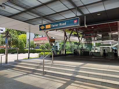
- Farrer Road (CC20), 1 min walk,
- Botanic Gardens (CC19|DT9), 14 min walk,
- Napier (Te12), 34 min walk,
Bus stops near Farrer Road in Northwest
- Farrer Rd - Farrer Rd Mkt (11101), 3 min walk,
- Bt Timah Rd - Bef Crown Ctr (41031), 13 min walk,
- Holland Rd - Sommerville Pk (11229), 14 min walk,
Bus lines to Farrer Road in Northwest
- 48, Bedok Nth Depot,
- 93, Harbourfront Int,
- 153, Bt Merah Int,
- 165, Hougang Ctrl Int,
- 174, Kg Bahru Ter,
- 186, Shenton Way Ter,
- 855, Harbourfront Int,
- 961, Lor 1 Geylang Ter,
- 961M, Woodlands Temp Int,
- 67, Choa Chu Kang Int ↔ Tampines Int,
- 74, Hougang Ctrl Int ↔ Buona Vista Ter,
- 151, Hougang Ctrl Int ↔ Kent Ridge Ter,
- 154, Boon Lay Int ↔ Eunos Int,
- 156, Buangkok Int ↔ Clementi Int,
- 157, Toa Payoh Int ↔ Boon Lay Int,
- 170, Queen St Ter ↔ Larkin Ter,
- 852, Yishun Int ↔ Bt Batok Int,
- 7, Bedok Int ↔ Clementi Int,
- 75, Gali Batu Ter ↔ Bt Merah Int,
- 77, Bt Batok Int ↔ Marina Ctr Ter,
What are the nearest stations to Farrer Road?
The nearest stations to Farrer Road are:
- Farrer Road (CC20) is 18 meters away, 1 min walk.
- Farrer Rd - Farrer Rd Mkt (11101) is 222 meters away, 3 min walk.
- Bt Timah Rd - Bef Crown Ctr (41031) is 1010 meters away, 13 min walk.
- Holland Rd - Sommerville Pk (11229) is 1085 meters away, 14 min walk.
- Botanic Gardens (CC19|DT9) is 1095 meters away, 14 min walk.
- Napier (Te12) is 2657 meters away, 34 min walk.
Which bus lines stop near Farrer Road?
These bus lines stop near Farrer Road: 165, 174, 48, 855, 93, 961.
Which metro line stops near Farrer Road?
CIRCLE LINE (to ⑩ Marina Bay)
What’s the nearest metro station to Farrer Road in Northwest?
The nearest metro station to Farrer Road in Northwest is Farrer Road (CC20). It’s a 1 min walk away.
What’s the nearest bus station to Farrer Road in Northwest?
The nearest bus station to Farrer Road in Northwest is Farrer Rd - Farrer Rd Mkt (11101). It’s a 3 min walk away.
What time is the first metro to Farrer Road in Northwest?
The DOWNTOWN LINE is the first metro that goes to Farrer Road in Northwest. It stops nearby at 05:44.
What time is the last metro to Farrer Road in Northwest?
The DOWNTOWN LINE is the last metro that goes to Farrer Road in Northwest. It stops nearby at 00:34.
What time is the first bus to Farrer Road in Northwest?
The 165 is the first bus that goes to Farrer Road in Northwest. It stops nearby at 05:35.
What time is the last bus to Farrer Road in Northwest?
The 156 is the last bus that goes to Farrer Road in Northwest. It stops nearby at 00:47.
See Farrer Road, Northwest, on the map
Public Transit to Farrer Road in Northwest
Wondering how to get to Farrer Road in Northwest? Moovit helps you find the best way to get to Farrer Road with step-by-step directions from the nearest public transit station.
Moovit provides free maps and live directions to help you navigate through your city. View schedules, routes, timetables, and find out how long does it take to get to Farrer Road in real time.
Looking for the nearest stop or station to Farrer Road? Check out this list of stops closest to your destination: Farrer Road (CC20); Farrer Rd - Farrer Rd Mkt (11101); Bt Timah Rd - Bef Crown Ctr (41031); Holland Rd - Sommerville Pk (11229); Botanic Gardens (CC19|DT9); Napier (Te12).
Bus: 165, 174, 48, 855, 93, 961, 153, 67, 74, 151, 154, 156, 7, 75, 77, 105, 106.Metro: CIRCLE LINE, DOWNTOWN LINE, THOMSON-EAST COAST LINE.
Want to see if there’s another route that gets you there at an earlier time? Moovit helps you find alternative routes or times. Get directions from and directions to Farrer Road easily from the Moovit App or Website.
We make riding to Farrer Road easy, which is why over 1.5 million users, including users in Northwest, trust Moovit as the best app for public transit. You don’t need to download an individual bus app or train app, Moovit is your all-in-one transit app that helps you find the best bus time or train time available.
For information on prices of metro and bus, costs and ride fares to Farrer Road, please check the Moovit app.
Use the app to navigate to popular places including to the airport, hospital, stadium, grocery store, mall, coffee shop, school, college, and university.
Farrer Road Address: Farrer Road street in Northwest
Places Near Farrer Road (Northwest)
How to get to popular places in Singapore with public transport
Get around Northwest by public transport!
Travelling around Northwest has never been so easy. See step by step directions as you travel to any attraction, street or major public transport station. View bus and train timetables, arrival times, service alerts and detailed routes on a map, so you know exactly how to get to anywhere in Northwest.
When travelling to any destination around Northwest use Moovit's Live Directions with Get Off Notifications to know exactly where and how far to walk, how long to wait for your line , and how many stops are left. Moovit will alert you when it’s time to get off — no need to constantly re-check whether yours is the next stop.
Wondering how to use public transport in Northwest or how to pay for public transport in Northwest? Moovit public transport app can help you navigate your way with public transport easily, and at minimum cost. It includes public transport fees, ticket prices, and costs. Looking for a map of Northwest public transport lines? Moovit public transport app shows all public transport maps in Northwest with all Bus, Train, Metro, MRT & LRT, Ferry and Cable Car routes and stops on an interactive map.
Singapore has 6 transport type(s), including: Bus, Train, Metro, MRT & LRT, Ferry and Cable Car, operated by several transport agencies, including SMRT, SBS Transit, Tower Transit, Go-Ahead Singapore, Premium Bus, City Direct Bus, Changi Airport, Sentosa Development Corporation, Cross Border Bus, Singapore Cable Car Network, NUS Shuttle (ComfortDelGro), NTU Shuttle (ComfortDelGro), JTC Corp, Shuttle Bus (Appx. Schedule) and Tourist Bus (Book in Advance)