Directions to Fenny Bentley (Derbyshire Dales) with public transport
The following transport lines have routes that pass near Fenny Bentley
Directions to Fenny Bentley (Derbyshire Dales) with public transport
The following transport lines have routes that pass near Fenny Bentley
How to get to Fenny Bentley by bus?
Click on the bus route to see step by step directions with maps, line arrival times and updated time schedules.
Bus lines to Fenny Bentley in Derbyshire Dales
- 441,Buxton,
- 442,Ashbourne,
What are the nearest stations to Fenny Bentley?
The nearest stations to Fenny Bentley are:
- Coach And Horses, Fenny Bentley is 698 meters away, 10 min walk.
Which bus lines stop near Fenny Bentley?
These bus lines stop near Fenny Bentley: 441, 442.
What’s the nearest bus stop to Fenny Bentley in Derbyshire Dales?
The nearest bus stop to Fenny Bentley in Derbyshire Dales is Coach And Horses, Fenny Bentley. It’s a 10 min walk away.
See Fenny Bentley, Derbyshire Dales, on the map
Public Transit to Fenny Bentley in Derbyshire Dales
Wondering how to get to Fenny Bentley in Derbyshire Dales, United Kingdom? Moovit helps you find the best way to get to Fenny Bentley with step-by-step directions from the nearest public transit station.
Moovit provides free maps and live directions to help you navigate through your city. View schedules, routes, timetables, and find out how long does it take to get to Fenny Bentley in real time.
Looking for the nearest stop or station to Fenny Bentley? Check out this list of stops closest to your destination: Coach And Horses.
Bus: 441, 442.
Want to see if there’s another route that gets you there at an earlier time? Moovit helps you find alternative routes or times. Get directions from and directions to Fenny Bentley easily from the Moovit App or Website.
We make riding to Fenny Bentley easy, which is why over 1.5 million users, including users in Derbyshire Dales, trust Moovit as the best app for public transit. You don’t need to download an individual bus app or train app, Moovit is your all-in-one transit app that helps you find the best bus time or train time available.
For information on prices of bus, costs and ride fares to Fenny Bentley, please check the Moovit app.
Use the app to navigate to popular places including to the airport, hospital, stadium, grocery store, mall, coffee shop, school, college, and university.
Location: Derbyshire Dales, East Midlands
Attractions near Fenny Bentley
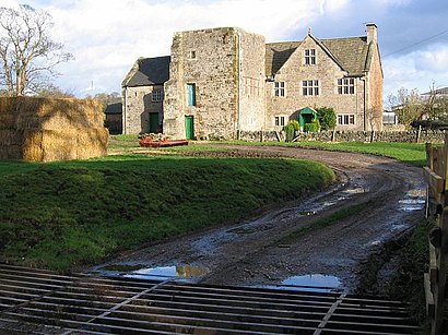
Lees Farm,Fenny Bentley Old Hall,Leatherbritches Nursery,Bentley Brook Inn,The Bentley Brook,Coach And Horses,Woodeaves Mill,Tissington Wood Farm,The Priory,Fitzherbert C Of E (Va) Primary School,Millfields Bed And Breakfast,Disused,Dovedale National Nature Reserve,Bassett Wood Farm,Brookwood Farm,Farm,Woodeaves Farm,Tissington Estates Wild Refuge,Woodcock Delph Holiday Cottages,Mill Pond PlantationHow to get to popular attractions in Derbyshire Dales with public transportation
Nottingham NHS Treatment Centre, Nottingham,Nottingham City Hospital, Nottingham,Derby Station Pride Park Car Park, Derby,Rolls-Royce OED Building, Derby,Stoneygate Eye Hospital, Leicester,Planet Ice Peterborough, Peterborough,Beacon Hill Country Park, Loughborough,B&Q, Northampton,Boston United F.C., Boston,Premier Inn East Midlands Airport, North West Leicestershire,RS Components, Corby,NHS Walk-in Centre, Peterborough,Trent Valley Crematorium, South Derbyshire,Paulet High School,Phoenix Park, Nottingham,Mapperley, Nottingham,Kettering Train Station, Kettering,The Cresset Theatre, Peterborough,Lodge Park School, Corby, Corby,Kingsway Hospital, DerbyGet around East Midlands by public transport!
Travelling around East Midlands has never been so easy. See step by step directions as you travel to any attraction, street or major public transport station. View bus and train timetables, arrival times, service alerts and detailed routes on a map, so you know exactly how to get to anywhere in East Midlands.
When travelling to any destination around East Midlands use Moovit's Live Directions with Get Off Notifications to know exactly where and how far to walk, how long to wait for your line , and how many stops are left. Moovit will alert you when it’s time to get off — no need to constantly re-check whether yours is the next stop.
Wondering how to use public transport in East Midlands or how to pay for public transport in East Midlands? Moovit public transport app can help you navigate your way with public transport easily, and at minimum cost. It includes public transport fees, ticket prices, and costs. Looking for a map of East Midlands public transport lines? Moovit public transport app shows all public transport maps in East Midlands with all Bus, Train and Light rail routes and stops on an interactive map.
East Midlands has 3 transport type(s), including: Bus, Train and Light rail, operated by several transport agencies, including National Rail, Ashbourne Community Transport, Delaine Buses, Arriva Midlands, Centrebus, Our Centre, Hulleys of Baslow, D & G Bus, Stagecoach East Midlands, North Lincolnshire Council, Roberts Coaches, Lawson's of Corby, Hawkes Coaches, East Yorkshire, Soar Valley Community Bus