Five Ways Station stop - Thursday schedule
| Line | Direction | Time |
|---|---|---|
| 8A | Saltley | 05:02 |
| 8A | Saltley | 05:34 |
| 8A | Ladywood | 05:54 |
| 8A | Saltley | 06:12 |
| 8A | Ladywood | 06:26 |
| 8A | Saltley | 06:37 |
| 8A | Ladywood | 06:49 |
| 8A | Saltley | 07:02 |
| 8A | Ladywood | 07:12 |
| 8A | Ladywood | 07:21 |
| 8A | Ladywood | 07:32 |
| 8A | Ladywood | 07:42 |
| 8A | Ladywood | 07:53 |
| 8A | Ladywood | 08:05 |
| 8A | Ladywood | 08:18 |
| 8A | Ladywood | 08:31 |
| 8A | Ladywood | 08:43 |
| 8A | Ladywood | 08:56 |
| 8A | Ladywood | 09:10 |
| 8A | Ladywood | 09:23 |
| 8A | Ladywood | 09:37 |
| 8A | Ladywood | 09:49 |
| 8A | Ladywood | 10:02 |
| 8A | Ladywood | 10:14 |
| 8A | Ladywood | 10:27 |
See Five Ways Station, Ladywood, on the map
Directions to Five Ways Station (Ladywood) with public transport
The following transport lines have routes that pass near Five Ways Station
 Bus:
Bus: - Train:
How to get to Five Ways Station by bus?
Click on the bus route to see step by step directions with maps, line arrival times and updated time schedules.
How to get to Five Ways Station by train?
Click on the train route to see step by step directions with maps, line arrival times and updated time schedules.
Bus stations near Five Ways Station in Ladywood
- Five Ways Station,2 min walk,
- Lee Crescent,4 min walk,
- Five Ways Metro (Stop Fd),8 min walk,
Light Rail stations near Five Ways Station in Ladywood
- Brindley Place,6 min walk,
Train stations near Five Ways Station in Ladywood
- Five Ways,29 min walk,
Bus lines to Five Ways Station in Ladywood
- 8C,Ladywood,
- 80,Digbeth,
- 8A,Saltley,
- X21,Bartley Green,
- X22,Bartley Green,
- 10,Quinton - Ladywood,
- 23,Ladywood - Bartley Green,
- 24,Ladywood - Quinton,
- 822,Bartley Green - Ladywood,
What are the nearest stations to Five Ways Station?
The nearest stations to Five Ways Station are:
- Five Ways Station is 113 meters away, 2 min walk.
- Lee Crescent is 239 meters away, 4 min walk.
- Brindley Place is 353 meters away, 6 min walk.
- Five Ways Metro (Stop Fd) is 610 meters away, 8 min walk.
- Five Ways is 2264 meters away, 29 min walk.
Which bus lines stop near Five Ways Station?
These bus lines stop near Five Ways Station: 80, 8A, 8C, X10, X21, X22.
Which train line stops near Five Ways Station?
WEST MIDLANDS RAILWAY
What’s the nearest light rail station to Five Ways Station in Ladywood?
The nearest light rail station to Five Ways Station in Ladywood is Brindley Place. It’s a 6 min walk away.
What’s the nearest train station to Five Ways Station in Ladywood?
The nearest train station to Five Ways Station in Ladywood is Five Ways. It’s a 29 min walk away.
What’s the nearest bus stop to Five Ways Station in Ladywood?
The nearest bus stop to Five Ways Station in Ladywood is Five Ways Station. It’s a 2 min walk away.
What time is the first light rail to Five Ways Station in Ladywood?
The METRO is the first light rail that goes to Five Ways Station in Ladywood. It stops nearby at 05:06.
What time is the last light rail to Five Ways Station in Ladywood?
The METRO is the last light rail that goes to Five Ways Station in Ladywood. It stops nearby at 00:34.
What time is the first train to Five Ways Station in Ladywood?
The WEST MIDLANDS RAILWAY is the first train that goes to Five Ways Station in Ladywood. It stops nearby at 05:47.
What time is the last train to Five Ways Station in Ladywood?
The WEST MIDLANDS RAILWAY is the last train that goes to Five Ways Station in Ladywood. It stops nearby at 00:08.
What time is the first bus to Five Ways Station in Ladywood?
The 23 is the first bus that goes to Five Ways Station in Ladywood. It stops nearby at 04:42.
What time is the last bus to Five Ways Station in Ladywood?
The 23 is the last bus that goes to Five Ways Station in Ladywood. It stops nearby at 01:17.
How much is the train fare to Five Ways Station?
The train fare to Five Ways Station costs about £3.00 - £11.10.
How much is the bus fare to Five Ways Station?
The bus fare to Five Ways Station costs about £2.40.
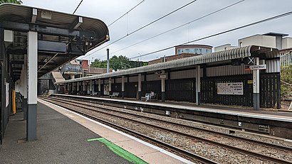
Five Ways Station station
 Taken by Anonymous
See Five Ways Station, Ladywood, on the map
Public transport to Five Ways Station stop (ID: nwmapdjp) in Ladywood
Looking for directions to Five Ways Station in Ladywood, United Kingdom?
Download the Moovit App to find the current schedule and step-by-step directions for Bus or Train routes that pass through Five Ways Station.
Looking for the nearest stops closest to Five Ways Station ? Check out this list of closest stops to your destination: Five Ways Station; Lee Crescent; Brindley Place; Five Ways Metro (Stop Fd); Five Ways.
Bus:Train:
We make riding on public transit to Five Ways Station easy, which is why over 1.5 million users, including users in Ladywood trust Moovit as the best app for public transit.
Use the app to navigate to popular places including to the airport, hospital, stadium, grocery store, mall, coffee shop, school, college, and university.
Five Ways Station stop’s code is nwmapdjp
The first line to this stop is 8A, at 05:02, and the last line is 8A at 00:11.
Chatsworth Way, Birmingham, England, United Kingdom
This stop serves National Express West Midlands’s lines
Popular routes from Five Ways Station, Ladywood
Light Rail station near Five Ways Station
Brindley PlaceTrain station near Five Ways Station
Five WaysPopular public transport stations in Ladywood
Northcroft Hospital,Highfield Rd,Coles Furniture Centre,Priory Hospital,Victoria Park,Evesham Country Park,Bull & Butcher,Perry Barr Rail Station (Stop Pb),Trafalgar Rd,Bournville Lane,Stratford Road,Redditch,Tally Ho Police Training,Sandwell District General Hospital (Stop Sb),Solihull Town Centre (Stop Sm),Health Centre,Manor Farm,Witton Station,Far Moor Lane End,Hubert RdGet around Ladywood by public transport!
Travelling around Ladywood has never been so easy. See step by step directions as you travel to any attraction, street or major public transport station. View bus and train timetables, arrival times, service alerts and detailed routes on a map, so you know exactly how to get to anywhere in Ladywood.
When travelling to any destination around Ladywood use Moovit's Live Directions with Get Off Notifications to know exactly where and how far to walk, how long to wait for your line , and how many stops are left. Moovit will alert you when it’s time to get off — no need to constantly re-check whether yours is the next stop.
Wondering how to use public transport in Ladywood or how to pay for public transport in Ladywood? Moovit public transport app can help you navigate your way with public transport easily, and at minimum cost. It includes public transport fees, ticket prices, and costs. Looking for a map of Ladywood public transport lines? Moovit public transport app shows all public transport maps in Ladywood with all bus or train routes and stops on an interactive map.
Ladywood has 2 transport type(s), including: bus or train, operated by several transport agencies, including National Express West Midlands, National Express Coventry, National Express, Diamond Bus, Arriva Midlands, Stagecoach Midlands, West Midlands Metro, Stagecoach West, Stagecoach South Wales, First Potteries, First Worcestershire, LandFlight, trentbarton, Flexibus and Lakeside Coaches