See Forest Fields, Nottingham, on the map
Directions to Forest Fields (Nottingham) with public transport
The following transport lines have routes that pass near Forest Fields
 Bus:
Bus: - Train:
- Light rail:
How to get to Forest Fields by bus?
Click on the bus route to see step by step directions with maps, line arrival times and updated time schedules.
How to get to Forest Fields by train?
Click on the train route to see step by step directions with maps, line arrival times and updated time schedules.
Bus stations near Forest Fields in Nottingham
- Berridge Road, Sherwood Rise,8 min walk,
Bus lines to Forest Fields in Nottingham
- 68,Nottingham,
- 68A,Nottingham,
- 69,Nottingham,
- 70,Nottingham,
- 71,Nottingham,
What are the nearest stations to Forest Fields?
The nearest stations to Forest Fields are:
- Berridge Road, Sherwood Rise is 542 meters away, 8 min walk.
Which bus lines stop near Forest Fields?
These bus lines stop near Forest Fields: 3A, 3C, 70, CALVERTON CONNETION, L12.
Which train line stops near Forest Fields?
EAST MIDLANDS TRAINS
Which light rail line stops near Forest Fields?
TRAM
What’s the nearest bus stop to Forest Fields in Nottingham?
The nearest bus stop to Forest Fields in Nottingham is Berridge Road, Sherwood Rise. It’s a 8 min walk away.
See Forest Fields, Nottingham, on the map
Public Transit to Forest Fields in Nottingham
Wondering how to get to Forest Fields in Nottingham, United Kingdom? Moovit helps you find the best way to get to Forest Fields with step-by-step directions from the nearest public transit station.
Moovit provides free maps and live directions to help you navigate through your city. View schedules, routes, timetables, and find out how long does it take to get to Forest Fields in real time.
Looking for the nearest stop or station to Forest Fields? Check out this list of stops closest to your destination: Berridge Road.
Bus:Train:Light rail:
Want to see if there’s another route that gets you there at an earlier time? Moovit helps you find alternative routes or times. Get directions from and directions to Forest Fields easily from the Moovit App or Website.
We make riding to Forest Fields easy, which is why over 1.5 million users, including users in Nottingham, trust Moovit as the best app for public transit. You don’t need to download an individual bus app or train app, Moovit is your all-in-one transit app that helps you find the best bus time or train time available.
For information on prices of bus, train and light rail, costs and ride fares to Forest Fields, please check the Moovit app.
Use the app to navigate to popular places including to the airport, hospital, stadium, grocery store, mall, coffee shop, school, college, and university.
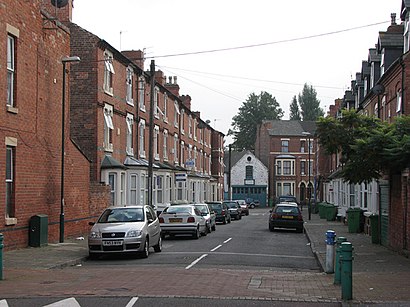
Forest Fields Address: Nottingham street in Nottingham
Forest Fields is an inner-city area of the City of Nottingham in the county of Nottinghamshire, England.Wiki
Attractions near Forest Fields
Family First Ltd.,Snaplink Ltd,Jaz Products Ltd.,Link Up Community Shop & Drop in Centre,Begin Basic Educational Guidance in Nottingham,Project Rahnama Ltd.,Kashmir Jewellers,Forest Fields Play Centre,Allott & Lomax,Ng7 5hz,Framework Housing Association,Ng7 6nx,Framework,Ng7 6nz,Ng7 6ny,Doctor's Orders,7 Leslie Road,Ng7 6lg,Kiev Translation Co,Foxhall Rd Business CentreHow to get to popular attractions in Nottingham with public transportation
Bilborough College, Nottingham,Ideal World Studios, Peterborough,Quorn & Woodhouse Railway Station (GC Railway), Charnwood,Nettleham, West Lindsey,Hotel ibis Chesterfield Centre, Chesterfield,Matalan, Corby,Billing Aquadrome, Northampton,Memsaab Restaurant, Nottingham,Peterborough Power Signal Box, Peterborough,Barlborough, Bolsover,Morrisons, Bassetlaw,Nottingham Station, Nottingham,Francis Crick House, Northampton,Cardea, Peterborough,E.ON (Bilborough), Nottingham,James France Building, Charnwood,Asda, Rushcliffe,The Castlewood (Brewers Fayre), Bolsover,Huthwaite, Ashfield,Currys PC World, NottinghamGet around Nottingham by public transport!
Travelling around Nottingham has never been so easy. See step by step directions as you travel to any attraction, street or major public transport station. View bus and train timetables, arrival times, service alerts and detailed routes on a map, so you know exactly how to get to anywhere in Nottingham.
When travelling to any destination around Nottingham use Moovit's Live Directions with Get Off Notifications to know exactly where and how far to walk, how long to wait for your line , and how many stops are left. Moovit will alert you when it’s time to get off — no need to constantly re-check whether yours is the next stop.
Wondering how to use public transport in Nottingham or how to pay for public transport in Nottingham? Moovit public transport app can help you navigate your way with public transport easily, and at minimum cost. It includes public transport fees, ticket prices, and costs. Looking for a map of Nottingham public transport lines? Moovit public transport app shows all public transport maps in Nottingham with all bus, train or light rail routes and stops on an interactive map.
Nottingham has 3 transport type(s), including: bus, train or light rail, operated by several transport agencies, including National Rail, Ashbourne Community Transport, Delaine Buses, Arriva Midlands, Centrebus, Our Centre, Hulleys of Baslow, D & G Bus, Stagecoach East Midlands, North Lincolnshire Council, National Rail, Roberts Coaches, Lawson's of Corby, Hawkes Coaches and East Yorkshire