Frederick Rd stop - Monday schedule
| Line | Direction | Time |
|---|---|---|
| X20 | Bromsgrove Bus Station | 05:43 |
| X20 | Bromsgrove Bus Station | 05:43 |
| X20 | Bromsgrove Bus Station | 06:28 |
| X20 | Bromsgrove Bus Station | 06:28 |
| X20 | Bromsgrove Bus Station | 07:26 |
| X20 | Bromsgrove Bus Station | 07:26 |
| X20 | Leach Green Lane | 08:00 |
| X20 | Bromsgrove Bus Station | 08:29 |
| X20 | Bromsgrove Bus Station | 08:30 |
| X20 | Leach Green Lane | 09:04 |
| X20 | Bromsgrove Bus Station | 09:29 |
| X20 | Bromsgrove Bus Station | 09:32 |
| X20 | Leach Green Lane | 10:00 |
| X20 | Bromsgrove Bus Station | 10:29 |
| X20 | Bromsgrove Bus Station | 10:29 |
| X20 | Leach Green Lane | 10:59 |
| X20 | Bromsgrove Bus Station | 11:29 |
| X20 | Bromsgrove Bus Station | 11:29 |
| X20 | Leach Green Lane | 11:59 |
| X20 | Bromsgrove Bus Station | 12:29 |
| X20 | Bromsgrove Bus Station | 12:29 |
| X20 | Leach Green Lane | 12:59 |
| X20 | Bromsgrove Bus Station | 13:29 |
| X20 | Bromsgrove Bus Station | 13:29 |
| X20 | Leach Green Lane | 13:59 |
Directions to Frederick Rd stop (Weoley & Selly Oak) with public transport
The following transport lines have routes that pass near Frederick Rd
 Bus: 11A, 76, X20, 11C, X21.
- Train: WEST MIDLANDS RAILWAY, CROSSCOUNTRY.
How to get to Frederick Rd stop by bus?
Click on the bus route to see step by step directions with maps, line arrival times and updated time schedules.
How to get to Frederick Rd stop by train?
Click on the train route to see step by step directions with maps, line arrival times and updated time schedules.
Bus stops near Frederick Rd stop in Weoley & Selly Oak
- Frederick Rd, 1 min walk,
- Gibbins Rd, 4 min walk,
- Lodge Hill Rd, 8 min walk,
Train stations near Frederick Rd station in Weoley & Selly Oak
- Bournville, 9 min walk,
- University, 47 min walk,
Light Rail stations near Frederick Rd station in Weoley & Selly Oak
- Edgbaston Village (West Midlands Metro), 56 min walk,
Bus lines to Frederick Rd stop in Weoley & Selly Oak
- X20, University Station,
- 11C, Six Ways,
- X21, Bartley Green War Memorial,
- 55, Tesco,
- 76, Solihull Town Centre,
- 11A, Shirley Road,
- 61, Arden Rd Terminus,
- 63, Moor St Queensway,
What are the nearest stations to Frederick Rd?
The nearest stations to Frederick Rd are:
- Frederick Rd is 54 meters away, 1 min walk.
- Gibbins Rd is 274 meters away, 4 min walk.
- Lodge Hill Rd is 579 meters away, 8 min walk.
- Bournville is 684 meters away, 9 min walk.
- University is 3698 meters away, 47 min walk.
- Edgbaston Village (West Midlands Metro) is 4349 meters away, 56 min walk.
Which bus lines stop near Frederick Rd?
These bus lines stop near Frederick Rd: 11A, 76, X20.
Which train line stops near Frederick Rd?
WEST MIDLANDS RAILWAY (Redditch)
What’s the nearest train station to Frederick Rd in Weoley & Selly Oak?
The nearest train station to Frederick Rd in Weoley & Selly Oak is Bournville. It’s a 9 min walk away.
What’s the nearest bus station to Frederick Rd in Weoley & Selly Oak?
The nearest bus station to Frederick Rd in Weoley & Selly Oak is Frederick Rd. It’s a 1 min walk away.
What time is the first light rail to Frederick Rd in Weoley & Selly Oak?
The METRO is the first light rail that goes to Frederick Rd in Weoley & Selly Oak. It stops nearby at 05:10.
What time is the last light rail to Frederick Rd in Weoley & Selly Oak?
The METRO is the last light rail that goes to Frederick Rd in Weoley & Selly Oak. It stops nearby at 00:30.
What time is the first train to Frederick Rd in Weoley & Selly Oak?
The WEST MIDLANDS RAILWAY is the first train that goes to Frederick Rd in Weoley & Selly Oak. It stops nearby at 05:51.
What time is the last train to Frederick Rd in Weoley & Selly Oak?
The WEST MIDLANDS RAILWAY is the last train that goes to Frederick Rd in Weoley & Selly Oak. It stops nearby at 00:04.
What time is the first bus to Frederick Rd in Weoley & Selly Oak?
The 63 is the first bus that goes to Frederick Rd in Weoley & Selly Oak. It stops nearby at 04:20.
What time is the last bus to Frederick Rd in Weoley & Selly Oak?
The 63 is the last bus that goes to Frederick Rd in Weoley & Selly Oak. It stops nearby at 02:50.
Frederick Rd station
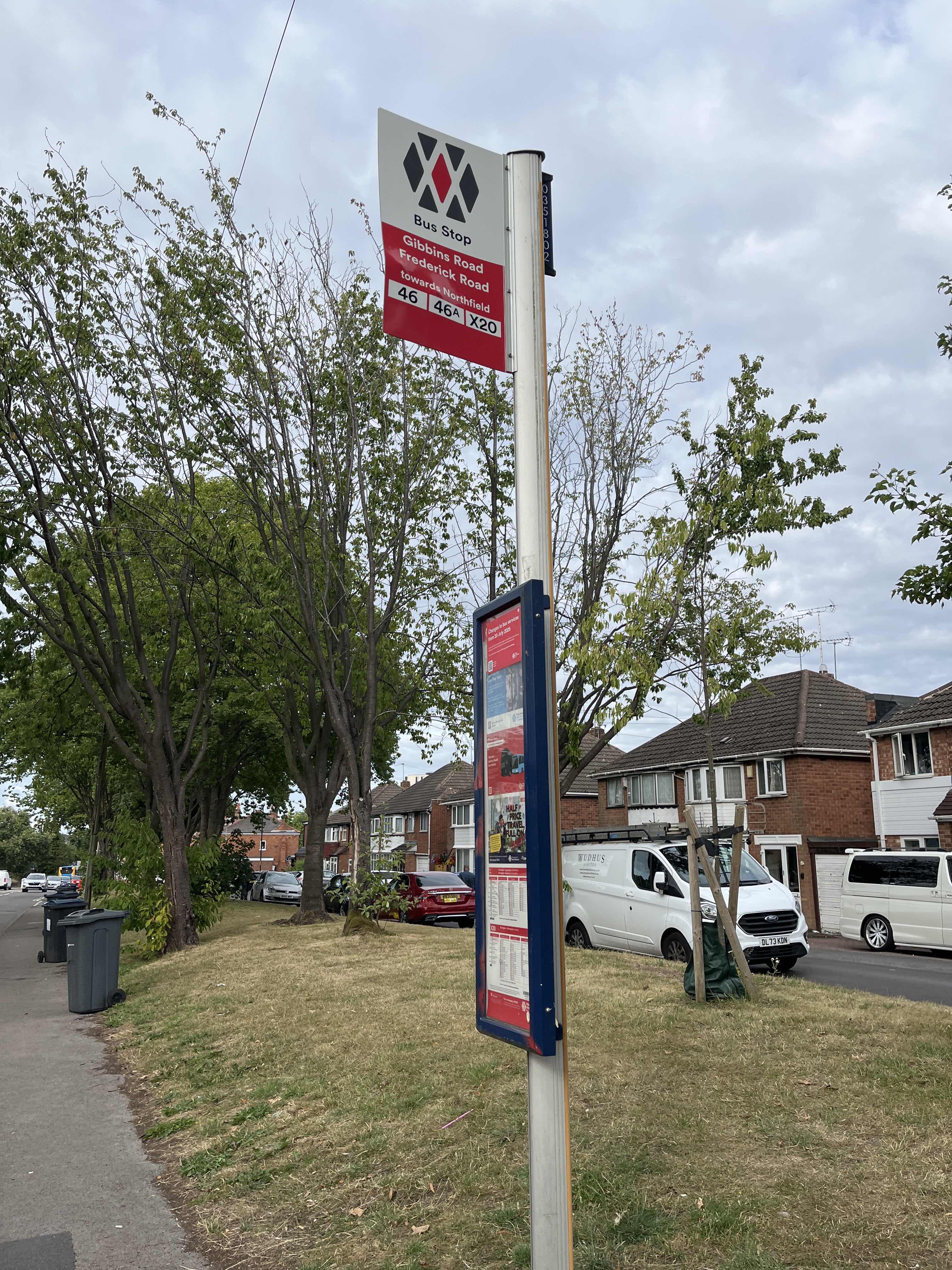 Taken by Anonymous
See Frederick Rd stop, Weoley & Selly Oak, on the map
Public transport to Frederick Rd stop (ID: nwmwgpdg) in Weoley & Selly Oak
Looking for directions to Frederick Rd in Weoley & Selly Oak, United Kingdom?
Download the Moovit App to find the current schedule and step-by-step directions for Bus or Train routes that pass through Frederick Rd.
Looking for the nearest stops closest to Frederick Rd ? Check out this list of closest stops to your destination: Frederick Rd; Gibbins Rd; Lodge Hill Rd; Bournville; University; Edgbaston Village (West Midlands Metro).
Bus: 11A, 76, X20, 11C, X21, 55, 61, 63.Train: WEST MIDLANDS RAILWAY, CROSSCOUNTRY.
We make riding on public transit to Frederick Rd easy, which is why over 1.5 million users, including users in Weoley & Selly Oak trust Moovit as the best app for public transit.
Use the app to navigate to popular places including to the airport, hospital, stadium, grocery store, mall, coffee shop, school, college, and university.
Frederick Rd stop’s code is nwmwgpdg
The first line to this stop is X20, at 05:43, and the last line is X20 at 22:39.
53 Gibbins Road, Birmingham, England, United Kingdom
This stop serves National Express West Midlands’s lines
- Frederick Rd,
- Gibbins Rd,
- Lodge Hill Rd
Bus stops near Frederick Rd stop
- Bournville,
- University
Train stations near Frederick Rd station
- Edgbaston Village (West Midlands Metro)
Light Rail station near Frederick Rd station
- Furlong Road,
- Manor Park Grove,
- Hinckley Road,
- Tapping Way,
- Solihull Town Centre,
- Dudley Port,
- Pets at Home,
- William Brookes School,
- Ocado,
- Moseley School,
- Warstone Ave,
- Canley Crematorium,
- Redditch,
- Yardley Wood Depot,
- Albert Rd,
- Halesowen Industrial Park,
- Black Cock Inn,
- Progress Way,
- Droitwich Spa Railway Station,
- Allard Way
Popular public transport stations in Weoley & Selly Oak
Get around Weoley & Selly Oak by public transport!
Travelling around Weoley & Selly Oak has never been so easy. See step by step directions as you travel to any attraction, street or major public transport station. View bus and train timetables, arrival times, service alerts and detailed routes on a map, so you know exactly how to get to anywhere in Weoley & Selly Oak.
When travelling to any destination around Weoley & Selly Oak use Moovit's Live Directions with Get Off Notifications to know exactly where and how far to walk, how long to wait for your line , and how many stops are left. Moovit will alert you when it’s time to get off — no need to constantly re-check whether yours is the next stop.
Wondering how to use public transport in Weoley & Selly Oak or how to pay for public transport in Weoley & Selly Oak? Moovit public transport app can help you navigate your way with public transport easily, and at minimum cost. It includes public transport fees, ticket prices, and costs. Looking for a map of Weoley & Selly Oak public transport lines? Moovit public transport app shows all public transport maps in Weoley & Selly Oak with all Bus, Train and Light rail routes and stops on an interactive map.
West Midlands has 3 transport type(s), including: Bus, Train and Light rail, operated by several transport agencies, including National Express West Midlands, National Express Coventry, National Express, Diamond Bus, Arriva Midlands, Stagecoach Midlands, West Midlands Metro, Stagecoach West, Stagecoach South Wales, First Potteries, First Worcestershire, LandFlight, trentbarton, D & G Bus and Flexibus