Directions to Gedung Kuning (Singapore) with public transport
The following transport lines have routes that pass near Gedung Kuning
How to get to Gedung Kuning by bus?
Click on the bus route to see step by step directions with maps, line arrival times and updated time schedules.
How to get to Gedung Kuning by metro?
Click on the metro route to see step by step directions with maps, line arrival times and updated time schedules.
Bus stations near Gedung Kuning in Singapore
- Nicoll Highway - Opp Nicoll Highway Stn (80161), 3 min walk,
- Victoria St - Opp Stamford Pr Sch (01129), 4 min walk,
- Beach Rd - Plaza Parkroyal (01529), 4 min walk,
- Beach Rd - Opp Plaza Parkroyal (01521), 4 min walk,
- Ophir Rd - Landmark Village Hotel (01559), 6 min walk,
- Jln Sultan - Opp Textile Ctr (01231), 7 min walk,
- Beach Rd - Opp the Gateway (01511), 7 min walk,
- Victoria St - Stamford Pr Sch (01121), 7 min walk,
- Nth Bridge Rd - Bef Sultan Mque (01229), 9 min walk,
Metro stations near Gedung Kuning in Singapore
- Nicoll Highway (CC5), 5 min walk,
- Rochor (DT13), 9 min walk,
- Bugis (EW12|DT14), 10 min walk,
Bus lines to Gedung Kuning in Singapore
- 10, Tampines Int ↔ Kent Ridge Ter,
- 14, Bedok Int ↔ Clementi Int,
- 16, Bedok Int ↔ Bt Merah Int,
- 70, Yio Chu Kang Int ↔ Shenton Way Ter,
- 196, Bedok Int ↔ Clementi Int,
- 591, [AM]: Anson Rd (Tg Pagar Stn Exit C) [PM]: Punggol Dr (Kadaloor Stn),
- 592, [AM]: Anson Rd (Tanjong Pagar Stn Exit C) [PM]: Sengkang West Way (Blk 471A),
- 14E, [AM Peak]: Orchard Rd (Orchard Stn/Lucky Plaza [PM Peak]: Bedok North Ave 3 (Bet Blks 139/140),
- 196E, [AM Peak]: Shenton Way (Opp MAS Bldg) [PM Peak]: Marine Parade Rd (Hua Xin Ct),
- 16M, Bedok Int ↔ Bt Merah Int,
- 70M, Yio Chu Kang Int ↺ Temasek Ave,
- THE CONCOURSE SHUTTLE, The Concourse ↔ City Hall MRT,
- 2, Changi Village Ter ↔ Kg Bahru Ter,
- 12, Pasir Ris Int ↔ Kg Bahru Ter,
- 33, Bedok Int ↔ Kent Ridge Ter,
- 133, Ang Mo Kio Int ↔ Shenton Way Ter,
- 100, Ghim Moh Ter,
- 107, Shenton Way Ter,
- 961, Lor 1 Geylang Ter,
- 980, Sembawang Int,
What are the nearest stations to Gedung Kuning?
The nearest stations to Gedung Kuning are:
- Nicoll Highway - Opp Nicoll Highway Stn (80161) is 150 meters away, 3 min walk.
- Victoria St - Opp Stamford Pr Sch (01129) is 223 meters away, 4 min walk.
- Beach Rd - Plaza Parkroyal (01529) is 224 meters away, 4 min walk.
- Beach Rd - Opp Plaza Parkroyal (01521) is 246 meters away, 4 min walk.
- Nicoll Highway (CC5) is 363 meters away, 5 min walk.
- Ophir Rd - Landmark Village Hotel (01559) is 366 meters away, 6 min walk.
- Jln Sultan - Opp Textile Ctr (01231) is 471 meters away, 7 min walk.
- Beach Rd - Opp the Gateway (01511) is 479 meters away, 7 min walk.
- Victoria St - Stamford Pr Sch (01121) is 517 meters away, 7 min walk.
- Nth Bridge Rd - Bef Sultan Mque (01229) is 609 meters away, 9 min walk.
- Rochor (DT13) is 665 meters away, 9 min walk.
- Bugis (EW12|DT14) is 744 meters away, 10 min walk.
Which bus lines stop near Gedung Kuning?
These bus lines stop near Gedung Kuning: 10, 100, 170, 48, 61.
Which metro lines stop near Gedung Kuning?
These metro lines stop near Gedung Kuning: DOWNTOWN LINE, EAST WEST LINE.
What’s the nearest metro station to Gedung Kuning in Singapore?
The nearest metro station to Gedung Kuning in Singapore is Nicoll Highway (CC5). It’s a 5 min walk away.
What’s the nearest bus stop to Gedung Kuning in Singapore?
The nearest bus stop to Gedung Kuning in Singapore is Nicoll Highway - Opp Nicoll Highway Stn (80161). It’s a 3 min walk away.
What time is the first metro to Gedung Kuning in Singapore?
The DOWNTOWN LINE is the first metro that goes to Gedung Kuning in Singapore. It stops nearby at 06:13.
What time is the last metro to Gedung Kuning in Singapore?
The DOWNTOWN LINE is the last metro that goes to Gedung Kuning in Singapore. It stops nearby at 00:54.
What time is the first bus to Gedung Kuning in Singapore?
The 197 is the first bus that goes to Gedung Kuning in Singapore. It stops nearby at 05:31.
What time is the last bus to Gedung Kuning in Singapore?
The 961M is the last bus that goes to Gedung Kuning in Singapore. It stops nearby at 01:21.
See Gedung Kuning, Singapore, on the map
Public Transit to Gedung Kuning in Singapore
Wondering how to get to Gedung Kuning in Singapore, Singapore? Moovit helps you find the best way to get to Gedung Kuning with step-by-step directions from the nearest public transit station.
Moovit provides free maps and live directions to help you navigate through your city. View schedules, routes, timetables, and find out how long does it take to get to Gedung Kuning in real time.
Looking for the nearest stop or station to Gedung Kuning? Check out this list of stops closest to your destination: Nicoll Highway - Opp Nicoll Highway Stn (80161); Victoria St - Opp Stamford Pr Sch (01129); Beach Rd - Plaza Parkroyal (01529); Beach Rd - Opp Plaza Parkroyal (01521); Nicoll Highway (CC5); Ophir Rd - Landmark Village Hotel (01559); Jln Sultan - Opp Textile Ctr (01231); Beach Rd - Opp the Gateway (01511); Victoria St - Stamford Pr Sch (01121); Nth Bridge Rd - Bef Sultan Mque (01229); Rochor (DT13); Bugis (EW12|DT14).
Bus: 10, 100, 170, 48, 61, 14, 16, 70, 196, 107, 961, 980, 107M, 2, 12, 33, 133.Metro: DOWNTOWN LINE, EAST WEST LINE, CIRCLE LINE.
Want to see if there’s another route that gets you there at an earlier time? Moovit helps you find alternative routes or times. Get directions from and directions to Gedung Kuning easily from the Moovit App or Website.
We make riding to Gedung Kuning easy, which is why over 1.5 million users, including users in Singapore, trust Moovit as the best app for public transit. You don’t need to download an individual bus app or train app, Moovit is your all-in-one transit app that helps you find the best bus time or train time available.
For information on prices of bus, metro and MRT & LRT, costs and ride fares to Gedung Kuning, please check the Moovit app.
Use the app to navigate to popular places including to the airport, hospital, stadium, grocery store, mall, coffee shop, school, college, and university.
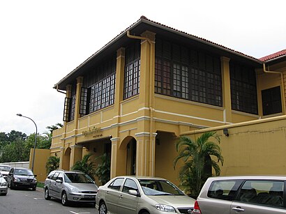
Gedung Kuning Address: Kandahar Street street in Singapore
Attractions near Gedung Kuning
26 kandahar street,Wak Cantuk,Rich And Good Cake Shop,Istana Kampong Glam,Tepak Sireh Restoran,Rich & Good Cake Shop ,甘榜格南皇宫,Istana Kampong Glam (甘榜格南皇宫),Istana Kampong Glam (Gan Bang Ge Nan Huang Gong),Halijah Travel (HALIJAH TRAVELS PTE LTD),Kiah's Gallery,24 Kandahar St,73 Sultan Gate. Singapore (198497),Tamiya Mini 4wd Chop Shop,Street Art,Tash Tish Tosh,Got Luck,C P Ghariwala (Ghariwala Red Chillis Records),Little Shophouse Happy Nyonya Beaded Shoes,Dong Po Colonial Cafe | 東坡茶室How to get to popular attractions in Singapore with public transportation
Ssiksin Korean BBQ, Northwest,Teen Challenge Singapore, Southwest,Singapore Refining Company Pte Ltd, Southwest,Shaw Plaza, Singapore,Tan Boon Liat Building, Singapore,Kranji Loop, Northwest,Manjusri Secondary School, Southeast,BlueWork Loft@ American Express, Southwest,Keppel Shipyard Fire Station (benoi), Southwest,Mandarin Gardens, Southeast,Shaw House, Singapore,Halliburton Sing 3, Southwest,The Salvation Army, The Haven, Southwest,406 coffee shop, Northwest,Civil Service Club @ Bukit Batok, Southwest,陰福宮, Southwest,Zhongshan Mall, Singapore,Halliburton (SING 1), Southwest,Riversails, Northeast,Teddy's cave, SouthwestGet around Singapore by public transport!
Travelling around Singapore has never been so easy. See step by step directions as you travel to any attraction, street or major public transport station. View bus and train timetables, arrival times, service alerts and detailed routes on a map, so you know exactly how to get to anywhere in Singapore.
When travelling to any destination around Singapore use Moovit's Live Directions with Get Off Notifications to know exactly where and how far to walk, how long to wait for your line , and how many stops are left. Moovit will alert you when it’s time to get off — no need to constantly re-check whether yours is the next stop.
Wondering how to use public transport in Singapore or how to pay for public transport in Singapore? Moovit public transport app can help you navigate your way with public transport easily, and at minimum cost. It includes public transport fees, ticket prices, and costs. Looking for a map of Singapore public transport lines? Moovit public transport app shows all public transport maps in Singapore with all Bus, Train, Metro, MRT & LRT, Ferry and Cable Car routes and stops on an interactive map.
Singapore has 6 transport type(s), including: Bus, Train, Metro, MRT & LRT, Ferry and Cable Car, operated by several transport agencies, including SMRT, SBS Transit, MRT/LRT Replacement Services, Tower Transit, Go-Ahead Singapore, Premium Bus, City Direct Bus, Changi Airport, Sentosa Development Corporation, Cross Border Bus, Singapore Cable Car Network, NUS Shuttle (ComfortDelGro), NTU Shuttle (ComfortDelGro), JTC Corp, Shuttle Bus (Appx. Schedule)