See Geelong Arts Centre on the map
Directions to Geelong Arts Centre with public transportation
The following transport lines have routes that pass near Geelong Arts Centre
 Bus:
Bus: - Train:
How to get to Geelong Arts Centre by bus?
Click on the bus route to see step by step directions with maps, line arrival times and updated time schedules.
How to get to Geelong Arts Centre by train?
Click on the train route to see step by step directions with maps, line arrival times and updated time schedules.
Bus stations near Geelong Arts Centre
- Deakin University Waterfront Campus/Brougham St (Geelong),5 min walk,
- Moorabool Street Bus Stops/Moorabool St (Geelong),6 min walk,
- Moorabool St/Malop St (Geelong),8 min walk,
- Brougham St/Mercer St (Geelong),9 min walk,
- Geelong,11 min walk,
- Geelong Railway Station (Geelong),12 min walk,
Bus routes to Geelong Arts Centre
- 1,North Shore Station,
- 22,Geelong Station - North Shore Station Via Anakie Rd,
- 24,Geelong Station - North Geelong Station Via Herne Hill, Newtown,
- 25,Bell Post Hill - Geelong Station Via Autumn St, McCurdy Rd,
- 30,Whittington - Geelong Station Via Newcomb,
- 31,St Albans Park - Geelong Station Via St Albans Park,
- 32,Leopold - Geelong Station Via Bellarine Hwy,
- 40,Deakin University - Geelong Station Via Breakwater, Marshall Station, Grovedale,
- 41,Deakin University - Geelong Station Via Grovedale,
- 42,Deakin University - Geelong Station Via South Valley Rd,
- 43,Deakin University - Geelong Station Via Highton,
- 53,Torquay (Bell St) - Geelong Station Via Torquay (Bell St),
- 55,Ocean Grove - Geelong Station Via Marshall Station, Barwon Heads,
- 56,Queenscliff - Geelong Station Via Leopold, Ocean Grove,
- 60,St Leonards - Geelong Station Via Portarlington,
- 61,Drysdale - Geelong Station Via Clifton Springs, Leopold,
- GEELONG - APOLLO BAY VIA LORNE, TORQUAY,Geelong,
- INVERLEIGH - CORIO ST/MOORABOOL ST (GEELONG) VIA FYANSFORD,Corio St/Moorabool St (Geelong),
- WARRNAMBOOL - MELBOURNE VIA GEELONG & APOLLO BAY,Melbourne,
- 19,Bannockburn,
What are the nearest stations to Geelong Arts Centre?
The nearest stations to Geelong Arts Centre are:
- Deakin University Waterfront Campus/Brougham St (Geelong) is 327 meters away, 5 min walk.
- Moorabool Street Bus Stops/Moorabool St (Geelong) is 401 meters away, 6 min walk.
- Moorabool St/Malop St (Geelong) is 607 meters away, 8 min walk.
- Brougham St/Mercer St (Geelong) is 675 meters away, 9 min walk.
- Geelong is 796 meters away, 11 min walk.
- Geelong Railway Station (Geelong) is 871 meters away, 12 min walk.
Which bus lines stop near Geelong Arts Centre?
These bus lines stop near Geelong Arts Centre: 22, 53, GEELONG - APOLLO BAY VIA LORNE, TORQUAY, GEELONG - MELBOURNE VIA GEELONG.
Which train line stops near Geelong Arts Centre?
GEELONG - MELBOURNE VIA GEELONG
What’s the nearest bus stop to Geelong Arts Centre?
The nearest bus stop to Geelong Arts Centre is Deakin University Waterfront Campus/Brougham St (Geelong). It’s a 5 min walk away.
What time is the first bus to Geelong Arts Centre?
The GEELONG - MELBOURNE VIA GEELONG is the first bus that goes to Geelong Arts Centre. It stops nearby at 03:11.
What time is the last bus to Geelong Arts Centre?
The GEELONG - MELBOURNE VIA GEELONG is the last bus that goes to Geelong Arts Centre. It stops nearby at 02:11.
See Geelong Arts Centre on the map
Public Transportation to Geelong Arts Centre
Wondering how to get to Geelong Arts Centre, Australia? Moovit helps you find the best way to get to Geelong Arts Centre with step-by-step directions from the nearest public transit station.
Moovit provides free maps and live directions to help you navigate through your city. View schedules, routes, timetables, and find out how long does it take to get to Geelong Arts Centre in real time.
Looking for the nearest stop or station to Geelong Arts Centre? Check out this list of stops closest to your destination: Deakin University Waterfront Campus/Brougham St (Geelong); Moorabool Street Bus Stops/Moorabool St (Geelong); Moorabool St/Malop St (Geelong); Brougham St/Mercer St (Geelong); Geelong; Geelong Railway Station (Geelong).
Bus:Train:
Want to see if there’s another route that gets you there at an earlier time? Moovit helps you find alternative routes or times. Get directions from and directions to Geelong Arts Centre easily from the Moovit App or Website.
We make riding to Geelong Arts Centre easy, which is why over 1.5 million users, including users in Geelong, trust Moovit as the best app for public transit. You don’t need to download an individual bus app or train app, Moovit is your all-in-one transit app that helps you find the best bus time or train time available.
For information on prices of bus and train, costs and ride fares to Geelong Arts Centre, please check the Moovit app.
Use the app to navigate to popular places including to the airport, hospital, stadium, grocery store, mall, coffee shop, school, college, and university.
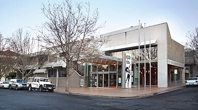
Geelong Arts Centre Address: Ryrie Street street in Geelong
Attractions near Geelong Arts Centre
Malone James Dr,Specialty Hardware,G21-Geelong Region Alliance,Wanyaari Jobs,One Good Cup,Xpose,Karingal,Seasons Cafe,Api Locksmiths,Kraft Systems Australia,Barwon Health,Geelong Court House,Gheringhap St / Ryrie St (Geelong),Wright Dental Ceramics,Hue & Cry,Financial Index Australia,Area Specialist,MFR Financial Planners Australia,Tournier Real Estate,ChaiverseHow to get to popular attractions in Geelong with public transportation
Manor Lakes Central, Wyndham Vale,Cbd, Melbourne,Westfield Airport West Shopping Centre, Airport West,Myer, Melbourne,AIA Australia, Melbourne,Cheltenham Secondary College, Cheltenham,Holmesglen Institute Of Tafe - Glen Waverley Campus, Glen Waverley,Glen Eira College, Caulfield East,Mcg, East Melbourne,South Oakleigh College, Oakleigh South,T2 - International, Melbourne Airport - Bal,Moorabbin Station, Moorabbin,Torquay Surf Beach, Torquay,Cranbourne Park Shopping Centre, Cranbourne,Box Hill Hospital, Box Hill,Westfield Airport West, Airport West,Narre Warren Station, Narre Warren,Albert Park Indoor Sports Centre, Albert Park,Keilor Plains Station, St Albans,Waverley Gardens Shopping Centre, MulgraveGet around Geelong by public transport!
Travelling around Geelong has never been so easy. See step by step directions as you travel to any attraction, street or major public transport station. View bus and train timetables, arrival times, service alerts and detailed routes on a map, so you know exactly how to get to anywhere in Geelong.
When travelling to any destination around Geelong use Moovit's Live Directions with Get Off Notifications to know exactly where and how far to walk, how long to wait for your line , and how many stops are left. Moovit will alert you when it’s time to get off — no need to constantly re-check whether yours is the next stop.
Wondering how to use public transport in Geelong or how to pay for public transport in Geelong? Moovit public transport app can help you navigate your way with public transport easily, and at minimum cost. It includes public transport fees, ticket prices, and costs. Looking for a map of Geelong public transport lines? Moovit public transport app shows all public transport maps in Geelong with all bus or train routes and stops on an interactive map.
Geelong has 2 transport type(s), including: bus or train, operated by several transport agencies, including PTV Metropolitan Trains, PTV Metropolitan Bus, Yarra Trams, PTV Regional Bus, SkyBus, Interstate Services, V/Line and V/Line (Coach)