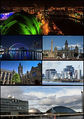
See Glasgow on the map
Directions to Glasgow with public transportation
The following transport lines have routes that pass near Glasgow
 Bus:
Bus: - Train:
How to get to Glasgow by bus?
Click on the bus route to see step by step directions with maps, line arrival times and updated time schedules.
How to get to Glasgow by train?
Click on the train route to see step by step directions with maps, line arrival times and updated time schedules.
Bus stations near Glasgow
- Govan Road, Cessnock,5 min walk,
- Exhibition Centre (Glasgow),11 min walk,
- Portman Street, Kinning Park,12 min walk,
Light Rail stations near Glasgow
- Cessnock Spt Subway Station, Cessnock,15 min walk,
Bus routes to Glasgow
- X19,Govan,
- 23,Inchinnan,
- 23A,North Barr,
- 23P,Paisley,
- 26,Nethercraigs,
- 9,Paisley, High St - GLASGOW Buchanan,
- 9A,Braehead Shopping Centre - GLASGOW Buchanan,
- 10,Silverburn Bus Station - Glasgow, West Regent St,
- 38,Spateston or Kilbarchan or Johnstone - Glasgow,
- 38A,Spateston - Glasgow,
- 90,Partick Bus Station - QEUH, Arrivals Sq,
- 121,Govan - Victoria Infirmary,
- 153,Glasgow - Silverburn Centre,
- SCOTRAIL,Cumbernauld,
What are the nearest stations to Glasgow?
The nearest stations to Glasgow are:
- Govan Road, Cessnock is 297 meters away, 5 min walk.
- Portman Street, Kinning Park is 803 meters away, 12 min walk.
- Exhibition Centre (Glasgow) is 808 meters away, 11 min walk.
- Cessnock Spt Subway Station, Cessnock is 1058 meters away, 15 min walk.
Which bus lines stop near Glasgow?
These bus lines stop near Glasgow: 10, 26, X19.
Which train line stops near Glasgow?
SCOTRAIL
What’s the nearest light rail station to Glasgow?
The nearest light rail station to Glasgow is Cessnock Spt Subway Station, Cessnock. It’s a 15 min walk away.
What’s the nearest bus stop to Glasgow?
The nearest bus stop to Glasgow is Govan Road, Cessnock. It’s a 5 min walk away.
See Glasgow on the map
Public Transportation to Glasgow
Wondering how to get to Glasgow, United Kingdom? Moovit helps you find the best way to get to Glasgow with step-by-step directions from the nearest public transit station.
Moovit provides free maps and live directions to help you navigate through your city. View schedules, routes, timetables, and find out how long does it take to get to Glasgow in real time.
Looking for the nearest stop or station to Glasgow? Check out this list of stops closest to your destination: Govan Road; Portman Street; Exhibition Centre (Glasgow); Cessnock Spt Subway Station.
Bus:Train:
Want to see if there’s another route that gets you there at an earlier time? Moovit helps you find alternative routes or times. Get directions from and directions to Glasgow easily from the Moovit App or Website.
We make riding to Glasgow easy, which is why over 1.5 million users, including users in Glasgow, trust Moovit as the best app for public transit. You don’t need to download an individual bus app or train app, Moovit is your all-in-one transit app that helps you find the best bus time or train time available.
For information on prices of bus, train and light rail, costs and ride fares to Glasgow, please check the Moovit app.
Use the app to navigate to popular places including to the airport, hospital, stadium, grocery store, mall, coffee shop, school, college, and university.
Glasgow Address: Pacific Quay, Glasgow G51 1DZ, United Kingdom street in Glasgow
Attractions near Glasgow
Premier Inn Glasgow Pacific Quay SECC,Premier Inn,Disclosure Scotland,Glasgow City Centre Pacific Quay,Pacific Quay Business Park And Media Village,Zen Rotunda Restaurant,Bells Bridge,Bus Stop 60903574 Pacific Drive,McGill's Bus Number 26,G51 1db,Village Hotel Glasgow,Derek Brown Personal Training,Govan Pacific,Bbc Scotland Hq (Servest),G51 1da,Zip Slide Across the Clyde,The Hub,Crowne Plaza,S.E.C.C, Glasgow,BBC Scotland Television StudioHow to get to popular attractions in Glasgow with public transportation
Haudagain Roundabout, Aberdeen,Buchanan Street Bus Station, Glasgow,Asda, Glasgow,Virgin Active, Glasgow,Edinburgh Christmas Market, Edinburgh,New Gorbals, Glasgow,North Berwick, North Berwick,Ninewells Hospital & Medical School, Dundee,Perth Railway Station (PTH), Perth,Dundee Railway Station (DEE), Dundee,Clyde Arc (Squinty Bridge), Glasgow City,Edinburgh Castle, Edinburgh,Gallowgate, Glasgow,Sauchiehall Street, Glasgow,Glasgow Central Railway Station (GLC), Glasgow,Saughton House, Edinburgh,The Three Sisters, Edinburgh,Buchanan Bus Station, Glasgow,The Crystal Palace (Wetherspoon), Glasgow,The Justice Mill (Wetherspoon), AberdeenGet around Glasgow by public transport!
Travelling around Glasgow has never been so easy. See step by step directions as you travel to any attraction, street or major public transport station. View bus and train timetables, arrival times, service alerts and detailed routes on a map, so you know exactly how to get to anywhere in Glasgow.
When travelling to any destination around Glasgow use Moovit's Live Directions with Get Off Notifications to know exactly where and how far to walk, how long to wait for your line , and how many stops are left. Moovit will alert you when it’s time to get off — no need to constantly re-check whether yours is the next stop.
Wondering how to use public transport in Glasgow or how to pay for public transport in Glasgow? Moovit public transport app can help you navigate your way with public transport easily, and at minimum cost. It includes public transport fees, ticket prices, and costs. Looking for a map of Glasgow public transport lines? Moovit public transport app shows all public transport maps in Glasgow with all bus, train or light rail routes and stops on an interactive map.
Glasgow has 3 transport type(s), including: bus, train or light rail, operated by several transport agencies, including First Greater Glasgow, First Aberdeen, Lothian Buses, McGill's Bus Service, Stagecoach East Scotland, Stagecoach Bluebird, Xplore Dundee, Community Transport Glasgow, Prentice Westwood, McCall's Coaches, J P Minibus, National Rail, R Robertson & Son, Burnbrae Garage and Ember