See Glasgow on the map
Directions to Glasgow with public transportation
The following transport lines have routes that pass near Glasgow
 Bus:
Bus: - Train:
How to get to Glasgow by bus?
Click on the bus route to see step by step directions with maps, line arrival times and updated time schedules.
How to get to Glasgow by train?
Click on the train route to see step by step directions with maps, line arrival times and updated time schedules.
Bus stations near Glasgow
- Bridgeton Cross, Bridgeton,1 min walk,
- Bridgeton Railway Station, Bridgeton,2 min walk,
- Anson Street, Bridgeton,2 min walk,
Bus routes to Glasgow
- 65,City Centre, Osborne St - Halfway, Mill Rd,
- 65,City Centre, Osborne St - City Centre, Osborne St,
- 164,Glasgow - Halfway,
- 18,Greenhills,
- 46,Easterhouse,
- 46,Shettleston,
- 263,Hamilton,
- N18,Greenhills,
- 64,Glasgow,
- 64,Halfway,
What are the nearest stations to Glasgow?
The nearest stations to Glasgow are:
- Bridgeton Cross, Bridgeton is 58 meters away, 1 min walk.
- Bridgeton Railway Station, Bridgeton is 76 meters away, 2 min walk.
- Anson Street, Bridgeton is 86 meters away, 2 min walk.
Which bus lines stop near Glasgow?
These bus lines stop near Glasgow: 18, 263.
Which train line stops near Glasgow?
SCOTRAIL
What’s the nearest bus stop to Glasgow?
The nearest bus stop to Glasgow is Bridgeton Cross, Bridgeton. It’s a 1 min walk away.
See Glasgow on the map
Public Transportation to Glasgow
Wondering how to get to Glasgow, United Kingdom? Moovit helps you find the best way to get to Glasgow with step-by-step directions from the nearest public transit station.
Moovit provides free maps and live directions to help you navigate through your city. View schedules, routes, timetables, and find out how long does it take to get to Glasgow in real time.
Looking for the nearest stop or station to Glasgow? Check out this list of stops closest to your destination: Bridgeton Cross; Bridgeton Railway Station; Anson Street.
Bus:Train:
Want to see if there’s another route that gets you there at an earlier time? Moovit helps you find alternative routes or times. Get directions from and directions to Glasgow easily from the Moovit App or Website.
We make riding to Glasgow easy, which is why over 1.5 million users, including users in Glasgow, trust Moovit as the best app for public transit. You don’t need to download an individual bus app or train app, Moovit is your all-in-one transit app that helps you find the best bus time or train time available.
For information on prices of bus and train, costs and ride fares to Glasgow, please check the Moovit app.
Use the app to navigate to popular places including to the airport, hospital, stadium, grocery store, mall, coffee shop, school, college, and university.
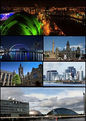
Glasgow Address: 23 Landressy Street, Glasgow G40 1BP, United Kingdom street in Glasgow
Attractions near Glasgow
Glasgow Women's Library,Amanda's,Landressy Day Centre,Keystane,G40 1bp,Bridgeton Bar,Landressy Street,Bridgeton Cross, Glasgow,G40 1bs,Christine's sweets and treats,G40 1bx,New Look Hair Salon,G40 1bt,Continental Cafe,James Mackeith,Dawn No2 Enterprises International,G40 1ha,175 James Street,G40 1ng,East End Independent NewspaperHow to get to popular attractions in Glasgow with public transportation
EICC, Edinburgh,St Andrews University Library, St Andrews,Edinburgh Christmas Market, Edinburgh,The Shore, Edinburgh,Queen Elizabeth University Hospital, Glasgow,The Crystal Palace (Wetherspoon), Glasgow,Asda, Glasgow,Annandale Water Motorway Services (RoadChef), Dumfries And Galloway,Dunfermline, Dunfermline,Tynecastle Park, Edinburgh,Thornliebank, Thornliebank,The Standing Order (Wetherspoon), Edinburgh,Shawlands, Glasgow,Costco Wholesale, Glasgow,Buchanan Street Bus Station, Glasgow,The Counting House (Wetherspoon), Dundee,The Queens Arms, Edinburgh,Queen's Park, Glasgow,Asda, Edinburgh,The Queen Elizabeth University Hospital Campus, GlasgowGet around Glasgow by public transport!
Travelling around Glasgow has never been so easy. See step by step directions as you travel to any attraction, street or major public transport station. View bus and train timetables, arrival times, service alerts and detailed routes on a map, so you know exactly how to get to anywhere in Glasgow.
When travelling to any destination around Glasgow use Moovit's Live Directions with Get Off Notifications to know exactly where and how far to walk, how long to wait for your line , and how many stops are left. Moovit will alert you when it’s time to get off — no need to constantly re-check whether yours is the next stop.
Wondering how to use public transport in Glasgow or how to pay for public transport in Glasgow? Moovit public transport app can help you navigate your way with public transport easily, and at minimum cost. It includes public transport fees, ticket prices, and costs. Looking for a map of Glasgow public transport lines? Moovit public transport app shows all public transport maps in Glasgow with all bus or train routes and stops on an interactive map.
Glasgow has 2 transport type(s), including: bus or train, operated by several transport agencies, including First Greater Glasgow, First Aberdeen, Lothian Buses, McGill's Bus Service, Stagecoach East Scotland, Stagecoach Bluebird, Xplore Dundee, Community Transport Glasgow, Prentice Westwood, McCall's Coaches, J P Minibus, National Rail, R Robertson & Son, Burnbrae Garage and Ember