See Gloucester Road Station, Kensington, on the map
Directions to Gloucester Road Station (Kensington) with public transport
The following transport lines have routes that pass near Gloucester Road Station
 Bus:
Bus: - Train:
- Tube:
How to get to Gloucester Road Station by bus?
Click on the bus route to see step by step directions with maps, line arrival times and updated time schedules.
How to get to Gloucester Road Station by train?
Click on the train route to see step by step directions with maps, line arrival times and updated time schedules.
How to get to Gloucester Road Station by Tube?
Click on the Tube route to see step by step directions with maps, line arrival times and updated time schedules.
Bus stations near Gloucester Road Station in Kensington
- Cromwell Road (GZ),3 min walk,
- Gloucester Road (GC),4 min walk,
- Ashburn Gardens (GV),4 min walk,
- Harrington Road (GN),6 min walk,
Tube stations near Gloucester Road Station in Kensington
- Gloucester Road,4 min walk,
Train stations near Gloucester Road Station in Kensington
- West Brompton,16 min walk,
Bus lines to Gloucester Road Station in Kensington
- 49,Clapham Junction,
- C1,Victoria,
- 430,South Kensington,
- 74,Putney, High Street,
- N74,Baker Street Station,
- N97,Trafalgar Square,
- 70,Chiswick, Business Park,
What are the nearest stations to Gloucester Road Station?
The nearest stations to Gloucester Road Station are:
- Cromwell Road (GZ) is 171 meters away, 3 min walk.
- Gloucester Road is 196 meters away, 4 min walk.
- Gloucester Road (GC) is 226 meters away, 4 min walk.
- Ashburn Gardens (GV) is 249 meters away, 4 min walk.
- Harrington Road (GN) is 356 meters away, 6 min walk.
- West Brompton is 1221 meters away, 16 min walk.
Which bus lines stop near Gloucester Road Station?
These bus lines stop near Gloucester Road Station: 49, 74.
Which train lines stop near Gloucester Road Station?
These train lines stop near Gloucester Road Station: ELIZABETH, OVERGROUND.
Which Tube lines stop near Gloucester Road Station?
These Tube lines stop near Gloucester Road Station: CIRCLE, DISTRICT, PICCADILLY.
What’s the nearest Tube station to Gloucester Road Station in Kensington?
The nearest Tube station to Gloucester Road Station in Kensington is Gloucester Road. It’s a 4 min walk away.
What’s the nearest train station to Gloucester Road Station in Kensington?
The nearest train station to Gloucester Road Station in Kensington is West Brompton. It’s a 16 min walk away.
What’s the nearest bus stop to Gloucester Road Station in Kensington?
The nearest bus stop to Gloucester Road Station in Kensington is Cromwell Road (GZ). It’s a 3 min walk away.
What time is the first Tube to Gloucester Road Station in Kensington?
The CIRCLE is the first Tube that goes to Gloucester Road Station in Kensington. It stops nearby at 05:06.
What time is the last Tube to Gloucester Road Station in Kensington?
The DISTRICT is the last Tube that goes to Gloucester Road Station in Kensington. It stops nearby at 01:14.
What time is the first train to Gloucester Road Station in Kensington?
The SOUTHERN is the first train that goes to Gloucester Road Station in Kensington. It stops nearby at 05:11.
What time is the last train to Gloucester Road Station in Kensington?
The SOUTHERN is the last train that goes to Gloucester Road Station in Kensington. It stops nearby at 00:22.
What time is the first bus to Gloucester Road Station in Kensington?
The N97 is the first bus that goes to Gloucester Road Station in Kensington. It stops nearby at 03:00.
What time is the last bus to Gloucester Road Station in Kensington?
The N74 is the last bus that goes to Gloucester Road Station in Kensington. It stops nearby at 03:06.
See Gloucester Road Station, Kensington, on the map
Public Transit to Gloucester Road Station in Kensington
Wondering how to get to Gloucester Road Station in Kensington, United Kingdom? Moovit helps you find the best way to get to Gloucester Road Station with step-by-step directions from the nearest public transit station.
Moovit provides free maps and live directions to help you navigate through your city. View schedules, routes, timetables, and find out how long does it take to get to Gloucester Road Station in real time.
Looking for the nearest stop or station to Gloucester Road Station? Check out this list of stops closest to your destination: Cromwell Road (GZ); Gloucester Road; Gloucester Road (GC); Ashburn Gardens (GV); Harrington Road (GN); West Brompton.
Bus:Train:Tube:
Want to see if there’s another route that gets you there at an earlier time? Moovit helps you find alternative routes or times. Get directions from and directions to Gloucester Road Station easily from the Moovit App or Website.
We make riding to Gloucester Road Station easy, which is why over 1.5 million users, including users in Kensington, trust Moovit as the best app for public transit. You don’t need to download an individual bus app or train app, Moovit is your all-in-one transit app that helps you find the best bus time or train time available.
For information on prices of bus, Tube and train, costs and ride fares to Gloucester Road Station, please check the Moovit app.
Use the app to navigate to popular places including to the airport, hospital, stadium, grocery store, mall, coffee shop, school, college, and university.
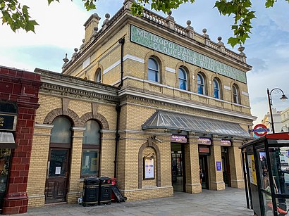
Gloucester Road Station Address: Gloucester Road street in Kensington
Attractions near Gloucester Road Station
Gloucester Road Station,Stanhope,Wing-Stop,Jack’S Hardware Homeware,SW7 4sz,The Bailey s Hotel,Bombay Brasserie,Stanhope Mews West Surgery,Gloucester Road Station,Fait Maison Salon De Thé,Gloucester Road London Underground Station,KFC,The Bailey’S Hotel,SW7 4sf,Millennium Gloucester Hotel London,Al Fanar Restaurant & Cafe,Viva Acai,Comptoir Libanais,Boots,Millennium Hotels & ResortsHow to get to popular attractions in Kensington with public transportation
Queen's Club, West Kensington,Feltham, Feltham,Folkestone Bus Station, Shepway,Oxford Brookes University Gipsy Lane Site, Oxford,Whitgift School, South Croydon,Catford Library, Catford,Lewisham Shopping Centre, Lewisham,Virgin Active, Wimbledon,Wimbledon, Wimbledon,Greenham Common, West Berkshire,Stratford Centre, Stratford,Chase Farm Hospital, Enfield,Putney, Putney,Westfield Stratford City, Stratford,Brookwood Railway Station (BKO), Woking,Barbican Centre, City Of London,Westwood Cross, Ramsgate,Southall Police Station, Southall,Parkside Gardens, East Barnet,Brentwood, BrentwoodGet around Kensington by public transport!
Travelling around Kensington has never been so easy. See step by step directions as you travel to any attraction, street or major public transport station. View bus and train timetables, arrival times, service alerts and detailed routes on a map, so you know exactly how to get to anywhere in Kensington.
When travelling to any destination around Kensington use Moovit's Live Directions with Get Off Notifications to know exactly where and how far to walk, how long to wait for your line , and how many stops are left. Moovit will alert you when it’s time to get off — no need to constantly re-check whether yours is the next stop.
Wondering how to use public transport in Kensington or how to pay for public transport in Kensington? Moovit public transport app can help you navigate your way with public transport easily, and at minimum cost. It includes public transport fees, ticket prices, and costs. Looking for a map of Kensington public transport lines? Moovit public transport app shows all public transport maps in Kensington with all bus, Tube or train routes and stops on an interactive map.
Kensington has 3 transport type(s), including: bus, Tube or train, operated by several transport agencies, including London Underground, London Buses, Transport for London, London Tramlink, Transport for London, National Rail, Bluestar, Berry's Coaches, Oxford Bus Company, Stagecoach West, Community First Wessex, Cresta Coaches, D & P Boat Hire, First Portsmouth, Fareham & Gosport and FYTbus