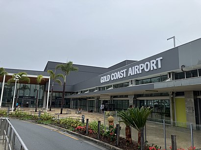
Gold Coast Airport stop - Friday schedule
| Line | Direction | Time |
|---|---|---|
| 777 | Gold Coast Airport | 05:01 |
| 777 | Broadbeach South Station | 05:16 |
| 760 | Robina Town Centre | 05:33 |
| 777 | Gold Coast Airport | 05:34 |
| 777 | Broadbeach South Station | 05:46 |
| 777 | Gold Coast Airport | 05:49 |
| 777 | Broadbeach South Station | 06:01 |
| 760 | Robina Town Centre | 06:03 |
| 777 | Gold Coast Airport | 06:05 |
| 777 | Broadbeach South Station | 06:16 |
| 777 | Gold Coast Airport | 06:24 |
| 760 | Robina Town Centre | 06:29 |
| 777 | Broadbeach South Station | 06:31 |
| 777 | Gold Coast Airport | 06:39 |
| 777 | Broadbeach South Station | 06:46 |
| 777 | Gold Coast Airport | 06:54 |
| 760 | Robina Town Centre | 06:54 |
| 777 | Broadbeach South Station | 07:01 |
| 777 | Gold Coast Airport | 07:09 |
| 777 | Broadbeach South Station | 07:16 |
| 760 | Robina Town Centre | 07:19 |
| 777 | Gold Coast Airport | 07:24 |
| 777 | Broadbeach South Station | 07:31 |
| 777 | Gold Coast Airport | 07:41 |
| 760 | Tweed Heads | 07:43 |
Directions to Gold Coast Airport stop (Brisbane) with public transport
The following transport lines have routes that pass near Gold Coast Airport
How to get to Gold Coast Airport stop by bus?
Click on the bus route to see step by step directions with maps, line arrival times and updated time schedules.
Bus stops near Gold Coast Airport stop in Brisbane
- Johnston Street, 9 min walk,
Bus lines to Gold Coast Airport stop in Brisbane
- 700, Tweed Heads - Broadbeach Via Burleigh Heads,
- 760, Tweed Heads - Robina Via Airport, Varsity Lakes,
- 768, Tweed Heads - The Pines Via John Flynn Hospital,
What are the nearest stations to Gold Coast Airport?
The nearest stations to Gold Coast Airport are:
- Johnston Street is 617 meters away, 9 min walk.
Which bus lines stop near Gold Coast Airport?
These bus lines stop near Gold Coast Airport: 760, 777.
What’s the nearest bus station to Gold Coast Airport in Brisbane?
The nearest bus station to Gold Coast Airport in Brisbane is Johnston Street. It’s a 9 min walk away.
What time is the first bus to Gold Coast Airport in Brisbane?
The 700 is the first bus that goes to Gold Coast Airport in Brisbane. It stops nearby at 03:27.
What time is the last bus to Gold Coast Airport in Brisbane?
The 700 is the last bus that goes to Gold Coast Airport in Brisbane. It stops nearby at 03:29.
See Gold Coast Airport stop, Brisbane, on the map
Public transport to Gold Coast Airport stop (ID: 300008) in Brisbane
Looking for directions to Gold Coast Airport in Brisbane, Australia?
Download the Moovit App to find the current schedule and step-by-step directions for Bus routes that pass through Gold Coast Airport.
Looking for the nearest stops closest to Gold Coast Airport ? Check out this list of closest stops to your destination: Johnston Street.
Bus: 760, 777, 700, 768.
We make riding on public transit to Gold Coast Airport easy, which is why over 1.5 million users, including users in Brisbane trust Moovit as the best app for public transit.
Use the app to navigate to popular places including to the airport, hospital, stadium, grocery store, mall, coffee shop, school, college, and university.
Gold Coast Airport stop’s code is 300008
The first line to this stop is 777, at 05:01, and the last line is 777 at 04:31.
This stop serves TransLink’s lines
Bus stop near Gold Coast Airport stop
Popular public transport stations in Brisbane
Get around Brisbane by public transport!
Travelling around Brisbane has never been so easy. See step by step directions as you travel to any attraction, street or major public transport station. View bus and train timetables, arrival times, service alerts and detailed routes on a map, so you know exactly how to get to anywhere in Brisbane.
When travelling to any destination around Brisbane use Moovit's Live Directions with Get Off Notifications to know exactly where and how far to walk, how long to wait for your line , and how many stops are left. Moovit will alert you when it’s time to get off — no need to constantly re-check whether yours is the next stop.
Wondering how to use public transport in Brisbane or how to pay for public transport in Brisbane? Moovit public transport app can help you navigate your way with public transport easily, and at minimum cost. It includes public transport fees, ticket prices, and costs. Looking for a map of Brisbane public transport lines? Moovit public transport app shows all public transport maps in Brisbane with all Bus, Train, Light rail and Ferry routes and stops on an interactive map.
Brisbane has 4 transport type(s), including: Bus, Train, Light rail and Ferry, operated by several transport agencies, including TransLink SEQ, TransLink, Christensens Bus and Coach, North Stradbroke Island Buses and Griffith Uni Intercampus bus