How to get to Gong Cha by bus?
Click on the bus route to see step by step directions with maps, line arrival times and updated time schedules.
From Bunnings Warehouse, Mile End South
56 minFrom Adelaide Oval, North Adelaide
32 minFrom The Highway Hotel, Plympton
51 minFrom Gasweld Tool Centres, Pooraka
63 minFrom Metrocard Recharge and Buy, Port Adelaide
22 minFrom Glen Osmond Creek Linear Trail, Parkside
69 minFrom Tram Stop 9 South Plympton, Plympton
55 minFrom Rundle Mall Tram Stop (To Moseley Square Glenelg), Adelaide
31 minFrom Burnside War Memorial Hospital, Toorak Gardens
52 minFrom Semaphore Park Beach, Semaphore Park
42 min
How to get to Gong Cha by train?
Click on the train route to see step by step directions with maps, line arrival times and updated time schedules.
Bus stops near Gong Cha in Kilkenny
Bus lines to Gong Cha in Kilkenny
- 251, Mansfield Park to City,VIEW
- 251A, Mansfield Park to Arndale Centre Interchange,VIEW
- 252, Port Adelaide Interchange to City,VIEW
- 252A, Port Adelaide Interchange to Arndale Centre Interchange,VIEW
- 253, Mansfield Park to City,VIEW
- 253X, Mansfield Park to City,VIEW
- 254, Port Adelaide Interchange to City,VIEW
- N254, After Midnight Saturday PM - Sunday AM Semaphore to City,VIEW
- 254X, Port Adelaide Interchange to City,VIEW
- 300, Suburban Connector,VIEW
- J8, West Lakes,VIEW
- 230, City,VIEW
- 232, City,VIEW
- 232R, Rosewater,VIEW
- 994, Arndale (School Bus),VIEW
- 100, Glen Osmond,VIEW
- 100B, Brooklyn Park,VIEW
- 100P, Plympton,VIEW
- 101, Arndale,VIEW
- 300H, Glen Osmond,VIEW
What are the nearest stations to Gong Cha?
The nearest stations to Gong Cha are:
- Zone D Arndale Interchange is 99 meters away, 2 min walk.
- Zone C Arndale Interchange is 148 meters away, 3 min walk.
- Zone A Arndale Interchange is 160 meters away, 3 min walk.
- Zone F Arndale Interchange is 172 meters away, 3 min walk.
- Zone B Arndale Interchange is 175 meters away, 3 min walk.
- St Clair is 194 meters away, 3 min walk.
- Kilkenny is 1350 meters away, 18 min walk.
Which bus lines stop near Gong Cha?
These bus lines stop near Gong Cha: 157, 230, 232, 253, 254.
Which train lines stop near Gong Cha?
These train lines stop near Gong Cha: OUTHA, PTDOCK.
What’s the nearest train station to Gong Cha in Kilkenny?
The nearest train station to Gong Cha in Kilkenny is St Clair. It’s a 3 min walk away.
What’s the nearest bus station to Gong Cha in Kilkenny?
The nearest bus station to Gong Cha in Kilkenny is Zone D Arndale Interchange. It’s a 2 min walk away.
What time is the first train to Gong Cha in Kilkenny?
The OUTHA is the first train that goes to Gong Cha in Kilkenny. It stops nearby at 06:21.
What time is the last train to Gong Cha in Kilkenny?
The OUTHA is the last train that goes to Gong Cha in Kilkenny. It stops nearby at 01:29.
What time is the first bus to Gong Cha in Kilkenny?
The N254 is the first bus that goes to Gong Cha in Kilkenny. It stops nearby at 03:05.
What time is the last bus to Gong Cha in Kilkenny?
The 254 is the last bus that goes to Gong Cha in Kilkenny. It stops nearby at 23:52.
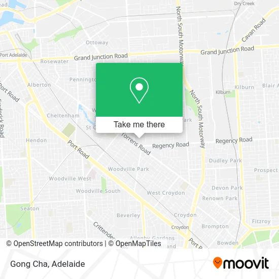
See Gong Cha, Kilkenny, on the map
Public Transit to Gong Cha in Kilkenny
Wondering how to get to Gong Cha in Kilkenny? Moovit helps you find the best way to get to Gong Cha with step-by-step directions from the nearest public transit station.
Moovit provides free maps and live directions to help you navigate through your city. View schedules, routes, timetables, and find out how long does it take to get to Gong Cha in real time.
Looking for the nearest stop or station to Gong Cha? Check out this list of stops closest to your destination: Zone D Arndale Interchange; Zone C Arndale Interchange; Zone A Arndale Interchange; Zone F Arndale Interchange; Zone B Arndale Interchange; St Clair; Kilkenny.
Bus: 157, 230, 232, 253, 254, 251, 251A, 252, 252A, J8, 232R, 994, 100, 100B, 100P, 101, 300H, AO16.Train: OUTHA, PTDOCK, OSBORN, GRNG.
Want to see if there’s another route that gets you there at an earlier time? Moovit helps you find alternative routes or times. Get directions from and directions to Gong Cha easily from the Moovit App or Website.
We make riding to Gong Cha easy, which is why over 1.5 million users, including users in Kilkenny, trust Moovit as the best app for public transit. You don’t need to download an individual bus app or train app, Moovit is your all-in-one transit app that helps you find the best bus time or train time available.
For information on prices of bus, train and light rail, costs and ride fares to Gong Cha, please check the Moovit app.
Use the app to navigate to popular places including to the airport, hospital, stadium, grocery store, mall, coffee shop, school, college, and university.
Gong Cha Address: Torrens Rd Kilkenny SA 5009 street in Kilkenny
- Park,
- Apm Employment Services Kilkenny,
- Miniso Adelaide Pty L,
- Labo Labo Tea & Taco,
- Connor,
- Strandbags 575,
- Sycorp Investments P,
- H Barber Arndale,
- Dr Stan Choimes,
- OP Beauty,
- Chi Body Care Arndale,
- Chi Thanh Poultry & Seafood,
- EZ Phone,
- Amal Express,
- Sa Selection,
- Maxmix Home & Gift,
- Coco Bubble Tea,
- NN Brows and Lashes,
- Pharmasave,
- FOODLAND
Places Near Gong Cha (Kilkenny)
- Marion Shopping Centre, Oaklands Park,
- Lyell McEwin Hospital, Elizabeth Vale,
- Regency TAFE, Regency Park,
- Womens and Childrens Hospital, North Adelaide,
- A Trip A Trip A Trip P, Port Noarlunga,
- Adelaide Central Market, Adelaide,
- IKEA, Adelaide Airport,
- Chinatown, Adelaide,
- Morphettville Racecourse, Morphettville,
- Adelaide Zoo, Adelaide,
- Semaphore Beach, Semaphore,
- Flinders Private Hospital, Bedford Park,
- Puff and Present Emporium, Glenelg North,
- Calvary Adelaide Hospital, Adelaide,
- Flinders Medical Centre (Hospital), Bedford Park,
- Westfield Marion Shopping Centre, Oaklands Park,
- St Andrews Hospital, Adelaide,
- Westfield West Lakes, West Lakes,
- Flinders Medical Centre, Bedford Park,
- Westfield Tea Tree Plaza, Modbury
How to get to popular places in Adelaide with public transport
Get around Kilkenny by public transport!
Travelling around Kilkenny has never been so easy. See step by step directions as you travel to any attraction, street or major public transport station. View bus and train timetables, arrival times, service alerts and detailed routes on a map, so you know exactly how to get to anywhere in Kilkenny.
When travelling to any destination around Kilkenny use Moovit's Live Directions with Get Off Notifications to know exactly where and how far to walk, how long to wait for your line , and how many stops are left. Moovit will alert you when it’s time to get off — no need to constantly re-check whether yours is the next stop.
Wondering how to use public transport in Kilkenny or how to pay for public transport in Kilkenny? Moovit public transport app can help you navigate your way with public transport easily, and at minimum cost. It includes public transport fees, ticket prices, and costs. Looking for a map of Kilkenny public transport lines? Moovit public transport app shows all public transport maps in Kilkenny with all Bus, Train, Light rail and Ferry routes and stops on an interactive map.
Adelaide has 4 transport type(s), including: Bus, Train, Light rail and Ferry, operated by several transport agencies, including Adelaide Metro (Busways), SouthLink, Torrens Transit, Adelaide Metro Train and Adelaide Metro (Rail Commissioner Tram)