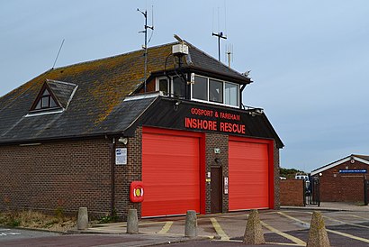
See Gosport & Fareham Inshore Rescue Services on the map
Directions to Gosport & Fareham Inshore Rescue Services with public transportation
The following transport lines have routes that pass near Gosport & Fareham Inshore Rescue Services
 Bus:
Bus:
How to get to Gosport & Fareham Inshore Rescue Services by bus?
Click on the bus route to see step by step directions with maps, line arrival times and updated time schedules.
Which bus lines stop near Gosport & Fareham Inshore Rescue Services?
These bus lines stop near Gosport & Fareham Inshore Rescue Services: 11, E2.
See Gosport & Fareham Inshore Rescue Services on the map
Public Transportation to Gosport & Fareham Inshore Rescue Services
Wondering how to get to Gosport & Fareham Inshore Rescue Services, United Kingdom? Moovit helps you find the best way to get to Gosport & Fareham Inshore Rescue Services with step-by-step directions from the nearest public transit station.
Moovit provides free maps and live directions to help you navigate through your city. View schedules, routes, timetables, and find out how long does it take to get to Gosport & Fareham Inshore Rescue Services in real time.
Bus:
Want to see if there’s another route that gets you there at an earlier time? Moovit helps you find alternative routes or times. Get directions from and directions to Gosport & Fareham Inshore Rescue Services easily from the Moovit App or Website.
We make riding to Gosport & Fareham Inshore Rescue Services easy, which is why over 1.5 million users, including users in Gosport, trust Moovit as the best app for public transit. You don’t need to download an individual bus app or train app, Moovit is your all-in-one transit app that helps you find the best bus time or train time available.
For information on prices of bus and train, costs and ride fares to Gosport & Fareham Inshore Rescue Services, please check the Moovit app.
Use the app to navigate to popular places including to the airport, hospital, stadium, grocery store, mall, coffee shop, school, college, and university.
Location: Gosport, South West
Attractions near Gosport & Fareham Inshore Rescue Services
Village Home,Lucas Golf Accessories,Standesign Ltd.,Miracles Hair & Beauty Salon & Fitness,A K Jupiter,Personal Trainer Gosport,Beechcroft Manor,A B C Nurseries,Beechcroft Manor Nusring Home,St Marys Avenue, Gosport,Cleall Marchant Partnership Ltd.,The Village Pre-school,A.B.C Coaches,Saint Mary's Avenue,Testcombe Road, Gosport,Alverstoke LTSBC,Alverstoke Lawn Tennis Squash & Badminton Club,Alverstoke Lawn Tennis Squash,Video Services,Zoe Unique MillineryHow to get to popular attractions in Gosport with public transportation
Salisbury City Centre, Wiltshire,Watergate Bay,Defence Academy of the United Kingdom, Vale Of White Horse,Bristol Marriott Hotel City Centre, Bristol, City Of,Cosmo Restaurant, Bristol, City Of,Tesco, Exeter,The King of Wessex (Wetherspoon), Bath And North East Somerset,M5 Avonmouth Bridge,Active Lifestyle Centre, South Gloucestershire,Barnstaple Bus Station, North Devon,The Giddy Bridge (Wetherspoon), Southampton,Uwe Bower Ashton Campus, Bristol, City Of,Parkstone Railway Station (PKS), Poole,Aviva, Eastleigh,Ikea, Bristol, City Of,DoubleTree by Hilton Hotel Swindon, Wiltshire,Brixham Harbour, Torbay,Waitrose, Basingstoke And Deane,Barnstaple Railway Station (BNP), North Devon,Lymington Ferry Terminal, New ForestGet around Gosport by public transport!
Travelling around Gosport has never been so easy. See step by step directions as you travel to any attraction, street or major public transport station. View bus and train timetables, arrival times, service alerts and detailed routes on a map, so you know exactly how to get to anywhere in Gosport.
When travelling to any destination around Gosport use Moovit's Live Directions with Get Off Notifications to know exactly where and how far to walk, how long to wait for your line , and how many stops are left. Moovit will alert you when it’s time to get off — no need to constantly re-check whether yours is the next stop.
Wondering how to use public transport in Gosport or how to pay for public transport in Gosport? Moovit public transport app can help you navigate your way with public transport easily, and at minimum cost. It includes public transport fees, ticket prices, and costs. Looking for a map of Gosport public transport lines? Moovit public transport app shows all public transport maps in Gosport with all bus or train routes and stops on an interactive map.
Gosport has 2 transport type(s), including: bus or train, operated by several transport agencies, including National Rail, Stagecoach South, Padstow Harbour Commissioners, Royal Buses, Tavistock Community Transport, River Link, Beaminster Town Council, Yeos Contracts, MD Coaches, Newport Bus, First Bristol, Bath & the West, First Kernow, St Mawes Ferry, First Wessex, Dorset & South Somerset and Isles of Scilly Steamship Co