How to get to Graphite Building Inspections by bus?
Click on the bus route to see step by step directions with maps, line arrival times and updated time schedules.
From bounce inc, Marleston
70 minFrom Majestic Old Lion Apartments, North Adelaide
62 minFrom Netball SA Stadium, Mile End South
52 minFrom Adelaide Riviera Hotel, Adelaide
36 minFrom Adelaide Festival Centre, Adelaide
42 minFrom Sir Donald Bradman Drive, Adelaide
38 minFrom Enfield Memorial Park, Enfield
73 minFrom Lockleys Hotel, Fulham
65 minFrom Animal House, Adelaide
34 minFrom Peter Elberg Funerals, Flinders Park
31 min
How to get to Graphite Building Inspections by train?
Click on the train route to see step by step directions with maps, line arrival times and updated time schedules.
Bus stops near Graphite Building Inspections in Royal Park
Train station near Graphite Building Inspections in Royal Park
- Alberton, 8 min walk,VIEW
Bus lines to Graphite Building Inspections in Royal Park
What are the nearest stations to Graphite Building Inspections?
The nearest stations to Graphite Building Inspections are:
- Stop 34 Old Port Rd - South West side is 114 meters away, 2 min walk.
- Stop 33C Tapleys Hill Rd - East side is 401 meters away, 6 min walk.
- Alberton is 604 meters away, 8 min walk.
- Stop 31 Port Rd - North East side is 629 meters away, 9 min walk.
- Stop Hail N Ride Poplar St / Crown Tce is 657 meters away, 9 min walk.
- Stop 32 Port Rd - South West side is 676 meters away, 10 min walk.
Which bus lines stop near Graphite Building Inspections?
These bus lines stop near Graphite Building Inspections: 118, 150.
Which train lines stop near Graphite Building Inspections?
These train lines stop near Graphite Building Inspections: OUTHA, PTDOCK.
What’s the nearest train station to Graphite Building Inspections in Royal Park?
The nearest train station to Graphite Building Inspections in Royal Park is Alberton. It’s a 8 min walk away.
What’s the nearest bus station to Graphite Building Inspections in Royal Park?
The nearest bus station to Graphite Building Inspections in Royal Park is Stop 34 Old Port Rd - South West side. It’s a 2 min walk away.
What time is the first train to Graphite Building Inspections in Royal Park?
The OUTHA is the first train that goes to Graphite Building Inspections in Royal Park. It stops nearby at 06:27.
What time is the last train to Graphite Building Inspections in Royal Park?
The OUTHA is the last train that goes to Graphite Building Inspections in Royal Park. It stops nearby at 01:22.
What time is the first bus to Graphite Building Inspections in Royal Park?
The 150 is the first bus that goes to Graphite Building Inspections in Royal Park. It stops nearby at 07:51.
What time is the last bus to Graphite Building Inspections in Royal Park?
The 118 is the last bus that goes to Graphite Building Inspections in Royal Park. It stops nearby at 23:33.
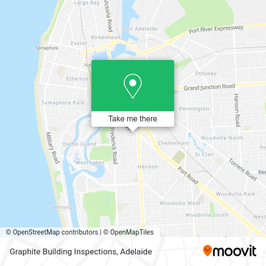
See Graphite Building Inspections, Royal Park, on the map
Public Transit to Graphite Building Inspections in Royal Park
Wondering how to get to Graphite Building Inspections in Royal Park? Moovit helps you find the best way to get to Graphite Building Inspections with step-by-step directions from the nearest public transit station.
Moovit provides free maps and live directions to help you navigate through your city. View schedules, routes, timetables, and find out how long does it take to get to Graphite Building Inspections in real time.
Looking for the nearest stop or station to Graphite Building Inspections? Check out this list of stops closest to your destination: Stop 34 Old Port Rd - South West side; Stop 33C Tapleys Hill Rd - East side; Alberton; Stop 31 Port Rd - North East side; Stop Hail N Ride Poplar St / Crown Tce; Stop 32 Port Rd - South West side.
Bus: 118, 150, J8, 650, 371, 372, AO17, 150B, 150P.Train: OUTHA, PTDOCK, OSBORN.
Want to see if there’s another route that gets you there at an earlier time? Moovit helps you find alternative routes or times. Get directions from and directions to Graphite Building Inspections easily from the Moovit App or Website.
We make riding to Graphite Building Inspections easy, which is why over 1.5 million users, including users in Royal Park, trust Moovit as the best app for public transit. You don’t need to download an individual bus app or train app, Moovit is your all-in-one transit app that helps you find the best bus time or train time available.
For information on prices of bus and train, costs and ride fares to Graphite Building Inspections, please check the Moovit app.
Use the app to navigate to popular places including to the airport, hospital, stadium, grocery store, mall, coffee shop, school, college, and university.
Graphite Building Inspections Address: 1160 Old Port Rd Royal Park SA 5014 street in Royal Park
- Safer Site Solutions,
- Visual Energy Studios Cheer Dance Tumble,
- Classic & American Imports,
- Big Shed Brewing Concern,
- The New Big Shed Brewing Concern,
- Old Port Road,
- Gia Auto Electrical,
- McMahon Services Roofing and Cladding,
- Mechanic Point,
- Alpha Tech,
- Roger Young Motors,
- Adelaide Pump Doctor,
- Epic Feast,
- Athome Computer Services,
- Same Day Trades sa,
- Baptist Church Queenstown,
- Slavic Evangelical Baptist Church,
- Grays Ice,
- G & G Tyres,
- Doggy Doos Adelaide
Places Near Graphite Building Inspections (Royal Park)
- Chinatown, Adelaide,
- Adelaide Central Market, Adelaide,
- Adelaide Zoo, Adelaide,
- St Andrews Hospital, Adelaide,
- Lyell McEwin Hospital, Elizabeth Vale,
- Flinders Medical Centre, Bedford Park,
- IKEA, Adelaide Airport,
- Flinders Medical Centre (Hospital), Bedford Park,
- Puff and Present Emporium, Glenelg North,
- Westfield West Lakes, West Lakes,
- Regency TAFE, Regency Park,
- Westfield Marion Shopping Centre, Oaklands Park,
- Marion Shopping Centre, Oaklands Park,
- Flinders Private Hospital, Bedford Park,
- A Trip A Trip A Trip P, Port Noarlunga,
- Calvary Adelaide Hospital, Adelaide,
- Womens and Childrens Hospital, North Adelaide,
- Semaphore Beach, Semaphore,
- Morphettville Racecourse, Morphettville,
- Westfield Tea Tree Plaza, Modbury
How to get to popular places in Adelaide with public transport
Get around Royal Park by public transport!
Travelling around Royal Park has never been so easy. See step by step directions as you travel to any attraction, street or major public transport station. View bus and train timetables, arrival times, service alerts and detailed routes on a map, so you know exactly how to get to anywhere in Royal Park.
When travelling to any destination around Royal Park use Moovit's Live Directions with Get Off Notifications to know exactly where and how far to walk, how long to wait for your line , and how many stops are left. Moovit will alert you when it’s time to get off — no need to constantly re-check whether yours is the next stop.
Wondering how to use public transport in Royal Park or how to pay for public transport in Royal Park? Moovit public transport app can help you navigate your way with public transport easily, and at minimum cost. It includes public transport fees, ticket prices, and costs. Looking for a map of Royal Park public transport lines? Moovit public transport app shows all public transport maps in Royal Park with all Bus, Train, Light rail and Ferry routes and stops on an interactive map.
Adelaide has 4 transport type(s), including: Bus, Train, Light rail and Ferry, operated by several transport agencies, including Adelaide Metro (Busways), SouthLink, Torrens Transit, Adelaide Metro Train and Adelaide Metro (Rail Commissioner Tram)