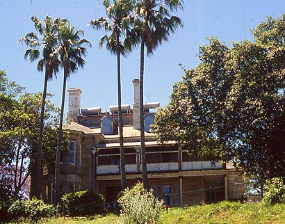
Directions to Graythwaite (North Sydney) with public transport
The following transport lines have routes that pass near Graythwaite
How to get to Graythwaite by bus?
Click on the bus route to see step by step directions with maps, line arrival times and updated time schedules.
How to get to Graythwaite by train?
Click on the train route to see step by step directions with maps, line arrival times and updated time schedules.
Which bus lines stop near Graythwaite?
These bus lines stop near Graythwaite: 208, 290, 343.
Which train line stops near Graythwaite?
T1
See Graythwaite, North Sydney, on the map
Public Transit to Graythwaite in North Sydney
Wondering how to get to Graythwaite in North Sydney, Australia? Moovit helps you find the best way to get to Graythwaite with step-by-step directions from the nearest public transit station.
Moovit provides free maps and live directions to help you navigate through your city. View schedules, routes, timetables, and find out how long does it take to get to Graythwaite in real time.
Bus: 208, 290, 343.Train: T1.
Want to see if there’s another route that gets you there at an earlier time? Moovit helps you find alternative routes or times. Get directions from and directions to Graythwaite easily from the Moovit App or Website.
We make riding to Graythwaite easy, which is why over 1.5 million users, including users in North Sydney, trust Moovit as the best app for public transit. You don’t need to download an individual bus app or train app, Moovit is your all-in-one transit app that helps you find the best bus time or train time available.
For information on prices of bus and train, costs and ride fares to Graythwaite, please check the Moovit app.
Use the app to navigate to popular places including to the airport, hospital, stadium, grocery store, mall, coffee shop, school, college, and university.
Location: North Sydney, Sydney
Attractions near Graythwaite
Leichhardt Public School,King George Park,The Garry Owen Hotel,Le Grande Bouffe,Rozelle Common,7-Eleven Rozelle,7-Eleven,Leichhardt Bus Depot,War Memorial Park,Lilyfield Newsagency,Lilyfield Corner Store,Victoria Hotel,Whites Creek,St. Brendan'S Catholic Church,Orange Grove Public School,Orange Grove Hotel,Trevor Street Playground,Inner Sydney Montessori School,St Francis,LilyfieldHow to get to popular attractions in North Sydney with public transportation
Single O, Surry Hills,Newtown, Newtown (NSW),Central, Haymarket,Campbelltown Station (Concourse), Campbelltown (NSW),George Street, Sydney,Zilver Restaurant, Haymarket,Sydney Airport (SYD), Mascot,The Sheaf, Double Bay,Bronte Beach, Bronte,Westfield Burwood, Burwood (NSW),St Marys Station, St Marys (NSW),King Street Brewhouse, Sydney,Bondi Beach, Bondi Beach,Wolli Creek Station (Concourse), Wolli Creek,University Of Newcastle (Callaghan Campus), Callaghan,Charlestown Square Shopping Centre, Charlestown (NSW),Sydney, Sydney,Reuben Hills Coffee Roastery & Café, Surry Hills,Broadway Shopping Centre, Glebe (NSW),Petersham Station, PetershamGet around Sydney by public transport!
Travelling around Sydney has never been so easy. See step by step directions as you travel to any attraction, street or major public transport station. View bus and train timetables, arrival times, service alerts and detailed routes on a map, so you know exactly how to get to anywhere in Sydney.
When travelling to any destination around Sydney use Moovit's Live Directions with Get Off Notifications to know exactly where and how far to walk, how long to wait for your line , and how many stops are left. Moovit will alert you when it’s time to get off — no need to constantly re-check whether yours is the next stop.
Wondering how to use public transport in Sydney or how to pay for public transport in Sydney? Moovit public transport app can help you navigate your way with public transport easily, and at minimum cost. It includes public transport fees, ticket prices, and costs. Looking for a map of Sydney public transport lines? Moovit public transport app shows all public transport maps in Sydney with all Bus, Train, Metro, Light rail and Ferry routes and stops on an interactive map.
Sydney has 5 transport type(s), including: Bus, Train, Metro, Light rail and Ferry, operated by several transport agencies, including Sydney Metro, Sydney Trains, Sydney Light Rail, Sydney Ferries, Intercity Trains, Intercity Train, NSW TrainLink, CDC NSW R14, U-Go Mobility, Keolis Downer Northern Beaches, Manly Fast Ferry, Transdev John Holland Buses, Busways, Busways North West, Dysons Buslines