See Great Ormond Street, Bloomsbury, on the map
Directions to Great Ormond Street (Bloomsbury) with public transport
The following transport lines have routes that pass near Great Ormond Street
 Bus:
Bus: - Train:
- Tube:
How to get to Great Ormond Street by bus?
Click on the bus route to see step by step directions with maps, line arrival times and updated time schedules.
How to get to Great Ormond Street by train?
Click on the train route to see step by step directions with maps, line arrival times and updated time schedules.
How to get to Great Ormond Street by Tube?
Click on the Tube route to see step by step directions with maps, line arrival times and updated time schedules.
Bus stations near Great Ormond Street in Bloomsbury
- Southampton Row (B),4 min walk,
- Red Lion Street (G),6 min walk,
- Red Lion Square (J),6 min walk,
- Bedford Place (K),6 min walk,
- Procter Street (H),7 min walk,
- Bloomsbury Square (F),7 min walk,
Train stations near Great Ormond Street in Bloomsbury
- Tottenham Court Road,10 min walk,
Tube stations near Great Ormond Street in Bloomsbury
- Holborn,11 min walk,
- Tottenham Court Road,15 min walk,
Bus lines to Great Ormond Street in Bloomsbury
- 1,Canada Water,
- SL6,West Croydon,
- 68,Euston,
- 91,Crouch End,
- N91,Trafalgar Square,
- 19,Battersea Bridge, South Side - Finsbury Park Station,
- N19,Clapham Junction - Finsbury Park Station,
- 38,Victoria - Clapton Pond,
- N38,Victoria - Walthamstow Central,
- N41,Tottenham Hale - Trafalgar Square,
- 55,Oxford Circus - Walthamstow Central,
- N55,Oxford Circus - Woodford Wells,
- 243,Waterloo - Wood Green,
- 98,Holborn - Willesden, Bus Garage,
- N98,Holborn - Stanmore Station,
- 14,Russell Square,
- 8,Bow Church,
- N8,Hainault, the Lowe,
- N25,Oxford Circus,
- 59,Smithfield, St Bartholomew's Hospital,
What are the nearest stations to Great Ormond Street?
The nearest stations to Great Ormond Street are:
- Southampton Row (B) is 267 meters away, 4 min walk.
- Red Lion Street (G) is 402 meters away, 6 min walk.
- Red Lion Square (J) is 428 meters away, 6 min walk.
- Bedford Place (K) is 448 meters away, 6 min walk.
- Procter Street (H) is 501 meters away, 7 min walk.
- Bloomsbury Square (F) is 513 meters away, 7 min walk.
- Tottenham Court Road is 704 meters away, 10 min walk.
- Holborn is 803 meters away, 11 min walk.
Which bus lines stop near Great Ormond Street?
These bus lines stop near Great Ormond Street: 14, 38, 55, 59, 68, 91.
Which train lines stop near Great Ormond Street?
These train lines stop near Great Ormond Street: ELIZABETH, OVERGROUND, THAMESLINK.
Which Tube lines stop near Great Ormond Street?
These Tube lines stop near Great Ormond Street: CENTRAL, PICCADILLY.
What’s the nearest Tube station to Great Ormond Street in Bloomsbury?
The nearest Tube station to Great Ormond Street in Bloomsbury is Holborn. It’s a 11 min walk away.
What’s the nearest train station to Great Ormond Street in Bloomsbury?
The nearest train station to Great Ormond Street in Bloomsbury is Tottenham Court Road. It’s a 10 min walk away.
What’s the nearest bus stop to Great Ormond Street in Bloomsbury?
The nearest bus stop to Great Ormond Street in Bloomsbury is Southampton Row (B). It’s a 4 min walk away.
What time is the first Tube to Great Ormond Street in Bloomsbury?
The PICCADILLY is the first Tube that goes to Great Ormond Street in Bloomsbury. It stops nearby at 05:40.
What time is the last Tube to Great Ormond Street in Bloomsbury?
The PICCADILLY is the last Tube that goes to Great Ormond Street in Bloomsbury. It stops nearby at 00:40.
What time is the first train to Great Ormond Street in Bloomsbury?
The ELIZABETH is the first train that goes to Great Ormond Street in Bloomsbury. It stops nearby at 05:48.
What time is the last train to Great Ormond Street in Bloomsbury?
The ELIZABETH is the last train that goes to Great Ormond Street in Bloomsbury. It stops nearby at 00:30.
What time is the first bus to Great Ormond Street in Bloomsbury?
The N91 is the first bus that goes to Great Ormond Street in Bloomsbury. It stops nearby at 03:00.
What time is the last bus to Great Ormond Street in Bloomsbury?
The 243 is the last bus that goes to Great Ormond Street in Bloomsbury. It stops nearby at 04:01.
See Great Ormond Street, Bloomsbury, on the map
Public Transit to Great Ormond Street in Bloomsbury
Wondering how to get to Great Ormond Street in Bloomsbury, United Kingdom? Moovit helps you find the best way to get to Great Ormond Street with step-by-step directions from the nearest public transit station.
Moovit provides free maps and live directions to help you navigate through your city. View schedules, routes, timetables, and find out how long does it take to get to Great Ormond Street in real time.
Looking for the nearest stop or station to Great Ormond Street? Check out this list of stops closest to your destination: Southampton Row (B); Red Lion Street (G); Red Lion Square (J); Bedford Place (K); Procter Street (H); Bloomsbury Square (F); Tottenham Court Road; Holborn.
Bus:Train:Tube:
Want to see if there’s another route that gets you there at an earlier time? Moovit helps you find alternative routes or times. Get directions from and directions to Great Ormond Street easily from the Moovit App or Website.
We make riding to Great Ormond Street easy, which is why over 1.5 million users, including users in Bloomsbury, trust Moovit as the best app for public transit. You don’t need to download an individual bus app or train app, Moovit is your all-in-one transit app that helps you find the best bus time or train time available.
For information on prices of bus, Tube and train, costs and ride fares to Great Ormond Street, please check the Moovit app.
Use the app to navigate to popular places including to the airport, hospital, stadium, grocery store, mall, coffee shop, school, college, and university.
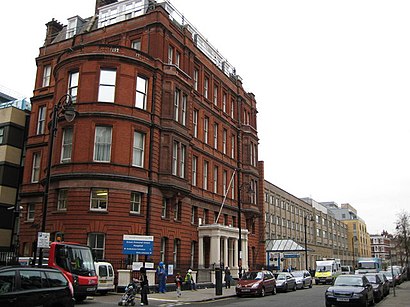
Great Ormond Street Address: Great Ormond St, London WC1N 3JH, UK street in Bloomsbury
Attractions near Great Ormond Street
Royal London Homeopathic Hospital,Royal London Hospital For Integrated Medicine,Royal London Hospital For Integrated Medicine,Great Ormond Street Children's Hospital- London,Great Ormond Street Hospital,National Hospital for Neurology and Neurosurgery Queen Square,Great Ormond Street Hospital For Children,Queen Square Greater London England,Babington Court,WC1N 3JH,WC1N 3BG,Great Ormond St Children's Hospital,National Hospital for Neurology and Neurosurgery,National Hospital For Neurology And Neurosurgery,Ormond / Boswell Street,Boiler House & Orangery,Queen Square Cosmo Place,Queen Square Old Gloucester Street,Mary Ward Centre,Queens Square Imaging CentreHow to get to popular attractions in Bloomsbury with public transportation
High Street, Hounslow,Westbourne Studios, Westbourne Park,Brent, Colindale,Nuffield Health Newbury Fitness & Wellbeing Gym, Newbury (W Berks),Westwood Cross, Ramsgate,Virgin Active Chelsea, Chelsea,Clapton Pond, Clapton,Lewisham Shopping Centre, Lewisham,Brighton Pier,Hayes Railway Station, Hayes (Kent),Heathrow Terminal 3, Heathrow,Orpington, Orpington,Wimbledon, Wimbledon,Reading College, Reading,Virgin Active, Wimbledon,Cineworld, Ashford,Queen's Club, West Kensington,Redbridge Roundabout, Clayhall,Royal Observatory Greenwich, Greenwich,Putney, PutneyGet around Bloomsbury by public transport!
Travelling around Bloomsbury has never been so easy. See step by step directions as you travel to any attraction, street or major public transport station. View bus and train timetables, arrival times, service alerts and detailed routes on a map, so you know exactly how to get to anywhere in Bloomsbury.
When travelling to any destination around Bloomsbury use Moovit's Live Directions with Get Off Notifications to know exactly where and how far to walk, how long to wait for your line , and how many stops are left. Moovit will alert you when it’s time to get off — no need to constantly re-check whether yours is the next stop.
Wondering how to use public transport in Bloomsbury or how to pay for public transport in Bloomsbury? Moovit public transport app can help you navigate your way with public transport easily, and at minimum cost. It includes public transport fees, ticket prices, and costs. Looking for a map of Bloomsbury public transport lines? Moovit public transport app shows all public transport maps in Bloomsbury with all bus, Tube or train routes and stops on an interactive map.
Bloomsbury has 3 transport type(s), including: bus, Tube or train, operated by several transport agencies, including London Underground, London Buses, Transport for London, London Tramlink, Transport for London, National Rail, Bluestar, Berry's Coaches, Oxford Bus Company, Stagecoach West, Community First Wessex, Cresta Coaches, D & P Boat Hire, First Portsmouth, Fareham & Gosport and FYTbus