Directions to Great Yarmouth with public transportation
The following transport lines have routes that pass near Great Yarmouth
How to get to Great Yarmouth by bus?
Click on the bus route to see step by step directions with maps, line arrival times and updated time schedules.
How to get to Great Yarmouth by train?
Click on the train route to see step by step directions with maps, line arrival times and updated time schedules.
Bus stops near Great Yarmouth
- White Horse Plain, Great Yarmouth, 3 min walk,
- St. Nicholas's Church, Great Yarmouth, 4 min walk,
- Police Station, Great Yarmouth, 7 min walk,
Bus routes to Great Yarmouth
- 1, Martham - Lowestoft,
- 1A, Martham - Lowestoft,
- 7, Norwich - Great Yarmouth,
- 8, Caister - James Paget Hospital,
- 983, Martham - East Norfolk Sixth Form,
- 6, Gorleston,
- X6, North Walsham,
- 68, Gorleston,
- 73C, Cantley,
- 271, Hemsby,
- 580, Great Yarmouth,
What are the nearest stations to Great Yarmouth?
The nearest stations to Great Yarmouth are:
- White Horse Plain, Great Yarmouth is 164 meters away, 3 min walk.
- St. Nicholas's Church, Great Yarmouth is 267 meters away, 4 min walk.
- Police Station, Great Yarmouth is 505 meters away, 7 min walk.
Which bus lines stop near Great Yarmouth?
These bus lines stop near Great Yarmouth: 6, 8.
Which train line stops near Great Yarmouth?
ABELLIO GREATER ANGLIA
What’s the nearest bus stop to Great Yarmouth?
The nearest bus stop to Great Yarmouth is White Horse Plain, Great Yarmouth. It’s a 3 min walk away.
See Great Yarmouth on the map
Public Transportation to Great Yarmouth
Wondering how to get to Great Yarmouth, United Kingdom? Moovit helps you find the best way to get to Great Yarmouth with step-by-step directions from the nearest public transit station.
Moovit provides free maps and live directions to help you navigate through your city. View schedules, routes, timetables, and find out how long does it take to get to Great Yarmouth in real time.
Looking for the nearest stop or station to Great Yarmouth? Check out this list of stops closest to your destination: White Horse Plain; St. Nicholas's Church; Police Station.
Bus: 6, 8, 1, 1A, 7, 983, X6, 68, 73C, 271, 580.Train: ABELLIO GREATER ANGLIA.
Want to see if there’s another route that gets you there at an earlier time? Moovit helps you find alternative routes or times. Get directions from and directions to Great Yarmouth easily from the Moovit App or Website.
We make riding to Great Yarmouth easy, which is why over 1.5 million users, including users in Great Yarmouth, trust Moovit as the best app for public transit. You don’t need to download an individual bus app or train app, Moovit is your all-in-one transit app that helps you find the best bus time or train time available.
For information on prices of bus and train, costs and ride fares to Great Yarmouth, please check the Moovit app.
Use the app to navigate to popular places including to the airport, hospital, stadium, grocery store, mall, coffee shop, school, college, and university.
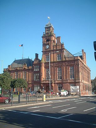
Great Yarmouth Address: Norfolk, England street in Great Yarmouth
Attractions near Great Yarmouth
How to get to popular places in East Anglia with public transit
Get around Great Yarmouth by public transport!
Travelling around Great Yarmouth has never been so easy. See step by step directions as you travel to any attraction, street or major public transport station. View bus and train timetables, arrival times, service alerts and detailed routes on a map, so you know exactly how to get to anywhere in Great Yarmouth.
When travelling to any destination around Great Yarmouth use Moovit's Live Directions with Get Off Notifications to know exactly where and how far to walk, how long to wait for your line , and how many stops are left. Moovit will alert you when it’s time to get off — no need to constantly re-check whether yours is the next stop.
Wondering how to use public transport in Great Yarmouth or how to pay for public transport in Great Yarmouth? Moovit public transport app can help you navigate your way with public transport easily, and at minimum cost. It includes public transport fees, ticket prices, and costs. Looking for a map of Great Yarmouth public transport lines? Moovit public transport app shows all public transport maps in Great Yarmouth with all bus or train routes and stops on an interactive map.
Great Yarmouth has 2 transport type(s), including: bus or train, operated by several transport agencies, including National Rail, Ambassador Travel, Harwich Harbour Ferry, Stephensons of Essex, Villager Minibus Sharnbrook, The Voluntary Network, Dews Coaches, Lord's Travel, Felixstowe Ferry Boat Yard, Hadleigh Community Transport, Beestons, Fenland Association for Community Transport, First Norfolk & Suffolk, National Rail and Mulleys Motorways