Directions to Greenford with public transportation
The following transport lines have routes that pass near Greenford
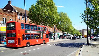
How to get to Greenford by bus?
Click on the bus route to see step by step directions with maps, line arrival times and updated time schedules.
How to get to Greenford by train?
Click on the train route to see step by step directions with maps, line arrival times and updated time schedules.
How to get to Greenford by Tube?
Click on the Tube route to see step by step directions with maps, line arrival times and updated time schedules.
Bus routes to Greenford
- 95,Southall, Town Hall,
- 105,Greenford Station,
- 282,Mount Vernon Hospital,
- E6,Bulls Bridge - Greenford Broadway,
- E7,Ealing Broadway - Ruislip,
- N7,Oxford Circus - Northolt,
- E9,Ealing Broadway - Yeading, Barnhill Estate,
- E10,Ealing Broadway - Northolt, Islip Manor,
- 92,St Raphael's North,
- E1,Ealing Broadway - Greenford Broadway,
- E3,Chiswick, Edensor Road - Greenford Broadway,
- E11,Ealing, Warwick Dene - Greenford Broadway,
- E2,Greenford Broadway,
- E5,Perivale, Tesco,
What are the nearest stations to Greenford?
The nearest stations to Greenford are:
- Oldfield Lane South (P) is 175 meters away, 3 min walk.
- Greenford Broadway (N) is 175 meters away, 3 min walk.
- Ruislip Road East (D) is 396 meters away, 6 min walk.
- Clifton Road (K) is 414 meters away, 6 min walk.
- Clifton Road (M) is 451 meters away, 6 min walk.
- Greenford is 1468 meters away, 20 min walk.
- Hanwell is 1688 meters away, 22 min walk.
Which bus lines stop near Greenford?
These bus lines stop near Greenford: 95, E10, E3, E7, E9.
Which train line stops near Greenford?
ELIZABETH
Which Tube line stops near Greenford?
CENTRAL
What’s the nearest train station to Greenford?
The nearest train station to Greenford is Greenford. It’s a 20 min walk away.
What’s the nearest bus stop to Greenford?
The nearest bus stops to Greenford are Oldfield Lane South (P) and Greenford Broadway (N). The closest one is a 3 min walk away.
What time is the first Tube to Greenford?
The CENTRAL is the first Tube that goes to Greenford. It stops nearby at 06:50.
What time is the last Tube to Greenford?
The CENTRAL is the last Tube that goes to Greenford. It stops nearby at 00:18.
What time is the first train to Greenford?
The ELIZABETH is the first train that goes to Greenford. It stops nearby at 08:10.
What time is the last train to Greenford?
The ELIZABETH is the last train that goes to Greenford. It stops nearby at 22:48.
What time is the first bus to Greenford?
The N7 is the first bus that goes to Greenford. It stops nearby at 03:00.
What time is the last bus to Greenford?
The N7 is the last bus that goes to Greenford. It stops nearby at 03:33.
See Greenford on the map
Public Transportation to Greenford
Wondering how to get to Greenford, United Kingdom? Moovit helps you find the best way to get to Greenford with step-by-step directions from the nearest public transit station.
Moovit provides free maps and live directions to help you navigate through your city. View schedules, routes, timetables, and find out how long does it take to get to Greenford in real time.
Looking for the nearest stop or station to Greenford? Check out this list of stops closest to your destination: Oldfield Lane South (P); Greenford Broadway (N); Ruislip Road East (D); Clifton Road (K); Clifton Road (M); Greenford; Hanwell.
Bus: 95, E10, E3, E7, E9, 105, 282, E6, N7, E1, E11, 92.Train: ELIZABETH, CENTRAL, GREAT WESTERN RAILWAY.Tube: CENTRAL.
Want to see if there’s another route that gets you there at an earlier time? Moovit helps you find alternative routes or times. Get directions from and directions to Greenford easily from the Moovit App or Website.
We make riding to Greenford easy, which is why over 1.5 million users, including users in Greenford, trust Moovit as the best app for public transit. You don’t need to download an individual bus app or train app, Moovit is your all-in-one transit app that helps you find the best bus time or train time available.
For information on prices of bus, train and Tube, costs and ride fares to Greenford, please check the Moovit app.
Use the app to navigate to popular places including to the airport, hospital, stadium, grocery store, mall, coffee shop, school, college, and university.
Greenford Address: Ruislip Rd, Greenford UB6 9QN, United Kingdom street in Greenford
Attractions near Greenford
Greenford Methodist Church,Greenford Hall,Ub6 9qn,Ealing Education Centre,VB & Sons Greenford,UB6 9EH,V.B. & Sons,Boots Uk,Greenford Broadway (Stop J), London,200 Windmill Lane,Ravenor Park,Adilee Restaurant,UB6 9DW,The Wishing Well (Wishing Well Greenford),Tesco Metro,Stanhope Primary School,Tsb Bank,Greenford Service Centre,Organic Raw Dog Food,Greenford BroadwayHow to get to popular attractions in Greenford with public transportation
IKEA, Bletchley (M Keynes),Dorking, Dorking,Northwick Park Hospital, Kenton,Churchill Square, Brighton And Hove,Harpenden, Harpenden,Uxbridge College, Uxbridge,Sands, High Wycombe,British Museum, Bloomsbury,Heathrow Terminal 3, Heathrow,St Thomas' Hospital, Waterloo,Queen Elizabeth Hospital, Woolwich,Imperial War Museum, Elephant & Castle,Kingston upon Thames, Kingston,John Radcliffe Main Hospital, Oxford,Chase Farm Hospital, Enfield,Nuffield Health, Kingston,High Wycombe Bus Station, High Wycombe,Virgin Active, Chiswick,Hayes Railway Station, Hayes (Kent),Croydon University Hospital, Broad GreenGet around London by public transport!
Travelling around London has never been so easy. See step by step directions as you travel to any attraction, street or major public transport station. View bus and train timetables, arrival times, service alerts and detailed routes on a map, so you know exactly how to get to anywhere in London.
When travelling to any destination around London use Moovit's Live Directions with Get Off Notifications to know exactly where and how far to walk, how long to wait for your line , and how many stops are left. Moovit will alert you when it’s time to get off — no need to constantly re-check whether yours is the next stop.
Wondering how to use public transport in London or how to pay for public transport in London? Moovit public transport app can help you navigate your way with public transport easily, and at minimum cost. It includes public transport fees, ticket prices, and costs. Looking for a map of London public transport lines? Moovit public transport app shows all public transport maps in London with all Bus, Train, Tube, Tramlink, River Bus and DLR routes and stops on an interactive map.
London has 6 transport type(s), including: Bus, Train, Tube, Tramlink, River Bus and DLR, operated by several transport agencies, including London Underground, London Buses, Transport for London, London Tramlink, National Rail, Bluestar, Berry's Coaches, Oxford Bus Company, Stagecoach West, Community First Wessex, Cresta Coaches, D & P Boat Hire, First Portsmouth, Fareham & Gosport, FYTbus, IFS Cloud Cable Car