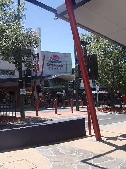
Directions to Greensborough Plaza with public transportation
The following transport lines have routes that pass near Greensborough Plaza
How to get to Greensborough Plaza by bus?
Click on the bus route to see step by step directions with maps, line arrival times and updated time schedules.
How to get to Greensborough Plaza by train?
Click on the train route to see step by step directions with maps, line arrival times and updated time schedules.
Bus stops near Greensborough Plaza
- Greensborough Plaza/Main St (Greensborough), 3 min walk,
- Greensborough Shopping Centre Para Rd/Main St (Greensborough), 4 min walk,
- Greensborough Station/Para Rd (Greensborough), 6 min walk,
Train stations near Greensborough Plaza
- Montmorency, 8 min walk,
Tram stations near Greensborough Plaza
- 69-Taunton Dr/Plenty Rd (Bundoora), 31 min walk,
Bus routes to Greensborough Plaza
- 343, Hurstbridge,
- 385, Mernda Station/Whittlesea,
- 514, Glenroy,
- 517, St Helena,
- 518, Greensborough,
- 566, Northland Sc,
- 902, Chelsea,
- 293, Greensborough,
- 901, Frankston,
What are the nearest stations to Greensborough Plaza?
The nearest stations to Greensborough Plaza are:
- Greensborough Plaza/Main St (Greensborough) is 191 meters away, 3 min walk.
- Greensborough Shopping Centre Para Rd/Main St (Greensborough) is 267 meters away, 4 min walk.
- Greensborough Station/Para Rd (Greensborough) is 413 meters away, 6 min walk.
- Montmorency is 618 meters away, 8 min walk.
- 69-Taunton Dr/Plenty Rd (Bundoora) is 2426 meters away, 31 min walk.
Which bus lines stop near Greensborough Plaza?
These bus lines stop near Greensborough Plaza: 514, 517, 566, 901, 902.
Which train line stops near Greensborough Plaza?
HURSTBRIDGE
What’s the nearest train station to Greensborough Plaza?
The nearest train station to Greensborough Plaza is Montmorency. It’s a 8 min walk away.
What’s the nearest bus stop to Greensborough Plaza?
The nearest bus stop to Greensborough Plaza is Greensborough Plaza/Main St (Greensborough). It’s a 3 min walk away.
What time is the first tram to Greensborough Plaza?
The 86 is the first tram that goes to Greensborough Plaza. It stops nearby at 03:15.
What time is the last tram to Greensborough Plaza?
The 86 is the last tram that goes to Greensborough Plaza. It stops nearby at 01:12.
What time is the first train to Greensborough Plaza?
The HURSTBRIDGE is the first train that goes to Greensborough Plaza. It stops nearby at 03:01.
What time is the last train to Greensborough Plaza?
The HURSTBRIDGE is the last train that goes to Greensborough Plaza. It stops nearby at 01:01.
What time is the first bus to Greensborough Plaza?
The 901 is the first bus that goes to Greensborough Plaza. It stops nearby at 06:33.
What time is the last bus to Greensborough Plaza?
The 517 is the last bus that goes to Greensborough Plaza. It stops nearby at 22:05.
See Greensborough Plaza on the map
Public Transportation to Greensborough Plaza
Wondering how to get to Greensborough Plaza, Australia? Moovit helps you find the best way to get to Greensborough Plaza with step-by-step directions from the nearest public transit station.
Moovit provides free maps and live directions to help you navigate through your city. View schedules, routes, timetables, and find out how long does it take to get to Greensborough Plaza in real time.
Looking for the nearest stop or station to Greensborough Plaza? Check out this list of stops closest to your destination: Greensborough Plaza/Main St (Greensborough); Greensborough Shopping Centre Para Rd/Main St (Greensborough); Greensborough Station/Para Rd (Greensborough); Montmorency; 69-Taunton Dr/Plenty Rd (Bundoora).
Bus: 514, 517, 566, 901, 902, 343, 385, 518, 293.Train: HURSTBRIDGE.
Want to see if there’s another route that gets you there at an earlier time? Moovit helps you find alternative routes or times. Get directions from and directions to Greensborough Plaza easily from the Moovit App or Website.
We make riding to Greensborough Plaza easy, which is why over 1.5 million users, including users in Greensborough, trust Moovit as the best app for public transit. You don’t need to download an individual bus app or train app, Moovit is your all-in-one transit app that helps you find the best bus time or train time available.
For information on prices of bus and train, costs and ride fares to Greensborough Plaza, please check the Moovit app.
Use the app to navigate to popular places including to the airport, hospital, stadium, grocery store, mall, coffee shop, school, college, and university.
Greensborough Plaza Address: Greensborough Plaza, Church Street, Greensborough VIC 3088, Australia street in Greensborough
Popular routes to Greensborough Plaza
Attractions near Greensborough Plaza
Greensborough Plaza Shopping Centre,Robinsons Bookshop,Kmart-Greensborough Plaza,Greensborough Plaza Main St,Age Old Stone Works Pty. Ltd,Watermarc,Savers,MCM Kalparrin Centre,1 Flintoff Street,Savers Australia Inc.,Nestled,Credence Curtain Cleaning LLC,Paradise Massage,Greensborough Station,Shell,Magnolia Centred Care Pty,Collaboration House Psychology,Centrelink,Banyule City Council,Cherry Blossom ProductionsHow to get to popular attractions in Greensborough with public transportation
Victorian Trades Hall, Carlton,Nicholson Street & Gertrude Street, Fitzroy,Lygon Street, Carlton,Arden Street, North Melbourne,Ikea, Springvale,Her Majesty's Theatre, Melbourne,The Avenue Hospital, Windsor,Park Street And St Kilda Road, South Melbourne,Dfo, Melbourne,Dfo Moorabbin, Mentone,Arts Centre Melbourne, Southbank,Caulfield Racecourse, Caulfield East,St Kevin's College Heyington Campus, Toorak,Westfield Knox Shopping Centre, Wantirna South,Port Phillip Ferries Docklands Terminal, Docklands,Victoria Police Academy, Glen Waverley,310-316 King Street, Melbourne,County Court Of Victoria, Melbourne,University of Melbourne, Parkville,Federation Square, MelbourneGet around Melbourne by public transport!
Travelling around Melbourne has never been so easy. See step by step directions as you travel to any attraction, street or major public transport station. View bus and train timetables, arrival times, service alerts and detailed routes on a map, so you know exactly how to get to anywhere in Melbourne.
When travelling to any destination around Melbourne use Moovit's Live Directions with Get Off Notifications to know exactly where and how far to walk, how long to wait for your line , and how many stops are left. Moovit will alert you when it’s time to get off — no need to constantly re-check whether yours is the next stop.
Wondering how to use public transport in Melbourne or how to pay for public transport in Melbourne? Moovit public transport app can help you navigate your way with public transport easily, and at minimum cost. It includes public transport fees, ticket prices, and costs. Looking for a map of Melbourne public transport lines? Moovit public transport app shows all public transport maps in Melbourne with all Bus, Train and Tram routes and stops on an interactive map.
Melbourne has 3 transport type(s), including: Bus, Train and Tram, operated by several transport agencies, including PTV Metropolitan Trains, PTV Metropolitan Bus, Yarra Trams, PTV Regional Bus, SkyBus, Interstate Services, V/Line, V/Line (Coach)