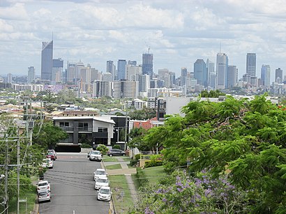
See Greenslopes on the map
Directions to Greenslopes with public transportation
The following transport lines have routes that pass near Greenslopes
 Bus:
Bus: - Train:
- Ferry:
How to get to Greenslopes by bus?
Click on the bus route to see step by step directions with maps, line arrival times and updated time schedules.
How to get to Greenslopes by train?
Click on the train route to see step by step directions with maps, line arrival times and updated time schedules.
Bus stations near Greenslopes
- Pear St Near Ridge St, Stop 20a,2 min walk,
- Earl St at Thompson Estate, Stop 17,4 min walk,
- Greenslopes Station, Platform 2,8 min walk,
- Ekibin Rd E at Ekibin, Stop 30,12 min walk,
Train stations near Greenslopes
- Fairfield Station,10 min walk,
- Park Road Station,24 min walk,
Ferry stations near Greenslopes
- UQ St Lucia Ferry Terminal,35 min walk,
Bus routes to Greenslopes
- 172,Garden City Interchange,
- P173,Mt Gravatt Central Fair,
- 114,City Gardens, Alice St,
- P119,City, Eagle St at Riverside,
- 120,Garden City Interchange,
- 121,Salisbury East, Henson Rd,
- 77,Eight Mile Plains - Chermside Via Clem7,
- 111,Eight Mile Plains - City,
- N111,Valley - Eight Mile Plains Nightlink,
- P137,Sunnybank Hills - City Pre-paid Rocket,
- 139,Sunnybank Hills - Uq Lakes,
- N154,City/valley - Browns Plains Nightlink,
- 160,Garden City - City,
- 161,Wishart Outlook - City,
- 169,Eight Mile Plains - Uq Lakes,
- 170,Garden City - City Express Via Newnham Road,
- 171,Garden City - City/valley Rocket Via Newnham Road,
- P176,Garden City - City Pre-paid Rocket Via Logan Road,
- 178,Carindale Heights - City/valley Via Mt Gravatt,
- 261,Mackenzie - Brisbane City,
What are the nearest stations to Greenslopes?
The nearest stations to Greenslopes are:
- Pear St Near Ridge St, Stop 20a is 102 meters away, 2 min walk.
- Earl St at Thompson Estate, Stop 17 is 270 meters away, 4 min walk.
- Greenslopes Station, Platform 2 is 622 meters away, 8 min walk.
- Fairfield Station is 730 meters away, 10 min walk.
- Ekibin Rd E at Ekibin, Stop 30 is 885 meters away, 12 min walk.
- Park Road Station is 1862 meters away, 24 min walk.
- UQ St Lucia Ferry Terminal is 2665 meters away, 35 min walk.
Which bus lines stop near Greenslopes?
These bus lines stop near Greenslopes: 111, 169, 555, 77, P137.
Which train lines stop near Greenslopes?
These train lines stop near Greenslopes: BEEN, DOOM, FERN.
What’s the nearest train station to Greenslopes?
The nearest train station to Greenslopes is Fairfield Station. It’s a 10 min walk away.
What’s the nearest bus stop to Greenslopes?
The nearest bus stop to Greenslopes is Pear St Near Ridge St, Stop 20a. It’s a 2 min walk away.
What time is the first train to Greenslopes?
The BEEN is the first train that goes to Greenslopes. It stops nearby at 04:17.
What time is the last train to Greenslopes?
The BEEN is the last train that goes to Greenslopes. It stops nearby at 00:42.
What time is the first bus to Greenslopes?
The 111 is the first bus that goes to Greenslopes. It stops nearby at 04:55.
What time is the last bus to Greenslopes?
The 111 is the last bus that goes to Greenslopes. It stops nearby at 00:21.
What time is the first ferry to Greenslopes?
The CITY CAT DOWNSTREAM - NORTHSHORE HAMILTON is the first ferry that goes to Greenslopes. It stops nearby at 05:30.
What time is the last ferry to Greenslopes?
The CITY CAT UPSTREAM - UQ is the last ferry that goes to Greenslopes. It stops nearby at 23:38.
How much is the bus fare to Greenslopes?
The bus fare to Greenslopes costs about $2.84 - $4.34.
How much is the train fare to Greenslopes?
The train fare to Greenslopes costs about $2.84 - $6.63.
See Greenslopes on the map
Public Transportation to Greenslopes
Wondering how to get to Greenslopes, Australia? Moovit helps you find the best way to get to Greenslopes with step-by-step directions from the nearest public transit station.
Moovit provides free maps and live directions to help you navigate through your city. View schedules, routes, timetables, and find out how long does it take to get to Greenslopes in real time.
Looking for the nearest stop or station to Greenslopes? Check out this list of stops closest to your destination: Pear St Near Ridge St; Earl St at Thompson Estate; Greenslopes Station; Fairfield Station; Ekibin Rd E at Ekibin; Park Road Station; UQ St Lucia Ferry Terminal.
Bus:Train:Ferry:
Want to see if there’s another route that gets you there at an earlier time? Moovit helps you find alternative routes or times. Get directions from and directions to Greenslopes easily from the Moovit App or Website.
We make riding to Greenslopes easy, which is why over 1.5 million users, including users in Greenslopes, trust Moovit as the best app for public transit. You don’t need to download an individual bus app or train app, Moovit is your all-in-one transit app that helps you find the best bus time or train time available.
For information on prices of bus and train, costs and ride fares to Greenslopes, please check the Moovit app.
Use the app to navigate to popular places including to the airport, hospital, stadium, grocery store, mall, coffee shop, school, college, and university.
Greenslopes Address: South East Busway street in Greenslopes
Attractions near Greenslopes
Greenslopes Busway Station,Multicultural Hub,Annerley Scout Hall,RMT Injury & Recovery,Sausage Tree Park,Stephens Mountain,C&C Painters Tarragindi,Harcourts Your Home,Craigs Hill,Ezshappy,Greenslopes Bowls Club,Gemini Planning,Jindalee Driving School,Steven May Productions,Mons Groupfit,Wow Pro Painting,Lash Sundays,Next Gen Erides,Brisbane Event Photographer,Anna OsetroffHow to get to popular attractions in Greenslopes with public transportation
Grand Plaza, Browns Plains,Cavendish Road State High School, Holland Park,Redland Bay Marina Platform 3,Forest Lake, Forest Lake,Sunnybank Railway Station, Sunnybank,Clear Island Waters, Clear Island Waters,Warner Bros. Movie World, Oxenford,Landmark Restaurant, Robertson,Surfers Paradise,RACQ, Eight Mile Plains,Mecca Bah, Broadbeach,Pacific Fair, Broadbeach Waters,Bunnings Warehouse, Morayfield,Fortitude Valley, Fortitude Valley,Brisbane, City,Westfield Garden City, Upper Mount Gravatt,Gold Coast,Noosaville, Noosaville,Southport Sharks, Southport,Lutwyche City, LutwycheGet around Greenslopes by public transport!
Travelling around Greenslopes has never been so easy. See step by step directions as you travel to any attraction, street or major public transport station. View bus and train timetables, arrival times, service alerts and detailed routes on a map, so you know exactly how to get to anywhere in Greenslopes.
When travelling to any destination around Greenslopes use Moovit's Live Directions with Get Off Notifications to know exactly where and how far to walk, how long to wait for your line , and how many stops are left. Moovit will alert you when it’s time to get off — no need to constantly re-check whether yours is the next stop.
Wondering how to use public transport in Greenslopes or how to pay for public transport in Greenslopes? Moovit public transport app can help you navigate your way with public transport easily, and at minimum cost. It includes public transport fees, ticket prices, and costs. Looking for a map of Greenslopes public transport lines? Moovit public transport app shows all public transport maps in Greenslopes with all bus or train routes and stops on an interactive map.
Greenslopes has 2 transport type(s), including: bus or train, operated by several transport agencies, including TransLink SEQ, TransLink, TransLink, TransLink, Christensens Bus and Coach, North Stradbroke Island Buses and Griffith Uni Intercampus bus