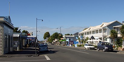
Directions to Greytown New Zealand with public transportation
The following transport lines have routes that pass near Greytown New Zealand
How to get to Greytown New Zealand by bus?
Click on the bus route to see step by step directions with maps, line arrival times and updated time schedules.
Bus stations near Greytown New Zealand
- Greytown - Main Street (Near 73),3 min walk,
Bus routes to Greytown New Zealand
- 200,Wairarapa Hospital,
- 204,Wood And Kempton Streets,
- 313,Featherston - Fitzherbert Street (Opposite 32),
- 315,Cnr Main Street And Hospital Street (Hail And Ride),
What are the nearest stations to Greytown New Zealand?
The nearest stations to Greytown New Zealand are:
- Greytown - Main Street (Near 73) is 182 meters away, 3 min walk.
Which bus lines stop near Greytown New Zealand?
These bus lines stop near Greytown New Zealand: 200, 204.
What’s the nearest bus stop to Greytown New Zealand?
The nearest bus stop to Greytown New Zealand is Greytown - Main Street (Near 73). It’s a 3 min walk away.
What time is the first bus to Greytown New Zealand?
The 204 is the first bus that goes to Greytown New Zealand. It stops nearby at 05:56.
What time is the last bus to Greytown New Zealand?
The 204 is the last bus that goes to Greytown New Zealand. It stops nearby at 19:55.
How much is the bus fare to Greytown New Zealand?
The bus fare to Greytown New Zealand costs about $0.46 - $2.26.
How much is the train fare to Greytown New Zealand?
The train fare to Greytown New Zealand costs about $1.00 - $9.50.
See Greytown New Zealand on the map
Public Transportation to Greytown New Zealand
Wondering how to get to Greytown New Zealand, New Zealand? Moovit helps you find the best way to get to Greytown New Zealand with step-by-step directions from the nearest public transit station.
Moovit provides free maps and live directions to help you navigate through your city. View schedules, routes, timetables, and find out how long does it take to get to Greytown New Zealand in real time.
Looking for the nearest stop or station to Greytown New Zealand? Check out this list of stops closest to your destination: Greytown - Main Street (Near 73).
Bus:200204313315
Want to see if there’s another route that gets you there at an earlier time? Moovit helps you find alternative routes or times. Get directions from and directions to Greytown New Zealand easily from the Moovit App or Website.
We make riding to Greytown New Zealand easy, which is why over 1.5 million users, including users in Greytown, trust Moovit as the best app for public transit. You don’t need to download an individual bus app or train app, Moovit is your all-in-one transit app that helps you find the best bus time or train time available.
For information on prices of bus and train, costs and ride fares to Greytown New Zealand, please check the Moovit app.
Use the app to navigate to popular places including to the airport, hospital, stadium, grocery store, mall, coffee shop, school, college, and university.
Location: Greytown, Wellington
Popular routes to Greytown New Zealand
- From Renall Street StationFrom Matarawa StationFrom Adelaide Road (Near 500)From The Glen - Horoeka Street at Glen Road (Near 5)From Hewer Crescent at Sladden StreetFrom Upper Hutt StationFrom Mitchell Street at Hoover Street (Near 138)From Kilbirnie - Stop AFrom Marsden Street at Bridge StreetFrom Woodside Station
Attractions near Greytown New Zealand
Ash Studio,Jayah with Soul,Chambers on Main,The White Swan Hotel,Baloos,Bayleys Wairarapa South,Greytown Information Centre,Greytown Town Hall,Kouka Cottage,Toi Toi Wines,La Dedah Greytown,Kirsten Tatham Physiotherapy,Physio Kate Anderson,Country Clothes,Cuckoo Pizza,Medina Organic Skincar,The Burger Guy,Meeneez Sweet Treats and Gelato,Lizette,ArabesqueHow to get to popular attractions in Greytown with public transportation
Kenepuru Railway Station, Porirua Central,Seatoun Heights, Seatoun Tunnel West,Ngauranga Gorge, Newlands South,The Warehouse Lyall Bay, Lyall Bay-Airport-Moa Point,Kapiti College, Raumati Beach,Mount Victoria Lookout, Mt Victoria West,Wellington SPCA, Newtown East,Silverstream Bakery & Cafe, Heretaunga-Silverstream,Carterton Railway Station, Carterton,Inland Revenue, Thorndon-Tinakori Road,Featherston Railway Station, Featherston,Harvey Norman Warehouse, Taita South,Mcdonald's, Willis Street-Cambridge Terrace,Harcourt Park - Upper Hutt, Emerald Hill,Macalister Park, Berhampore West,Coco at The Roxy, Miramar,The Plateau / Te Marua Store, Te Marua,Vivian St, Willis Street-Cambridge Terrace,Cossie Club, Upper Hutt Central,Topor Bistro & Bar, PlimmertonGet around Greytown by public transport!
Travelling around Greytown has never been so easy. See step by step directions as you travel to any attraction, street or major public transport station. View bus and train timetables, arrival times, service alerts and detailed routes on a map, so you know exactly how to get to anywhere in Greytown.
When travelling to any destination around Greytown use Moovit's Live Directions with Get Off Notifications to know exactly where and how far to walk, how long to wait for your line , and how many stops are left. Moovit will alert you when it’s time to get off — no need to constantly re-check whether yours is the next stop.
Wondering how to use public transport in Greytown or how to pay for public transport in Greytown? Moovit public transport app can help you navigate your way with public transport easily, and at minimum cost. It includes public transport fees, ticket prices, and costs. Looking for a map of Greytown public transport lines? Moovit public transport app shows all public transport maps in Greytown with all bus or train routes and stops on an interactive map.
Greytown has 2 transport type(s), including: bus or train, operated by several transport agencies, including Tranzit Coachlines, NZ Bus, Metlink Rail, Mana Coach Services Limited, Uzabus, East By West Ferry, Wellington Cable Car and Uzabus (Horizons)