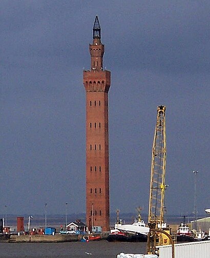
See Grimsby Dock Tower, North East Lincolnshire, on the map
Directions to Grimsby Dock Tower (North East Lincolnshire) with public transport
The following transport lines have routes that pass near Grimsby Dock Tower
 Bus:
Bus: - Train:
How to get to Grimsby Dock Tower by bus?
Click on the bus route to see step by step directions with maps, line arrival times and updated time schedules.
How to get to Grimsby Dock Tower by train?
Click on the train route to see step by step directions with maps, line arrival times and updated time schedules.
Bus stations near Grimsby Dock Tower in North East Lincolnshire
- Nacton Street, East Marsh,19 min walk,
- Tomline Street, East Marsh,20 min walk,
Train stations near Grimsby Dock Tower in North East Lincolnshire
- Grimsby Town,42 min walk,
Bus lines to Grimsby Dock Tower in North East Lincolnshire
- 2,East Marsh,
- 3,Cleethorpes Pier,
- 5M,Stallingborough,
- 9,Waltham,
- 10,Waltham,
What are the nearest stations to Grimsby Dock Tower?
The nearest stations to Grimsby Dock Tower are:
- Nacton Street, East Marsh is 1458 meters away, 19 min walk.
- Tomline Street, East Marsh is 1539 meters away, 20 min walk.
- Grimsby Town is 3188 meters away, 42 min walk.
Which bus lines stop near Grimsby Dock Tower?
These bus lines stop near Grimsby Dock Tower: 10, 3, 5.
Which train lines stop near Grimsby Dock Tower?
These train lines stop near Grimsby Dock Tower: EAST MIDLANDS RAILWAY, TRANSPENNINE EXPRESS.
What time is the first train to Grimsby Dock Tower in North East Lincolnshire?
The EAST MIDLANDS RAILWAY is the first train that goes to Grimsby Dock Tower in North East Lincolnshire. It stops nearby at 05:00.
What time is the last train to Grimsby Dock Tower in North East Lincolnshire?
The EAST MIDLANDS RAILWAY is the last train that goes to Grimsby Dock Tower in North East Lincolnshire. It stops nearby at 22:32.
What time is the first bus to Grimsby Dock Tower in North East Lincolnshire?
The 10 is the first bus that goes to Grimsby Dock Tower in North East Lincolnshire. It stops nearby at 05:09.
What time is the last bus to Grimsby Dock Tower in North East Lincolnshire?
The 3 is the last bus that goes to Grimsby Dock Tower in North East Lincolnshire. It stops nearby at 23:37.
See Grimsby Dock Tower, North East Lincolnshire, on the map
Public Transit to Grimsby Dock Tower in North East Lincolnshire
Wondering how to get to Grimsby Dock Tower in North East Lincolnshire, United Kingdom? Moovit helps you find the best way to get to Grimsby Dock Tower with step-by-step directions from the nearest public transit station.
Moovit provides free maps and live directions to help you navigate through your city. View schedules, routes, timetables, and find out how long does it take to get to Grimsby Dock Tower in real time.
Looking for the nearest stop or station to Grimsby Dock Tower? Check out this list of stops closest to your destination: Nacton Street; Tomline Street; Grimsby Town.
Bus:Train:
Want to see if there’s another route that gets you there at an earlier time? Moovit helps you find alternative routes or times. Get directions from and directions to Grimsby Dock Tower easily from the Moovit App or Website.
We make riding to Grimsby Dock Tower easy, which is why over 1.5 million users, including users in North East Lincolnshire, trust Moovit as the best app for public transit. You don’t need to download an individual bus app or train app, Moovit is your all-in-one transit app that helps you find the best bus time or train time available.
For information on prices of train and bus, costs and ride fares to Grimsby Dock Tower, please check the Moovit app.
Use the app to navigate to popular places including to the airport, hospital, stadium, grocery store, mall, coffee shop, school, college, and university.
Location: North East Lincolnshire, East Midlands
Attractions near Grimsby Dock Tower
30 Wharncliffe Rd N, Grimsby DN31 3QF Wharncliffe Road North,Grimsby Telegraph,Dn31 3qq,Auckland Road,Dn31 3sw,Wickham Road,Mighty Micks Boxing Club,Unique Academy of Dance,Banbury Court,Acton Court,2 Cleethorpe Road,Victor Street,Nelson Street,Birkwood Medical Centre,Prince Albert Gardens,Milk And Grocery Delivery Grimsby - Dairy Crest,Dn36 4rf,Garibaldi Street,Docks Beers,445 Cleethorpe RoadHow to get to popular attractions in North East Lincolnshire with public transportation
Mecca Bingo, Broxtowe,Westwood Centre, Peterborough,Forest Fields, Nottingham,Bracebridge Heath, North Kesteven,Currys PC World, Lincoln,Bradgate Park & Swithland Wood Country Park, Charnwood,University Of Derby, Derby,Chequered Flag (Hungry Horse), Corby,E.ON (Bilborough), Nottingham,Asda, Derby,The Watermill (Toby Carvery), Ashfield,Steep Hill, Lincoln,Francis Crick House, Northampton,Wingerworth, North East Derbyshire,Sutton-In-Ashfield, Ashfield,Huthwaite, Ashfield,University Of Nottingham, Nottingham,Daventry Court Hotel, Daventry,Bagworth, Hinckley And Bosworth,Lidl, PeterboroughGet around North East Lincolnshire by public transport!
Travelling around North East Lincolnshire has never been so easy. See step by step directions as you travel to any attraction, street or major public transport station. View bus and train timetables, arrival times, service alerts and detailed routes on a map, so you know exactly how to get to anywhere in North East Lincolnshire.
When travelling to any destination around North East Lincolnshire use Moovit's Live Directions with Get Off Notifications to know exactly where and how far to walk, how long to wait for your line , and how many stops are left. Moovit will alert you when it’s time to get off — no need to constantly re-check whether yours is the next stop.
Wondering how to use public transport in North East Lincolnshire or how to pay for public transport in North East Lincolnshire? Moovit public transport app can help you navigate your way with public transport easily, and at minimum cost. It includes public transport fees, ticket prices, and costs. Looking for a map of North East Lincolnshire public transport lines? Moovit public transport app shows all public transport maps in North East Lincolnshire with all train or bus routes and stops on an interactive map.
North East Lincolnshire has 2 transport type(s), including: train or bus, operated by several transport agencies, including National Rail, Ashbourne Community Transport, Delaine Buses, Arriva Midlands, Centrebus, Our Centre, Hulleys of Baslow, D & G Bus, Stagecoach East Midlands, North Lincolnshire Council, National Rail, Roberts Coaches, Lawson's of Corby, Hawkes Coaches and East Yorkshire