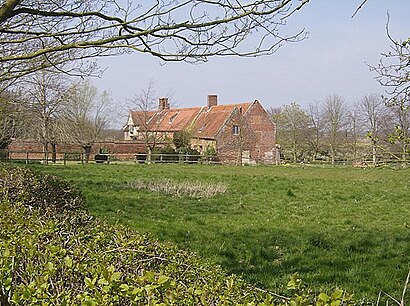
See Hales Hall, South Norfolk, on the map
Directions to Hales Hall (South Norfolk) with public transport
The following transport lines have routes that pass near Hales Hall
 Bus:
Bus:
How to get to Hales Hall by bus?
Click on the bus route to see step by step directions with maps, line arrival times and updated time schedules.
Bus stations near Hales Hall in South Norfolk
- Church Lane, Hales,20 min walk,
- Yarmouth Road, Kirby Cane,50 min walk,
Bus lines to Hales Hall in South Norfolk
- X2,Norwich - Lowestoft,
- X21,Norwich - Lowestoft,
- X22,Norwich - Lowestoft,
- 146,Southwold - Kessingland - Pakefield - Beccles - Norwich,
- 902,Notre Dame School - Lowestoft,
- 524,Southwold - Beccles - Halesworth/Bungay,
- 581,Beccles - Bungay - Harleston - Diss,
- 581,Beccles - Bungay / Bungay - Harleston,
What are the nearest stations to Hales Hall?
The nearest stations to Hales Hall are:
- Church Lane, Hales is 1524 meters away, 20 min walk.
- Yarmouth Road, Kirby Cane is 3895 meters away, 50 min walk.
Which bus line stops near Hales Hall?
146
See Hales Hall, South Norfolk, on the map
Public Transit to Hales Hall in South Norfolk
Wondering how to get to Hales Hall in South Norfolk, United Kingdom? Moovit helps you find the best way to get to Hales Hall with step-by-step directions from the nearest public transit station.
Moovit provides free maps and live directions to help you navigate through your city. View schedules, routes, timetables, and find out how long does it take to get to Hales Hall in real time.
Looking for the nearest stop or station to Hales Hall? Check out this list of stops closest to your destination: Church Lane; Yarmouth Road.
Bus:
Want to see if there’s another route that gets you there at an earlier time? Moovit helps you find alternative routes or times. Get directions from and directions to Hales Hall easily from the Moovit App or Website.
We make riding to Hales Hall easy, which is why over 1.5 million users, including users in South Norfolk, trust Moovit as the best app for public transit. You don’t need to download an individual bus app or train app, Moovit is your all-in-one transit app that helps you find the best bus time or train time available.
For information on prices of bus, costs and ride fares to Hales Hall, please check the Moovit app.
Use the app to navigate to popular places including to the airport, hospital, stadium, grocery store, mall, coffee shop, school, college, and university.
Location: South Norfolk, East Anglia
Attractions near Hales Hall
Nr14 6fn,Nr14 6fq,Hales Green,Nr14 6fp,Nr14 6gz,Nr14 6fl,Nr14 6tb,Nr14 6qw,Nr35 2hn,Bungay Road,Meadow Green Rescue Centre Kennels,Nr14 6td,Loddon,Nr14 6qj,Church Lane, Hales,Nr14 6ql,Hales,Beccles Road,The History of Advertising Trust,Nr14 6dzHow to get to popular attractions in South Norfolk with public transportation
Hunstanton Beach, King'S Lynn And West Norfolk,The Brickmakers, Norwich,Adelaide Street Bus Stop, Norwich,Caister On Sea, Great Yarmouth,Woolpit, Mid Suffolk,Milsoms, Kesgrave Hall, Suffolk Coastal,Bluntisham, Huntingdonshire,Felixstowe Beach, Suffolk Coastal,Lammas Land, Cambridge,Mulbarton, South Norfolk,Goals Soccer Centre, Norwich,Thickthorn Sevices A11 / A47 Interchange, South Norfolk,Potters Leisure Resort, Great Yarmouth,Seckford Hall, Suffolk Coastal,Murray Edwards College, Cambridge,Premier Inn Kings Lynn, King'S Lynn And West Norfolk,Holiday Inn Norwich - North, Norwich,Tesco, Harford Bridge Petrol Station, South Norfolk,Cringleford, South Norfolk,Better Jesus Green Lido, CambridgeGet around South Norfolk by public transport!
Travelling around South Norfolk has never been so easy. See step by step directions as you travel to any attraction, street or major public transport station. View bus and train timetables, arrival times, service alerts and detailed routes on a map, so you know exactly how to get to anywhere in South Norfolk.
When travelling to any destination around South Norfolk use Moovit's Live Directions with Get Off Notifications to know exactly where and how far to walk, how long to wait for your line , and how many stops are left. Moovit will alert you when it’s time to get off — no need to constantly re-check whether yours is the next stop.
Wondering how to use public transport in South Norfolk or how to pay for public transport in South Norfolk? Moovit public transport app can help you navigate your way with public transport easily, and at minimum cost. It includes public transport fees, ticket prices, and costs. Looking for a map of South Norfolk public transport lines? Moovit public transport app shows all public transport maps in South Norfolk with all bus routes and stops on an interactive map.
South Norfolk has 1 transport type(s), including: bus, operated by several transport agencies, including National Rail, Ambassador Travel, Harwich Harbour Ferry, Stephensons of Essex, Villager Minibus Sharnbrook, The Voluntary Network, Dews Coaches, Lord's Travel, Felixstowe Ferry Boat Yard, Hadleigh Community Transport, Beestons, Fenland Association for Community Transport, First Norfolk & Suffolk, National Rail and Mulleys Motorways