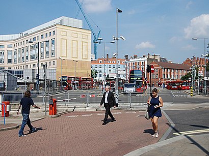
Hammersmith Bus Station (C) stop - Friday schedule
| Line | Direction | Time |
|---|---|---|
| N97 | Trafalgar Square | 03:05 |
| N11 | Whitehall, Horse Guards | 03:10 |
| 295 | Clapham Junction | 03:23 |
| 220 | Wandsworth | 03:24 |
| N97 | Trafalgar Square | 03:35 |
| N11 | Whitehall, Horse Guards | 03:35 |
| 295 | Clapham Junction | 03:53 |
| 220 | Wandsworth | 03:54 |
| N97 | Trafalgar Square | 04:05 |
| N11 | Whitehall, Horse Guards | 04:05 |
| 295 | Clapham Junction | 04:23 |
| 220 | Wandsworth | 04:24 |
| N11 | Whitehall, Horse Guards | 04:35 |
| N97 | Trafalgar Square | 04:40 |
| 295 | Clapham Junction | 04:53 |
| 220 | Wandsworth | 04:54 |
| 211 | Battersea Power Station | 05:05 |
| N97 | Trafalgar Square | 05:15 |
| 211 | Battersea Power Station | 05:20 |
| 295 | Clapham Junction | 05:23 |
| 220 | Wandsworth | 05:24 |
| 211 | Battersea Power Station | 05:35 |
| 220 | Wandsworth | 05:44 |
| 295 | Clapham Junction | 05:44 |
| 211 | Battersea Power Station | 05:47 |
See Hammersmith Bus Station (C) on the map
Directions to Hammersmith Bus Station (C) with public transportation
The following transport lines have routes that pass near Hammersmith Bus Station (C)
 Bus:
Bus: - Train:
- Tube:
How to get to Hammersmith Bus Station (C) by bus?
Click on the bus route to see step by step directions with maps, line arrival times and updated time schedules.
How to get to Hammersmith Bus Station (C) by train?
Click on the train route to see step by step directions with maps, line arrival times and updated time schedules.
How to get to Hammersmith Bus Station (C) by Tube?
Click on the Tube route to see step by step directions with maps, line arrival times and updated time schedules.
Bus stations near Hammersmith Bus Station (C)
- Hammersmith Bus Station, Hammersmith,1 min walk,
- Hammersmith Bus Station (B),1 min walk,
- Hammersmith Bus Station (F),1 min walk,
- Hammersmith Bus Station (A),1 min walk,
- Hammersmith Bus Station (E),2 min walk,
- Hammersmith Broadway, Hammersmith,3 min walk,
- Hammersmith Bridge Road, Hammersmith,3 min walk,
- Hammersmith Bridge Road (T),3 min walk,
- Hammersmith Broadway (M),4 min walk,
Tube stations near Hammersmith Bus Station (C)
- Hammersmith,2 min walk,
Bus routes to Hammersmith Bus Station (C)
- SUPERFAST-1,Wellington,
- SUPERFAST-2,Taunton,
- SUPERFAST-3,Monkton Heathfield,
- N9,Heathrow Terminal 5 - Aldwych,
- N11,Whitehall, Horse Guards - Ealing Broadway,
- H91,Hammersmith - Hounslow West,
- 110,Hammersmith - Hounslow, Bus Station,
- 190,West Brompton - Richmond,
- 218,North Acton - Hammersmith,
- N266,Brent Cross, Shopping Centre - Hammersmith,
- 267,Fulwell - Hammersmith,
- 306,Fulham, Sands End - Acton Vale,
- 9,Hammersmith,
- 72,Hammersmith Bridge, North Side - East Acton,
- N72,Roehampton, Bessborough Road - East Acton,
- 220,Wandsworth - Willesden Junction,
- 283,Hammersmith - East Acton,
- 295,Clapham Junction - Ladbroke Grove, Sainsbury's,
- N97,Trafalgar Square,
- 211,Battersea Power Station,
What are the nearest stations to Hammersmith Bus Station (C)?
The nearest stations to Hammersmith Bus Station (C) are:
- Hammersmith Bus Station, Hammersmith is 33 meters away, 1 min walk.
- Hammersmith Bus Station (B) is 33 meters away, 1 min walk.
- Hammersmith Bus Station (F) is 47 meters away, 1 min walk.
- Hammersmith Bus Station (A) is 69 meters away, 1 min walk.
- Hammersmith is 75 meters away, 2 min walk.
- Hammersmith Bus Station (E) is 131 meters away, 2 min walk.
- Hammersmith Broadway, Hammersmith is 176 meters away, 3 min walk.
- Hammersmith Bridge Road, Hammersmith is 195 meters away, 3 min walk.
- Hammersmith Bridge Road (T) is 195 meters away, 3 min walk.
- Hammersmith Broadway (M) is 213 meters away, 4 min walk.
Which bus lines stop near Hammersmith Bus Station (C)?
These bus lines stop near Hammersmith Bus Station (C): 105, 240, 253, 279, 53.
Which train line stops near Hammersmith Bus Station (C)?
OVERGROUND
Which Tube lines stop near Hammersmith Bus Station (C)?
These Tube lines stop near Hammersmith Bus Station (C): CIRCLE, DISTRICT, PICCADILLY.
What’s the nearest Tube station to Hammersmith Bus Station (C)?
The nearest Tube station to Hammersmith Bus Station (C) is Hammersmith. It’s a 2 min walk away.
What’s the nearest bus stop to Hammersmith Bus Station (C)?
The nearest bus stops to Hammersmith Bus Station (C) are Hammersmith Bus Station, Hammersmith, Hammersmith Bus Station (B), Hammersmith Bus Station (F) and Hammersmith Bus Station (A). The closest one is a 1 min walk away.
What time is the first Tube to Hammersmith Bus Station (C)?
The CIRCLE is the first Tube that goes to Hammersmith Bus Station (C). It stops nearby at 04:38.
What time is the last Tube to Hammersmith Bus Station (C)?
The CIRCLE is the last Tube that goes to Hammersmith Bus Station (C). It stops nearby at 01:09.
What time is the first bus to Hammersmith Bus Station (C)?
The N72 is the first bus that goes to Hammersmith Bus Station (C). It stops nearby at 03:01.
What time is the last bus to Hammersmith Bus Station (C)?
The N9 is the last bus that goes to Hammersmith Bus Station (C). It stops nearby at 03:47.
See Hammersmith Bus Station (C) on the map
Public transport to Hammersmith Bus Station (C) stop (ID: C)
Looking for directions to Hammersmith Bus Station (C) in Hammersmith, United Kingdom?
Download the Moovit App to find the current schedule and step-by-step directions for Bus, Tube or Train routes that pass through Hammersmith Bus Station (C).
Looking for the nearest stops closest to Hammersmith Bus Station (C) ? Check out this list of closest stops to your destination: Hammersmith Bus Station; Hammersmith Bus Station (B); Hammersmith Bus Station (F); Hammersmith Bus Station (A); Hammersmith; Hammersmith Bus Station (E); Hammersmith Broadway; Hammersmith Bridge Road; Hammersmith Bridge Road (T); Hammersmith Broadway (M).
Bus:Train:Tube:
We make riding on public transit to Hammersmith Bus Station (C) easy, which is why over 1.5 million users, including users in Hammersmith trust Moovit as the best app for public transit.
Use the app to navigate to popular places including to the airport, hospital, stadium, grocery store, mall, coffee shop, school, college, and university.
Hammersmith Bus Station (C) stop’s code is C
The first line to this stop is N97, at 03:05, and the last line is 220 at 02:54.
This stop serves London Buses’s lines
Bus stops near Hammersmith Bus Station (C)
Hammersmith Bus Station, Hammersmith,Hammersmith Bus Station (B),Hammersmith Bus Station (F),Hammersmith Bus Station (A),Hammersmith Bus Station (E),Hammersmith Broadway, Hammersmith,Hammersmith Bridge Road, Hammersmith,Hammersmith Bridge Road (T),Hammersmith Broadway (M)Tube station near Hammersmith Bus Station (C)
HammersmithPopular public transport stations in Hammersmith
Tessa Jowell Health Centre (T),Bishops Bridge / Paddington Station (J),Westbourne Park,Beaconsfield,Bush Hill Park Station,Kennington Lane (KH),The Grove (G),Reading Railair, Reading Town Centre,Southlands Outpatients, Shoreham-By-Sea,Dartford Girls' Grammar School,Hendon Central,King John School, South Benfleet,West Middlesex Hospital (HA),Cemetery Junction, Reading,Princess Alice Hospice, Esher,Teddington Memorial Hospital (L),Wembley Arena (G),Silverthorn Centre (HB),Leicester SquareGet around Hammersmith by public transport!
Travelling around Hammersmith has never been so easy. See step by step directions as you travel to any attraction, street or major public transport station. View bus and train timetables, arrival times, service alerts and detailed routes on a map, so you know exactly how to get to anywhere in Hammersmith.
When travelling to any destination around Hammersmith use Moovit's Live Directions with Get Off Notifications to know exactly where and how far to walk, how long to wait for your line , and how many stops are left. Moovit will alert you when it’s time to get off — no need to constantly re-check whether yours is the next stop.
Wondering how to use public transport in Hammersmith or how to pay for public transport in Hammersmith? Moovit public transport app can help you navigate your way with public transport easily, and at minimum cost. It includes public transport fees, ticket prices, and costs. Looking for a map of Hammersmith public transport lines? Moovit public transport app shows all public transport maps in Hammersmith with all bus, Tube or train routes and stops on an interactive map.
Hammersmith has 3 transport type(s), including: bus, Tube or train, operated by several transport agencies, including London Underground, London Buses, Transport for London, London Tramlink, Transport for London, National Rail, Bluestar, Berry's Coaches, Oxford Bus Company, Stagecoach West, Community First Wessex, Cresta Coaches, D & P Boat Hire, First Portsmouth, Fareham & Gosport and FYTbus