See Hampton Court Palace on the map
Directions to Hampton Court Palace with public transportation
The following transport lines have routes that pass near Hampton Court Palace
 Bus:
Bus: - Train:
How to get to Hampton Court Palace by bus?
Click on the bus route to see step by step directions with maps, line arrival times and updated time schedules.
How to get to Hampton Court Palace by train?
Click on the train route to see step by step directions with maps, line arrival times and updated time schedules.
Bus stations near Hampton Court Palace
- Hampton Court Palace Hampton Court (F),5 min walk,
- Hampton Court Palace Hampton Court (C),7 min walk,
- Hampton Court Railway Station, East Molesey,7 min walk,
- Hampton Court,7 min walk,
- Bridge Road (L),10 min walk,
Bus routes to Hampton Court Palace
- R68,Kew, Retail Park,
- 411,West Molesey,
- 461,Chertsey,
- 111,Heathrow Central,
- 216,Staines,
- APPS,East Molesey,
- SOUTH WESTERN RAILWAY,Wimbledon,
- 881,Thames Ditton,
What are the nearest stations to Hampton Court Palace?
The nearest stations to Hampton Court Palace are:
- Hampton Court Palace Hampton Court (F) is 341 meters away, 5 min walk.
- Hampton Court Palace Hampton Court (C) is 454 meters away, 7 min walk.
- Hampton Court Railway Station, East Molesey is 523 meters away, 7 min walk.
- Hampton Court is 528 meters away, 7 min walk.
- Bridge Road (L) is 696 meters away, 10 min walk.
Which bus lines stop near Hampton Court Palace?
These bus lines stop near Hampton Court Palace: 111, 411, 461, R68.
Which train line stops near Hampton Court Palace?
SOUTH WESTERN RAILWAY
What’s the nearest bus stop to Hampton Court Palace?
The nearest bus stop to Hampton Court Palace is Hampton Court Palace Hampton Court (F). It’s a 5 min walk away.
What time is the first train to Hampton Court Palace?
The SOUTH WESTERN RAILWAY is the first train that goes to Hampton Court Palace. It stops nearby at 05:54.
What time is the last train to Hampton Court Palace?
The SOUTH WESTERN RAILWAY is the last train that goes to Hampton Court Palace. It stops nearby at 00:12.
What time is the first bus to Hampton Court Palace?
The 111 is the first bus that goes to Hampton Court Palace. It stops nearby at 03:01.
What time is the last bus to Hampton Court Palace?
The 111 is the last bus that goes to Hampton Court Palace. It stops nearby at 04:05.
See Hampton Court Palace on the map
Public Transportation to Hampton Court Palace
Wondering how to get to Hampton Court Palace, United Kingdom? Moovit helps you find the best way to get to Hampton Court Palace with step-by-step directions from the nearest public transit station.
Moovit provides free maps and live directions to help you navigate through your city. View schedules, routes, timetables, and find out how long does it take to get to Hampton Court Palace in real time.
Looking for the nearest stop or station to Hampton Court Palace? Check out this list of stops closest to your destination: Hampton Court Palace Hampton Court (F); Hampton Court Palace Hampton Court (C); Hampton Court Railway Station; Hampton Court; Bridge Road (L).
Bus:Train:
Want to see if there’s another route that gets you there at an earlier time? Moovit helps you find alternative routes or times. Get directions from and directions to Hampton Court Palace easily from the Moovit App or Website.
We make riding to Hampton Court Palace easy, which is why over 1.5 million users, including users in Hampton Court, trust Moovit as the best app for public transit. You don’t need to download an individual bus app or train app, Moovit is your all-in-one transit app that helps you find the best bus time or train time available.
For information on prices of bus and train, costs and ride fares to Hampton Court Palace, please check the Moovit app.
Use the app to navigate to popular places including to the airport, hospital, stadium, grocery store, mall, coffee shop, school, college, and university.
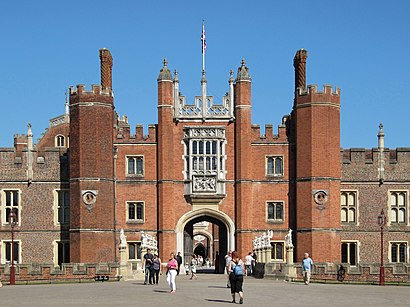
Hampton Court Palace Address: Tennis Court Lane street in Hampton Court
Popular routes to Hampton Court Palace
Popular routes from Hampton Court Palace
Attractions near Hampton Court Palace
East Molesey,KT8 9AU,Hampton Court Tours,Hampton Court Palace,Hampton Court Palace Ice Rink,East Molesey,Trophy Gate,Hampton Court Palace Maze,Royal School of Needlework,Hampton Court Palace,Station To Flower Show,Terrace on the Green,The Mute Swan,Kt8 9dd,Wilderness House,Riverside,Adams Gate,Hampton Court Bridge,Mitre Hotel Kingston upon Thames,The Magic GardenHow to get to popular attractions in Hampton Court with public transportation
Oxford Circus, Soho,O2 Academy Brixton, Brixton,Romford, Romford,Orpington, Orpington,Barking Station, Barking,University Of Brighton - Falmer Campus, Brighton And Hove,Stratford Centre, Stratford,Southall Police Station, Southall,Terminal 4, Heathrow,Oxford Brookes University Gipsy Lane Site, Oxford,Sainsbury's, Guildford,Brighton Pier,Camden Market Hall, Camden Town,Charing Cross Hospital, Hammersmith,Brentwood, Brentwood,High Street, Hounslow,London Hilton Hotel, Mayfair,Brixton, Brixton,Queen's Club, West Kensington,Hayes Railway Station, Hayes (Kent)Get around Hampton Court by public transport!
Travelling around Hampton Court has never been so easy. See step by step directions as you travel to any attraction, street or major public transport station. View bus and train timetables, arrival times, service alerts and detailed routes on a map, so you know exactly how to get to anywhere in Hampton Court.
When travelling to any destination around Hampton Court use Moovit's Live Directions with Get Off Notifications to know exactly where and how far to walk, how long to wait for your line , and how many stops are left. Moovit will alert you when it’s time to get off — no need to constantly re-check whether yours is the next stop.
Wondering how to use public transport in Hampton Court or how to pay for public transport in Hampton Court? Moovit public transport app can help you navigate your way with public transport easily, and at minimum cost. It includes public transport fees, ticket prices, and costs. Looking for a map of Hampton Court public transport lines? Moovit public transport app shows all public transport maps in Hampton Court with all bus or train routes and stops on an interactive map.
Hampton Court has 2 transport type(s), including: bus or train, operated by several transport agencies, including London Underground, London Buses, Transport for London, London Tramlink, Transport for London, National Rail, Bluestar, Berry's Coaches, Oxford Bus Company, Stagecoach West, Community First Wessex, Cresta Coaches, D & P Boat Hire, First Portsmouth, Fareham & Gosport and FYTbus