See Harborne on the map
Directions to Harborne with public transportation
The following transport lines have routes that pass near Harborne
 Bus:
Bus: - Train:
How to get to Harborne by bus?
Click on the bus route to see step by step directions with maps, line arrival times and updated time schedules.
How to get to Harborne by train?
Click on the train route to see step by step directions with maps, line arrival times and updated time schedules.
Bus stations near Harborne
- Harborne Junction,3 min walk,
- St Marys Road,8 min walk,
Train stations near Harborne
- Selly Oak,20 min walk,
- University,32 min walk,
Light Rail stations near Harborne
- Edgbaston,34 min walk,
Bus routes to Harborne
- 19,Halesowen,
- 23,Bartley Green,
- 24,Birmingham,
- 48,West Bromwich,
- 55,Longbridge,
- 76,Northfield,
- 822,Bartley Green,
- 11A,Acocks Green,
What are the nearest stations to Harborne?
The nearest stations to Harborne are:
- Harborne Junction is 101 meters away, 3 min walk.
- St Marys Road is 560 meters away, 8 min walk.
- Selly Oak is 1536 meters away, 20 min walk.
- University is 2468 meters away, 32 min walk.
- Edgbaston is 2592 meters away, 34 min walk.
Which bus lines stop near Harborne?
These bus lines stop near Harborne: 19, 23, 24, 48, 76.
Which train line stops near Harborne?
WEST MIDLANDS RAILWAY
What’s the nearest train station to Harborne?
The nearest train station to Harborne is Selly Oak. It’s a 20 min walk away.
What’s the nearest bus stop to Harborne?
The nearest bus stop to Harborne is Harborne Junction. It’s a 3 min walk away.
What time is the first light rail to Harborne?
The METRO is the first light rail that goes to Harborne. It stops nearby at 05:10.
What time is the last light rail to Harborne?
The METRO is the last light rail that goes to Harborne. It stops nearby at 00:32.
What time is the first train to Harborne?
The WEST MIDLANDS RAILWAY is the first train that goes to Harborne. It stops nearby at 05:47.
What time is the last train to Harborne?
The WEST MIDLANDS RAILWAY is the last train that goes to Harborne. It stops nearby at 00:08.
What time is the first bus to Harborne?
The 23 is the first bus that goes to Harborne. It stops nearby at 04:15.
What time is the last bus to Harborne?
The 23 is the last bus that goes to Harborne. It stops nearby at 01:26.
See Harborne on the map
Public Transportation to Harborne
Wondering how to get to Harborne, United Kingdom? Moovit helps you find the best way to get to Harborne with step-by-step directions from the nearest public transit station.
Moovit provides free maps and live directions to help you navigate through your city. View schedules, routes, timetables, and find out how long does it take to get to Harborne in real time.
Looking for the nearest stop or station to Harborne? Check out this list of stops closest to your destination: Harborne Junction; St Marys Road; Selly Oak; University; Edgbaston.
Bus:Train:
Want to see if there’s another route that gets you there at an earlier time? Moovit helps you find alternative routes or times. Get directions from and directions to Harborne easily from the Moovit App or Website.
We make riding to Harborne easy, which is why over 1.5 million users, including users in Harborne, trust Moovit as the best app for public transit. You don’t need to download an individual bus app or train app, Moovit is your all-in-one transit app that helps you find the best bus time or train time available.
For information on prices of bus and train, costs and ride fares to Harborne, please check the Moovit app.
Use the app to navigate to popular places including to the airport, hospital, stadium, grocery store, mall, coffee shop, school, college, and university.
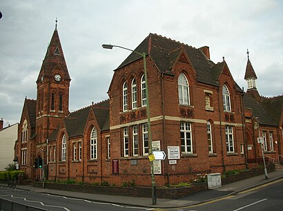
Harborne Address: Regent Road street in Harborne
Popular routes to Harborne
Popular routes from Harborne
Attractions near Harborne
Public Toilets in Harborne,Harborne High Street,WESTERN UNION,B17 9pp,Silver and Love,Waitrose & Partners,The Bun & Barrel,Waitrose,St John's Church,High Street Station,Harborne Primary School,Damascena,CR LTD High St B17,Harborne Post Office,Property Diagnostics Limited,Harborne Police Station,The Vine Harborne,Boston Tea Party Harborne,Greenfield Rd, Birmingham,Sue Ryder Social Care Birmingham - HarborneHow to get to popular attractions in Harborne with public transportation
Telford Forge Retail Park, Ketley & Overdale,Joseph Chamberlain 6th Form College, Sparkbrook & Balsall Heath East,Dudley, St. James's,University Hospital Coventry & Warwickshire, Henley,Villa Park, Aston,Ikea, Bentley And Darlaston North,Woodbourne Priory Hospital, Harborne,PSA Peugeot Citroen HQ, Lower Stoke,Park Hall Academy, Castle Bromwich,Mere Green, Sutton Mere Green,Odeon Cinema, Arbury,Forbes Estate, Warwick Aylesford,Ricoh Arena, Longford,Bloxwich, Bloxwich East,Great Bridge, Great Bridge,Coleshill, Coleshill South,Aston University, Nechells,National Exhibition Centre, Bickenhill,Faculty of Humanities, Wainbody,Severn Valley Railway - Kidderminster Station, Aggborough & SpennellsGet around Harborne by public transport!
Travelling around Harborne has never been so easy. See step by step directions as you travel to any attraction, street or major public transport station. View bus and train timetables, arrival times, service alerts and detailed routes on a map, so you know exactly how to get to anywhere in Harborne.
When travelling to any destination around Harborne use Moovit's Live Directions with Get Off Notifications to know exactly where and how far to walk, how long to wait for your line , and how many stops are left. Moovit will alert you when it’s time to get off — no need to constantly re-check whether yours is the next stop.
Wondering how to use public transport in Harborne or how to pay for public transport in Harborne? Moovit public transport app can help you navigate your way with public transport easily, and at minimum cost. It includes public transport fees, ticket prices, and costs. Looking for a map of Harborne public transport lines? Moovit public transport app shows all public transport maps in Harborne with all bus or train routes and stops on an interactive map.
Harborne has 2 transport type(s), including: bus or train, operated by several transport agencies, including National Express West Midlands, National Express Coventry, National Express, Diamond Bus, Arriva Midlands, Stagecoach Midlands, West Midlands Metro, Stagecoach West, Stagecoach South Wales, First Potteries, First Worcestershire, LandFlight, trentbarton, D & G Bus and Flexibus