See Haw Par Villa, Southwest, on the map
Directions to Haw Par Villa (Southwest) with public transport
The following transport lines have routes that pass near Haw Par Villa
 Bus:
Bus: - Metro:
How to get to Haw Par Villa by bus?
Click on the bus route to see step by step directions with maps, line arrival times and updated time schedules.
How to get to Haw Par Villa by metro?
Click on the metro route to see step by step directions with maps, line arrival times and updated time schedules.
Bus stations near Haw Par Villa in Southwest
- West Coast Highway - Haw Par Villa Stn (16229),1 min walk,
- Pasir Panjang Rd - Haw Par Villa Stn (16019),2 min walk,
- Pasir Panjang Rd - Opp Haw Par Villa Stn (16011),2 min walk,
- Science Pk Rd - Aries (16111),11 min walk,
- Sparkle,11 min walk,
Metro stations near Haw Par Villa in Southwest
- Labrador Park (CC27),24 min walk,
Bus lines to Haw Par Villa in Southwest
- 175,Lor 1 Geylang Ter,
- 176,Bt Merah Int,
- RSYC SHUTTLE,Haw Par Villa MRT & Clementi MRT,
- 10,Tampines Int ↔ Kent Ridge Ter,
- 30,Bedok Int ↔ Boon Lay Int,
- 51,Hougang Ctrl Int ↔ Jurong East Int,
- 143,Toa Payoh Int ↔ Jurong East Int,
- 188,Choa Chu Kang Int ↔ HarbourFront Int,
- 200,Buona Vista Ter ↺ Kent Ridge Ter,
- 30E,[AM Peak]: Pasir Panjang Rd (Opp Heng Mui Keng Terrace) [PM Peak]: Bedok Int,
- SCIENCE PARK 2 SHUTTLE,Opp Haw Par Villa MRT,
- 183,Jurong East Int,
- SCIENCE PARK 2 LUNCH SHUTTLE,[Tue] West Coast Plaza,
- SCIENCE PARK 1 AND 2 SHUTTLE,Science Park 1,
What are the nearest stations to Haw Par Villa?
The nearest stations to Haw Par Villa are:
- West Coast Highway - Haw Par Villa Stn (16229) is 47 meters away, 1 min walk.
- Pasir Panjang Rd - Haw Par Villa Stn (16019) is 89 meters away, 2 min walk.
- Pasir Panjang Rd - Opp Haw Par Villa Stn (16011) is 104 meters away, 2 min walk.
- Science Pk Rd - Aries (16111) is 830 meters away, 11 min walk.
- Sparkle is 834 meters away, 11 min walk.
- Labrador Park (CC27) is 1829 meters away, 24 min walk.
Which bus lines stop near Haw Par Villa?
These bus lines stop near Haw Par Villa: 10, 143, 176, 188, 30, 30E.
Which metro line stops near Haw Par Villa?
CIRCLE LINE
What’s the nearest metro station to Haw Par Villa in Southwest?
The nearest metro station to Haw Par Villa in Southwest is Labrador Park (CC27). It’s a 24 min walk away.
What’s the nearest bus stop to Haw Par Villa in Southwest?
The nearest bus stop to Haw Par Villa in Southwest is West Coast Highway - Haw Par Villa Stn (16229). It’s a 1 min walk away.
What time is the first metro to Haw Par Villa in Southwest?
The CIRCLE LINE is the first metro that goes to Haw Par Villa in Southwest. It stops nearby at 05:38.
What time is the last metro to Haw Par Villa in Southwest?
The CIRCLE LINE is the last metro that goes to Haw Par Villa in Southwest. It stops nearby at 00:21.
What time is the first bus to Haw Par Villa in Southwest?
The 143 is the first bus that goes to Haw Par Villa in Southwest. It stops nearby at 05:35.
What time is the last bus to Haw Par Villa in Southwest?
The 30 is the last bus that goes to Haw Par Villa in Southwest. It stops nearby at 00:58.
How much is the metro fare to Haw Par Villa?
The metro fare to Haw Par Villa costs about $0.49 - $2.37.
See Haw Par Villa, Southwest, on the map
Public Transit to Haw Par Villa in Southwest
Wondering how to get to Haw Par Villa in Southwest, Singapore? Moovit helps you find the best way to get to Haw Par Villa with step-by-step directions from the nearest public transit station.
Moovit provides free maps and live directions to help you navigate through your city. View schedules, routes, timetables, and find out how long does it take to get to Haw Par Villa in real time.
Looking for the nearest stop or station to Haw Par Villa? Check out this list of stops closest to your destination: West Coast Highway - Haw Par Villa Stn (16229); Pasir Panjang Rd - Haw Par Villa Stn (16019); Pasir Panjang Rd - Opp Haw Par Villa Stn (16011); Science Pk Rd - Aries (16111); Sparkle; Labrador Park (CC27).
Bus:Metro:
Want to see if there’s another route that gets you there at an earlier time? Moovit helps you find alternative routes or times. Get directions from and directions to Haw Par Villa easily from the Moovit App or Website.
We make riding to Haw Par Villa easy, which is why over 1.5 million users, including users in Southwest, trust Moovit as the best app for public transit. You don’t need to download an individual bus app or train app, Moovit is your all-in-one transit app that helps you find the best bus time or train time available.
For information on prices of metro and bus, costs and ride fares to Haw Par Villa, please check the Moovit app.
Use the app to navigate to popular places including to the airport, hospital, stadium, grocery store, mall, coffee shop, school, college, and university.
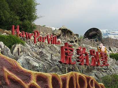
Haw Par Villa Address: West Coast Highway street in Southwest
Attractions near Haw Par Villa
虎豹别墅地铁站,Uob,Bus Stop 16011 (Opp Haw Par Villa Stn),Haw Par Villa MRT Station,Haw Par Villa MRT Station (CC25),Bicycle Parking,Haw Par Villa (Hu Bao Bie Shu),虎豹别墅,Haw Par Villa MRT Station (CC25) Pasir Panjang Rd,Pasir Panjang Park,262 Pasir Panjang Road,Ju Shin Jung West,Opposite Haw Par Villa Station,Coastal Acoustic,The Wild Restaurant,Chelsea FC Supporters Club (CFCSG),27 West Coast Highway,Ju Shin Jung,MRT-Haw Par Villa-Exit A,The AriesHow to get to popular attractions in Southwest with public transportation
7-Eleven, Southwest,Boost Juice Bars, Singapore,Blk 18 @ TradeHub 21, Southwest,313@Somerset, Singapore,Earle Swensen's, Singapore,Black Society 黑社會, Singapore,ZARA, Singapore,Toast Box 土司工坊, Southwest,Westech Building, Southwest,That Aquarium (Y618), Northwest,Tajimaya Japanese Charcoal Grill Yakiniku, Singapore,Ventus, Southwest,SAF.eMart, Southwest,Jia Xiang Sarawak Kuching Kolo Mee 家香面, Singapore,Prime Supermarket, Southwest,Xin Wang Hong Kong Café, Southwest,包公XO鱼头米粉 Bao Gong XO Fish Head Beehoon, Southwest,Harry's Bar, Singapore,Compass One, Northeast,Lim Chu Kang Chinese Cemetery 1065, SouthwestGet around Southwest by public transport!
Travelling around Southwest has never been so easy. See step by step directions as you travel to any attraction, street or major public transport station. View bus and train timetables, arrival times, service alerts and detailed routes on a map, so you know exactly how to get to anywhere in Southwest.
When travelling to any destination around Southwest use Moovit's Live Directions with Get Off Notifications to know exactly where and how far to walk, how long to wait for your line , and how many stops are left. Moovit will alert you when it’s time to get off — no need to constantly re-check whether yours is the next stop.
Wondering how to use public transport in Southwest or how to pay for public transport in Southwest? Moovit public transport app can help you navigate your way with public transport easily, and at minimum cost. It includes public transport fees, ticket prices, and costs. Looking for a map of Southwest public transport lines? Moovit public transport app shows all public transport maps in Southwest with all metro or bus routes and stops on an interactive map.
Southwest has 2 transport type(s), including: metro or bus, operated by several transport agencies, including SMRT, SBS Transit, SMRT, MRT/LRT Replacement Services, SBS Transit, SBS Transit, SMRT, Tower Transit, Go-Ahead Singapore, Premium Bus, City Direct Bus, Changi Airport, Sentosa Development Corporation, Sentosa Development Corporation and Cross Border Bus