See Heanor Gate, Amber Valley, on the map
Directions to Heanor Gate (Amber Valley) with public transport
The following transport lines have routes that pass near Heanor Gate
 Bus:
Bus: - Train:
How to get to Heanor Gate by bus?
Click on the bus route to see step by step directions with maps, line arrival times and updated time schedules.
How to get to Heanor Gate by train?
Click on the train route to see step by step directions with maps, line arrival times and updated time schedules.
Bus stations near Heanor Gate in Amber Valley
- Burnthouse Road, Heanor,6 min walk,
- Roper Avenue Shops, Marlpool,22 min walk,
Bus lines to Heanor Gate in Amber Valley
- H1,Alfreton,
- 34,Ilkeston,
What are the nearest stations to Heanor Gate?
The nearest stations to Heanor Gate are:
- Burnthouse Road, Heanor is 380 meters away, 6 min walk.
- Roper Avenue Shops, Marlpool is 1637 meters away, 22 min walk.
Which bus line stops near Heanor Gate?
H1
Which train line stops near Heanor Gate?
NORTHERN
What’s the nearest bus stop to Heanor Gate in Amber Valley?
The nearest bus stop to Heanor Gate in Amber Valley is Burnthouse Road, Heanor. It’s a 6 min walk away.
See Heanor Gate, Amber Valley, on the map
Public Transit to Heanor Gate in Amber Valley
Wondering how to get to Heanor Gate in Amber Valley, United Kingdom? Moovit helps you find the best way to get to Heanor Gate with step-by-step directions from the nearest public transit station.
Moovit provides free maps and live directions to help you navigate through your city. View schedules, routes, timetables, and find out how long does it take to get to Heanor Gate in real time.
Looking for the nearest stop or station to Heanor Gate? Check out this list of stops closest to your destination: Burnthouse Road; Roper Avenue Shops.
Bus:Train:
Want to see if there’s another route that gets you there at an earlier time? Moovit helps you find alternative routes or times. Get directions from and directions to Heanor Gate easily from the Moovit App or Website.
We make riding to Heanor Gate easy, which is why over 1.5 million users, including users in Amber Valley, trust Moovit as the best app for public transit. You don’t need to download an individual bus app or train app, Moovit is your all-in-one transit app that helps you find the best bus time or train time available.
For information on prices of bus and train, costs and ride fares to Heanor Gate, please check the Moovit app.
Use the app to navigate to popular places including to the airport, hospital, stadium, grocery store, mall, coffee shop, school, college, and university.
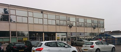
Heanor Gate Address: Heanor Heanor street in Amber Valley
Attractions near Heanor Gate
Heanor Gate Industrial Estate,Heanor Road,Plan Profile Ltd.,Beetle Swop Shop,Tri-Mach,V.P.K Engineering Services Ltd,G Slater & Partners,Light-Wire Ltd.,De7 7qz,Kirkley Drive, Heanor,De75 7qz,De7 7ua,De7 7xe,De75 7xe,Bowers Engineering Ltd,Bpi 2008 Ltd.,Autobond Ltd.,Promopack Ltd,Cox Hire Centres,The Emily Grace School of Dance LTDHow to get to popular attractions in Amber Valley with public transportation
Quorn & Woodhouse Railway Station (GC Railway), Charnwood,Lidl, Peterborough,Queens Medical Centre, Nottingham,Steep Hill, Lincoln,Western Park, Leicester,David Lloyd Nottingham, Nottingham,Northampton College, Northampton,Ibis Hotel, Northampton,Tottle Bakery, Nottingham,Bracebridge Heath, North Kesteven,Chesterfield College, Chesterfield,Matalan, Corby,Ratcliffe Power Station, Rushcliffe,Lakeside Arts Centre, Nottingham,James France Building, Charnwood,Ikea, Broxtowe,Billing Aquadrome, Northampton,Tesco Extra, Leicester,YBS Group - Lynch Wood, Peterborough,Peterborough Power Signal Box, PeterboroughGet around Amber Valley by public transport!
Travelling around Amber Valley has never been so easy. See step by step directions as you travel to any attraction, street or major public transport station. View bus and train timetables, arrival times, service alerts and detailed routes on a map, so you know exactly how to get to anywhere in Amber Valley.
When travelling to any destination around Amber Valley use Moovit's Live Directions with Get Off Notifications to know exactly where and how far to walk, how long to wait for your line , and how many stops are left. Moovit will alert you when it’s time to get off — no need to constantly re-check whether yours is the next stop.
Wondering how to use public transport in Amber Valley or how to pay for public transport in Amber Valley? Moovit public transport app can help you navigate your way with public transport easily, and at minimum cost. It includes public transport fees, ticket prices, and costs. Looking for a map of Amber Valley public transport lines? Moovit public transport app shows all public transport maps in Amber Valley with all bus or train routes and stops on an interactive map.
Amber Valley has 2 transport type(s), including: bus or train, operated by several transport agencies, including National Rail, Ashbourne Community Transport, Delaine Buses, Arriva Midlands, Centrebus, Our Centre, Hulleys of Baslow, D & G Bus, Stagecoach East Midlands, North Lincolnshire Council, National Rail, Roberts Coaches, Lawson's of Corby, Hawkes Coaches and East Yorkshire