Directions to Henley Beach with public transportation
The following transport lines have routes that pass near Henley Beach
How to get to Henley Beach by bus?
Click on the bus route to see step by step directions with maps, line arrival times and updated time schedules.
How to get to Henley Beach by train?
Click on the train route to see step by step directions with maps, line arrival times and updated time schedules.
Bus stops near Henley Beach
- Stop 27A North St - North side, 3 min walk,
- Stop 27A North St - South side, 3 min walk,
- Stop 29B East Tce - East side, 4 min walk,
- Stop 29B East Tce - West side, 4 min walk,
- Stop 29A Marlborough St - North side, 5 min walk,
- Stop 29A Marlborough St - South side, 5 min walk,
- Stop School St Michaels College Lawrie St, 10 min walk,
Train stations near Henley Beach
- Seaton Park, 20 min walk,
Bus routes to Henley Beach
- 286, City,
- 669, Glenelg (School Bus),
- H33, Rostrevor,
- 287, Henley Beach,
- H33C, City,
- 654, St Michael's Primary Campus (School Bus),
- 653, St Michael's Primary Campus (School Bus),
- 655, Port Adelaide (School Bus),
- 656, Henley Beach South (School Bus),
- 650, Alberton to St Michael's College Secondary Campus,
- 651, Alberton to St Michael's College Secondary Campus,
- 652, Alberton to St Michael's College Primary Campus,
- 657, St Michael's College Secondary Campus to Queenstown,
- 658, St Michael's College Secondary Campus to Largs Bay,
- 659, St Michael's College Secondary Campus to Birkenhead,
- 660, St Michael's College Secondary Campus to West Lakes,
What are the nearest stations to Henley Beach?
The nearest stations to Henley Beach are:
- Stop 27A North St - North side is 168 meters away, 3 min walk.
- Stop 27A North St - South side is 188 meters away, 3 min walk.
- Stop 29B East Tce - East side is 265 meters away, 4 min walk.
- Stop 29B East Tce - West side is 272 meters away, 4 min walk.
- Stop 29A Marlborough St - North side is 333 meters away, 5 min walk.
- Stop 29A Marlborough St - South side is 354 meters away, 5 min walk.
- Stop School St Michaels College Lawrie St is 726 meters away, 10 min walk.
- Seaton Park is 1542 meters away, 20 min walk.
Which bus lines stop near Henley Beach?
These bus lines stop near Henley Beach: 287, 300H, H30, H30S.
Which train line stops near Henley Beach?
GRNG
What’s the nearest train station to Henley Beach?
The nearest train station to Henley Beach is Seaton Park. It’s a 20 min walk away.
What’s the nearest bus stop to Henley Beach?
The nearest bus stops to Henley Beach are Stop 27A North St - North side and Stop 27A North St - South side. The closest one is a 3 min walk away.
What time is the first train to Henley Beach?
The GRNG is the first train that goes to Henley Beach. It stops nearby at 07:11.
What time is the last train to Henley Beach?
The GRNG is the last train that goes to Henley Beach. It stops nearby at 00:37.
What time is the first bus to Henley Beach?
The 287 is the first bus that goes to Henley Beach. It stops nearby at 08:32.
What time is the last bus to Henley Beach?
The 287 is the last bus that goes to Henley Beach. It stops nearby at 23:57.
How much is the bus fare to Henley Beach?
The bus fare to Henley Beach costs about $2.40 - $4.25.
See Henley Beach on the map
Public Transportation to Henley Beach
Wondering how to get to Henley Beach, Australia? Moovit helps you find the best way to get to Henley Beach with step-by-step directions from the nearest public transit station.
Moovit provides free maps and live directions to help you navigate through your city. View schedules, routes, timetables, and find out how long does it take to get to Henley Beach in real time.
Looking for the nearest stop or station to Henley Beach? Check out this list of stops closest to your destination: Stop 27A North St - North side; Stop 27A North St - South side; Stop 29B East Tce - East side; Stop 29B East Tce - West side; Stop 29A Marlborough St - North side; Stop 29A Marlborough St - South side; Stop School St Michaels College Lawrie St; Seaton Park.
Bus: 287, 300H, H30, H30S, 286, 669, H33, H33C, 654.Train: GRNG.
Want to see if there’s another route that gets you there at an earlier time? Moovit helps you find alternative routes or times. Get directions from and directions to Henley Beach easily from the Moovit App or Website.
We make riding to Henley Beach easy, which is why over 1.5 million users, including users in Henley Beach, trust Moovit as the best app for public transit. You don’t need to download an individual bus app or train app, Moovit is your all-in-one transit app that helps you find the best bus time or train time available.
For information on prices of bus, train and light rail, costs and ride fares to Henley Beach, please check the Moovit app.
Use the app to navigate to popular places including to the airport, hospital, stadium, grocery store, mall, coffee shop, school, college, and university.
Henley Beach Address: Wright Street street in Henley Beach
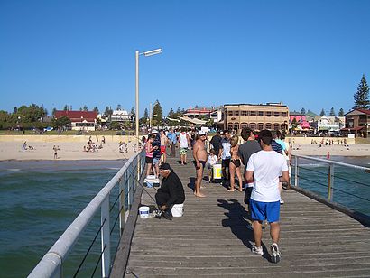
Henley Beach is a coastal suburb of Adelaide, South Australia in the City of Charles Sturt.Wiki
Popular routes to Henley Beach
- From Stop 73 Old Port Wakefield Rd - East sideFrom Stop 89 Carcoola Rd - East sideFrom Stop See Differently - West sideFrom Stop 74A Hamblynn Rd - East sideFrom Adelaide AirportFrom AdelaideFrom Morphettville Racecourse Tram StopFrom Zone A Glenelg Interchange - West sideFrom Stop 74A Hamblynn Rd - West sideFrom Port Adelaide
Attractions near Henley Beach
How to get to popular places in Adelaide with public transport
Get around Henley Beach by public transport!
Travelling around Henley Beach has never been so easy. See step by step directions as you travel to any attraction, street or major public transport station. View bus and train timetables, arrival times, service alerts and detailed routes on a map, so you know exactly how to get to anywhere in Henley Beach.
When travelling to any destination around Henley Beach use Moovit's Live Directions with Get Off Notifications to know exactly where and how far to walk, how long to wait for your line , and how many stops are left. Moovit will alert you when it’s time to get off — no need to constantly re-check whether yours is the next stop.
Wondering how to use public transport in Henley Beach or how to pay for public transport in Henley Beach? Moovit public transport app can help you navigate your way with public transport easily, and at minimum cost. It includes public transport fees, ticket prices, and costs. Looking for a map of Henley Beach public transport lines? Moovit public transport app shows all public transport maps in Henley Beach with all bus, train or light rail routes and stops on an interactive map.
Henley Beach has 3 transport type(s), including: bus, train or light rail, operated by several transport agencies, including Adelaide Metro (Busways), SouthLink, Torrens Transit, Adelaide Metro Train, Adelaide Metro (Torrens Connect), Adelaide Metro (Industrial Service - Torrens Transit), Adelaide Metro (School Service - SouthLink), Adelaide Metro (School Service - Torrens Transit) and Adelaide Metro (School Service - Busways)