See Hereford Museu, Central, on the map
Directions to Hereford Museu (Central) with public transport
The following transport lines have routes that pass near Hereford Museu
 Bus:
Bus: - Train:
How to get to Hereford Museu by bus?
Click on the bus route to see step by step directions with maps, line arrival times and updated time schedules.
How to get to Hereford Museu by train?
Click on the train route to see step by step directions with maps, line arrival times and updated time schedules.
Bus stations near Hereford Museu in Central
- Victoria Court,1 min walk,
- Maylord Shopping Centre (Stand 1),2 min walk,
- St Martin's Street,2 min walk,
- Maylord Shopping Centre (Stand 3),3 min walk,
- Maylord Shopping Centre (Stand 2),3 min walk,
- Hereford City,4 min walk,
- Franklin Barnes,4 min walk,
- Shire Hall (Stand 3),6 min walk,
- Hereford,11 min walk,
Bus lines to Hereford Museu in Central
- E,Central,
- X15,Central - Powys,
- 71,Credenhill - Central,
- 71B,Central - Credenhill,
- 437,Queenswood - Central,
- 446,Castle - Central,
- 461,Widemarsh - Kington,
- 462,Widemarsh - Kington,
- 809,Whitecross - Golden Valley North,
- 861,Widemarsh - Kington,
- D,Bobblestock,
- Z,Hereford Circular,
- 23,Monmouthshire - Central,
- 33,Herefordshire, County Of - Gloucester,
- 36,Monmouthshire - Widemarsh,
- 39A,Hay - Widemarsh,
- 413,Central - Birch,
- 440,Golden Valley South,
- 441,Golden Valley South - Central,
- 447,Central - Golden Valley North,
What are the nearest stations to Hereford Museu?
The nearest stations to Hereford Museu are:
- Victoria Court is 33 meters away, 1 min walk.
- Maylord Shopping Centre (Stand 1) is 83 meters away, 2 min walk.
- St Martin's Street is 95 meters away, 2 min walk.
- Maylord Shopping Centre (Stand 3) is 162 meters away, 3 min walk.
- Maylord Shopping Centre (Stand 2) is 172 meters away, 3 min walk.
- Hereford City is 270 meters away, 4 min walk.
- Franklin Barnes is 272 meters away, 4 min walk.
- Shire Hall (Stand 3) is 374 meters away, 6 min walk.
- Hereford is 783 meters away, 11 min walk.
Which bus lines stop near Hereford Museu?
These bus lines stop near Hereford Museu: 23, 33, 476, 76A.
Which train lines stop near Hereford Museu?
These train lines stop near Hereford Museu: TRANSPORT FOR WALES, WEST MIDLANDS RAILWAY.
What’s the nearest bus stop to Hereford Museu in Central?
The nearest bus stop to Hereford Museu in Central is Victoria Court. It’s a 1 min walk away.
What time is the first bus to Hereford Museu in Central?
The 39A is the first bus that goes to Hereford Museu in Central. It stops nearby at 10:19.
What time is the last bus to Hereford Museu in Central?
The 39A is the last bus that goes to Hereford Museu in Central. It stops nearby at 18:24.
See Hereford Museu, Central, on the map
Public Transit to Hereford Museu in Central
Wondering how to get to Hereford Museu in Central, United Kingdom? Moovit helps you find the best way to get to Hereford Museu with step-by-step directions from the nearest public transit station.
Moovit provides free maps and live directions to help you navigate through your city. View schedules, routes, timetables, and find out how long does it take to get to Hereford Museu in real time.
Looking for the nearest stop or station to Hereford Museu? Check out this list of stops closest to your destination: Victoria Court; Maylord Shopping Centre (Stand 1); St Martin's Street; Maylord Shopping Centre (Stand 3); Maylord Shopping Centre (Stand 2); Hereford City; Franklin Barnes; Shire Hall (Stand 3); Hereford.
Bus:Train:
Want to see if there’s another route that gets you there at an earlier time? Moovit helps you find alternative routes or times. Get directions from and directions to Hereford Museu easily from the Moovit App or Website.
We make riding to Hereford Museu easy, which is why over 1.5 million users, including users in Central, trust Moovit as the best app for public transit. You don’t need to download an individual bus app or train app, Moovit is your all-in-one transit app that helps you find the best bus time or train time available.
For information on prices of bus and train, costs and ride fares to Hereford Museu, please check the Moovit app.
Use the app to navigate to popular places including to the airport, hospital, stadium, grocery store, mall, coffee shop, school, college, and university.
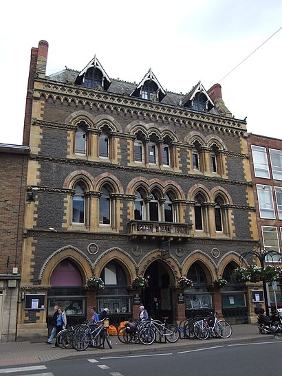
Hereford Museu Address: Broad Street Hereford Hereford HR4 9 street in Central
Attractions near Hereford Museu
Hereford Library,Herefordshire Council,Knight Frank,Hereford Museum And Art Gallery,Broad Street,Provident Personal Credit,Jackson Preece Surveyors,Boultbee Aviation 3,Library,RBS,Right at Home Hereford,Parking Little Berrington Street,Harrison Clark Rickerbys,La'de Kitchen,The Gerald Crane Artist Painting Studio,The Tea Room,Bright Wells Lettings,Andrew Grant Hereford,Pear-Laine Lingerie,Harrison Clark Rickerbys SolicitorsHow to get to popular attractions in Central with public transportation
Cadbury Sixth Form College, King's Norton South,PSA Peugeot Citroen HQ, Lower Stoke,Telford Forge Retail Park, Ketley & Overdale,The Square Peg, Ladywood,Forbes Estate, Warwick Aylesford,Cineworld, Wednesfield South,Birmingham Snow Hill, Ladywood,Woodbourne Priory Hospital, Harborne,Phoenix Group, Wythall West,Aston University, Nechells,West Heath Hospital, King's Norton North,Bewdley Bridge, Bewdley & Rock,Warwick Racecourse, Warwick Aylesford,Ricoh Arena, Longford,Olton, Olton,Selly Park, Bournbrook & Selly Park,Warwick, Warwick Aylesford,Vue Cinema, Cathedral,Birmingham Heartlands Hospital, Heartlands,Staffordshire Place, ForebridgeGet around Central by public transport!
Travelling around Central has never been so easy. See step by step directions as you travel to any attraction, street or major public transport station. View bus and train timetables, arrival times, service alerts and detailed routes on a map, so you know exactly how to get to anywhere in Central.
When travelling to any destination around Central use Moovit's Live Directions with Get Off Notifications to know exactly where and how far to walk, how long to wait for your line , and how many stops are left. Moovit will alert you when it’s time to get off — no need to constantly re-check whether yours is the next stop.
Wondering how to use public transport in Central or how to pay for public transport in Central? Moovit public transport app can help you navigate your way with public transport easily, and at minimum cost. It includes public transport fees, ticket prices, and costs. Looking for a map of Central public transport lines? Moovit public transport app shows all public transport maps in Central with all bus or train routes and stops on an interactive map.
Central has 2 transport type(s), including: bus or train, operated by several transport agencies, including National Express West Midlands, National Express Coventry, National Express, Diamond Bus, Arriva Midlands, Stagecoach Midlands, West Midlands Metro, Stagecoach West, Stagecoach South Wales, First Potteries, First Worcestershire, LandFlight, trentbarton, D & G Bus and Flexibus