See High School for Girls, Gloucester on the map
Directions to High School for Girls, Gloucester with public transportation
The following transport lines have routes that pass near High School for Girls, Gloucester
 Bus:
Bus: - Train:
How to get to High School for Girls, Gloucester by bus?
Click on the bus route to see step by step directions with maps, line arrival times and updated time schedules.
How to get to High School for Girls, Gloucester by train?
Click on the train route to see step by step directions with maps, line arrival times and updated time schedules.
Bus stations near High School for Girls, Gloucester
- Denmark Road, Kingsholm,5 min walk,
- Rugby Ground, Kingsholm,5 min walk,
- 88 Estcourt Road, Longlevens,9 min walk,
- Bus Depot, Gloucester,10 min walk,
Bus routes to High School for Girls, Gloucester
- 71,Gloucester,
- C71,Cirencester,
- 97,Churchdown,
- 98,Cheltenham,
- 351,Tewkesbury,
- JD4,Tuffley,
- JD5,Tuffley,
- 353,Gloucester,
- 10,Brockworth,
- N10,Brockworth,
- 94,Cheltenham,
- N94,Cheltenham,
- NX94,Gloucester,
- 94X,Cheltenham,
- 882,Cirencester,
What are the nearest stations to High School for Girls, Gloucester?
The nearest stations to High School for Girls, Gloucester are:
- Denmark Road, Kingsholm is 345 meters away, 5 min walk.
- Rugby Ground, Kingsholm is 369 meters away, 5 min walk.
- 88 Estcourt Road, Longlevens is 636 meters away, 9 min walk.
- Bus Depot, Gloucester is 704 meters away, 10 min walk.
Which bus lines stop near High School for Girls, Gloucester?
These bus lines stop near High School for Girls, Gloucester: 71, 8, 882, 94X.
Which train lines stop near High School for Girls, Gloucester?
These train lines stop near High School for Girls, Gloucester: GREAT WESTERN RAILWAY, TRANSPORT FOR WALES.
What’s the nearest bus stop to High School for Girls, Gloucester?
The nearest bus stops to High School for Girls, Gloucester are Denmark Road, Kingsholm and Rugby Ground, Kingsholm. The closest one is a 5 min walk away.
What time is the first bus to High School for Girls, Gloucester?
The 94X is the first bus that goes to High School for Girls, Gloucester. It stops nearby at 04:57.
What time is the last bus to High School for Girls, Gloucester?
The NX94 is the last bus that goes to High School for Girls, Gloucester. It stops nearby at 02:48.
See High School for Girls, Gloucester on the map
Public Transportation to High School for Girls, Gloucester
Wondering how to get to High School for Girls, Gloucester, United Kingdom? Moovit helps you find the best way to get to High School for Girls, Gloucester with step-by-step directions from the nearest public transit station.
Moovit provides free maps and live directions to help you navigate through your city. View schedules, routes, timetables, and find out how long does it take to get to High School for Girls, Gloucester in real time.
Looking for the nearest stop or station to High School for Girls, Gloucester? Check out this list of stops closest to your destination: Denmark Road; Rugby Ground; 88 Estcourt Road; Bus Depot.
Bus:Train:
Want to see if there’s another route that gets you there at an earlier time? Moovit helps you find alternative routes or times. Get directions from and directions to High School for Girls, Gloucester easily from the Moovit App or Website.
We make riding to High School for Girls, Gloucester easy, which is why over 1.5 million users, including users in Gloucester, trust Moovit as the best app for public transit. You don’t need to download an individual bus app or train app, Moovit is your all-in-one transit app that helps you find the best bus time or train time available.
For information on prices of bus and train, costs and ride fares to High School for Girls, Gloucester, please check the Moovit app.
Use the app to navigate to popular places including to the airport, hospital, stadium, grocery store, mall, coffee shop, school, college, and university.
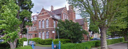
High School for Girls, Gloucester Address: Denmark Road Gloucester Gloucester GL1 3 street in Gloucester
Attractions near High School for Girls, Gloucester
Denmark Road School, Gloucester,Timoneer Consultancy Limited,Home First Property,Pink Rabbit Properties,Connected Kerb,Speciality Tooling & Designs,Plastering Contractor,Heat for Events,Basker Leitch,Spartans R F C,Spartans Rugby Club,Senaye Company,M & O Gates Builders,Akp,Gloucester Charities Trust the St Marks Court Warden,Cosy Corner, Evenlode,Rochelles Blis,Phone Pay Plus,Jen Properties,Wenchford Picnic Area Forest of DeanHow to get to popular attractions in Gloucester with public transportation
Ilfracombe Harbour, North Devon,M5 Junction 11 / A40, Tewkesbury,Tesco, Poole,Swindon Marriott Hotel, Swindon,Central Park, Plymouth,Uwe Bower Ashton Campus, Bristol, City Of,South Devon College, Torbay,Lymington Ferry Terminal, New Forest,Bradley Stoke, South Gloucestershire,De Vere Cotswold Water Park, Cotswold,Polzeath Beach, Cornwall,Port Solent Marina, Portsmouth,We The Curious, Bristol, City Of,Avonmouth Docks, Bristol, City Of,Paignton Zoo Environmental Park, Torbay,EE - Parkgate, South Gloucestershire,DoubleTree by Hilton Hotel Swindon, Wiltshire,Salisbury City Centre, Wiltshire,Redcliffe Bascule Bridge, Bristol, City Of,Great Western Hospital, SwindonGet around Gloucester by public transport!
Travelling around Gloucester has never been so easy. See step by step directions as you travel to any attraction, street or major public transport station. View bus and train timetables, arrival times, service alerts and detailed routes on a map, so you know exactly how to get to anywhere in Gloucester.
When travelling to any destination around Gloucester use Moovit's Live Directions with Get Off Notifications to know exactly where and how far to walk, how long to wait for your line , and how many stops are left. Moovit will alert you when it’s time to get off — no need to constantly re-check whether yours is the next stop.
Wondering how to use public transport in Gloucester or how to pay for public transport in Gloucester? Moovit public transport app can help you navigate your way with public transport easily, and at minimum cost. It includes public transport fees, ticket prices, and costs. Looking for a map of Gloucester public transport lines? Moovit public transport app shows all public transport maps in Gloucester with all bus or train routes and stops on an interactive map.
Gloucester has 2 transport type(s), including: bus or train, operated by several transport agencies, including National Rail, Stagecoach South, Padstow Harbour Commissioners, Royal Buses, Tavistock Community Transport, River Link, Beaminster Town Council, Yeos Contracts, MD Coaches, Newport Bus, First Bristol, Bath & the West, First Kernow, St Mawes Ferry, First Wessex, Dorset & South Somerset and Isles of Scilly Steamship Co