See Hobson Bay, Inlet-Waitemata Harbour, on the map
Directions to Hobson Bay (Inlet-Waitemata Harbour) with public transport
The following transport lines have routes that pass near Hobson Bay
 Bus:
Bus: - Train:
How to get to Hobson Bay by bus?
Click on the bus route to see step by step directions with maps, line arrival times and updated time schedules.
How to get to Hobson Bay by train?
Click on the train route to see step by step directions with maps, line arrival times and updated time schedules.
Bus stations near Hobson Bay in Inlet-Waitemata Harbour
- Tamaki Drive/Ngapipi Road, 14 min walk,
Bus lines to Hobson Bay in Inlet-Waitemata Harbour
- TMK, Britomart To Glen Innes Via Tamaki Dr And St Heliers,
- 774, Britomart To West Tamaki Rd Via Tamaki Dr And Long Dr,
- 775, Britomart To Glendowie Via Tamaki Dr,
- 76, Glen Innes To Britomart Via Orakei,
What are the nearest stations to Hobson Bay?
The nearest stations to Hobson Bay are:
- Tamaki Drive/Ngapipi Road is 703 meters away, 14 min walk.
Which bus lines stop near Hobson Bay?
These bus lines stop near Hobson Bay: 76, TMK.
Which train lines stop near Hobson Bay?
These train lines stop near Hobson Bay: STH, WEST.
What’s the nearest bus stop to Hobson Bay in Inlet-Waitemata Harbour?
The nearest bus stop to Hobson Bay in Inlet-Waitemata Harbour is Tamaki Drive/Ngapipi Road. It’s a 14 min walk away.
What time is the first train to Hobson Bay in Inlet-Waitemata Harbour?
The STH is the first train that goes to Hobson Bay in Inlet-Waitemata Harbour. It stops nearby at 06:17.
What time is the last train to Hobson Bay in Inlet-Waitemata Harbour?
The STH is the last train that goes to Hobson Bay in Inlet-Waitemata Harbour. It stops nearby at 22:51.
What time is the first bus to Hobson Bay in Inlet-Waitemata Harbour?
The TMK is the first bus that goes to Hobson Bay in Inlet-Waitemata Harbour. It stops nearby at 03:04.
What time is the last bus to Hobson Bay in Inlet-Waitemata Harbour?
The TMK is the last bus that goes to Hobson Bay in Inlet-Waitemata Harbour. It stops nearby at 00:01.
How much is the bus fare to Hobson Bay?
The bus fare to Hobson Bay costs about $1.06 - $3.59.
See Hobson Bay, Inlet-Waitemata Harbour, on the map
Public Transit to Hobson Bay in Inlet-Waitemata Harbour
Wondering how to get to Hobson Bay in Inlet-Waitemata Harbour, New Zealand? Moovit helps you find the best way to get to Hobson Bay with step-by-step directions from the nearest public transit station.
Moovit provides free maps and live directions to help you navigate through your city. View schedules, routes, timetables, and find out how long does it take to get to Hobson Bay in real time.
Looking for the nearest stop or station to Hobson Bay? Check out this list of stops closest to your destination: Tamaki Drive/Ngapipi Road.
Bus:Train:
Want to see if there’s another route that gets you there at an earlier time? Moovit helps you find alternative routes or times. Get directions from and directions to Hobson Bay easily from the Moovit App or Website.
We make riding to Hobson Bay easy, which is why over 1.5 million users, including users in Inlet-Waitemata Harbour, trust Moovit as the best app for public transit. You don’t need to download an individual bus app or train app, Moovit is your all-in-one transit app that helps you find the best bus time or train time available.
For information on prices of bus and train, costs and ride fares to Hobson Bay, please check the Moovit app.
Use the app to navigate to popular places including to the airport, hospital, stadium, grocery store, mall, coffee shop, school, college, and university.
Location: Inlet-Waitemata Harbour, Auckland and Hamilton
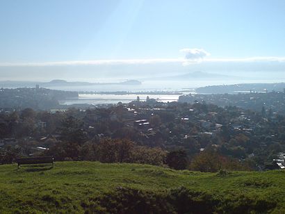
Hobson Bay is a bay in the Auckland Region of New Zealand's North Island. It is located to the east of the Auckland City Centre, and is bisected by the Eastern Line and Tamaki Drive.Wiki
Attractions near Hobson Bay
Lilliputtsafari&Trexal,Auiator,Legasea,Early Bird,Grace and Flora,678.5/North Island Main Trunk,Racing Buoy 18,Tamaki Dr Opp Parnell Pools,Point Resolution Bridge,Luxury las,Urban Events LTD,Akoranga Properties,25 Judges Bay Road,NU Cleer New Zealand,Orakei Marina,Parnell Baths,Angee Investments,CK Eden,Grafton Accommodation,Lilliputt Mini-Golf CafeHow to get to popular attractions in Inlet-Waitemata Harbour with public transportation
Pride Mobility NZ, Glenavon,Wok'n Noodle, Mt Eden North,The Warehouse Lincoln Road, Fairdene,Wendy's Old Fashioned Hamburgers, Ellerslie South,Theobroma Chocolate Lounge, Mt Wellington South,Doolan Brothers Lynfield, Lynfield South,Sovereign Building, Westlake,Lone Star Bar And Restaurant,Lincoln Road, Kingdale,Nespresso Boutique, Newmarket,Target Furniture, Sherbourne,The Elephant Wrestler, Takapuna Central,Chelsea Primary School, Chelsea,Hansan Vietnamese Restaurant | 漢山越南餐館, Target Road,New Lynn War Memorial Library, Lynnmall,Sri Mahkota Malaysian Restaurant, Grafton West,Golf Warehouse & Driving Range - Ellerslie, Abbotts Park,Sylvia Park Shopping Centre, Mt Wellington South,Middlemore Retail Pharmacy, Middlemore,Sturdee St Car Park, Auckland HarboursideGet around Inlet-Waitemata Harbour by public transport!
Travelling around Inlet-Waitemata Harbour has never been so easy. See step by step directions as you travel to any attraction, street or major public transport station. View bus and train timetables, arrival times, service alerts and detailed routes on a map, so you know exactly how to get to anywhere in Inlet-Waitemata Harbour.
When travelling to any destination around Inlet-Waitemata Harbour use Moovit's Live Directions with Get Off Notifications to know exactly where and how far to walk, how long to wait for your line , and how many stops are left. Moovit will alert you when it’s time to get off — no need to constantly re-check whether yours is the next stop.
Wondering how to use public transport in Inlet-Waitemata Harbour or how to pay for public transport in Inlet-Waitemata Harbour? Moovit public transport app can help you navigate your way with public transport easily, and at minimum cost. It includes public transport fees, ticket prices, and costs. Looking for a map of Inlet-Waitemata Harbour public transport lines? Moovit public transport app shows all public transport maps in Inlet-Waitemata Harbour with all bus or train routes and stops on an interactive map.
Inlet-Waitemata Harbour has 2 transport type(s), including: bus or train, operated by several transport agencies, including AT Metro, AT Metro Bus, Fullers360, SeaLink Pine Harbour, Belaire Ferries, Tranzit Group Ltd, New Zealand Bus, Pavlovich Transport Solutions, Bayes Coachlines, Howick and Eastern, Ritchies Transport, Waiheke Bus Company, Mahu City Express, Go Bus and SeaLink