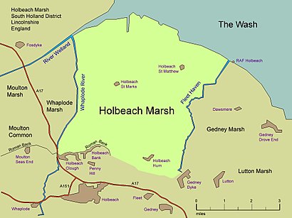
See Holbeach Marsh, South Holland, on the map
Directions to Holbeach Marsh (South Holland) with public transport
The following transport lines have routes that pass near Holbeach Marsh
 Bus:
Bus:
Bus stations near Holbeach Marsh in South Holland
- Demand Responsive Area, Holbeach St Marks,16 min walk,
Bus lines to Holbeach Marsh in South Holland
- 505H,Holbeach St Matthew,
What are the nearest stations to Holbeach Marsh?
The nearest stations to Holbeach Marsh are:
- Demand Responsive Area, Holbeach St Marks is 1206 meters away, 16 min walk.
Which bus lines stop near Holbeach Marsh?
These bus lines stop near Holbeach Marsh: 7B, S36.
See Holbeach Marsh, South Holland, on the map
Public Transit to Holbeach Marsh in South Holland
Wondering how to get to Holbeach Marsh in South Holland, United Kingdom? Moovit helps you find the best way to get to Holbeach Marsh with step-by-step directions from the nearest public transit station.
Moovit provides free maps and live directions to help you navigate through your city. View schedules, routes, timetables, and find out how long does it take to get to Holbeach Marsh in real time.
Looking for the nearest stop or station to Holbeach Marsh? Check out this list of stops closest to your destination: Demand Responsive Area.
Bus:
Want to see if there’s another route that gets you there at an earlier time? Moovit helps you find alternative routes or times. Get directions from and directions to Holbeach Marsh easily from the Moovit App or Website.
We make riding to Holbeach Marsh easy, which is why over 1.5 million users, including users in South Holland, trust Moovit as the best app for public transit. You don’t need to download an individual bus app or train app, Moovit is your all-in-one transit app that helps you find the best bus time or train time available.
For information on prices of bus and train, costs and ride fares to Holbeach Marsh, please check the Moovit app.
Use the app to navigate to popular places including to the airport, hospital, stadium, grocery store, mall, coffee shop, school, college, and university.
Location: South Holland, East Midlands
Attractions near Holbeach Marsh
Somerset Cottage,The Grange,Christie Cottage,Sycamore Farm,New Inn,Holbeach St Marks,Trevethoe Farm,Caulton'S Cottage,Christie House,Holbeach St Marks Church of England Primary School,Lundys House,Bingham Lodge,Hunts Lodge,Caulton'S Farm,Lundy'S Farm,Woodstock House,Hospital Cottages,Poplars Farm,Decoy Outfall,Reckerby FarmHow to get to popular attractions in South Holland with public transportation
Billing Aquadrome, Northampton,Westwood Centre, Peterborough,Currys PC World, Nottingham,Market Warsop, Mansfield,Nettleham, West Lindsey,Holiday Inn Express Peterborough, Peterborough,Fosse Shopping Park, Blaby,Outwood Academy Newbold, Chesterfield,Campanile Hotel Northampton, South Northamptonshire,Queens Medical Centre, Nottingham,Quorn & Woodhouse Railway Station (GC Railway), Charnwood,Peterborough Power Signal Box, Peterborough,De Montfort University, Leicester,RBS Kegworth Data Centre, North West Leicestershire,Wicksteed Park, Kettering,Sir Robert Pattinson Academy, North Kesteven,Hucknall Tram Stop, Ashfield,Ikea, Broxtowe,Colwick Country Park, Nottingham,Gedling, GedlingGet around South Holland by public transport!
Travelling around South Holland has never been so easy. See step by step directions as you travel to any attraction, street or major public transport station. View bus and train timetables, arrival times, service alerts and detailed routes on a map, so you know exactly how to get to anywhere in South Holland.
When travelling to any destination around South Holland use Moovit's Live Directions with Get Off Notifications to know exactly where and how far to walk, how long to wait for your line , and how many stops are left. Moovit will alert you when it’s time to get off — no need to constantly re-check whether yours is the next stop.
Wondering how to use public transport in South Holland or how to pay for public transport in South Holland? Moovit public transport app can help you navigate your way with public transport easily, and at minimum cost. It includes public transport fees, ticket prices, and costs. Looking for a map of South Holland public transport lines? Moovit public transport app shows all public transport maps in South Holland with all bus or train routes and stops on an interactive map.
South Holland has 2 transport type(s), including: bus or train, operated by several transport agencies, including National Rail, Ashbourne Community Transport, Delaine Buses, Arriva Midlands, Centrebus, Our Centre, Hulleys of Baslow, D & G Bus, Stagecoach East Midlands, North Lincolnshire Council, National Rail, Roberts Coaches, Lawson's of Corby, Hawkes Coaches and East Yorkshire