Directions to Holbeach Marsh (South Holland) with public transport
The following transport lines have routes that pass near Holbeach Marsh
How to get to Holbeach Marsh by bus?
Click on the bus route to see step by step directions with maps, line arrival times and updated time schedules.
Bus stops near Holbeach Marsh in South Holland
- Demand Responsive Area, Holbeach Hurn, 19 min walk,
- The Old Schoolhouse, Fleet Hargate, 53 min walk,
- Demand Responsive Area, Gedney Dyke, 97 min walk,
Bus lines to Holbeach Marsh in South Holland
- 505H, Holbeach St Matthew,
- NG1, Spalding,
- 505, Spalding,
- 505A, Kings Lynn,
- 505B, Kings Lynn,
- 505L, Sutton St Edmund,
What are the nearest stations to Holbeach Marsh?
The nearest stations to Holbeach Marsh are:
- Demand Responsive Area, Holbeach Hurn is 1461 meters away, 19 min walk.
- The Old Schoolhouse, Fleet Hargate is 4159 meters away, 53 min walk.
- Demand Responsive Area, Gedney Dyke is 7634 meters away, 97 min walk.
Which bus line stops near Holbeach Marsh?
505H
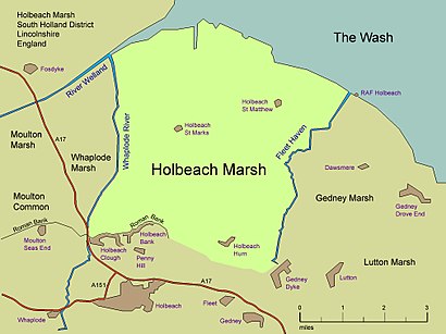
See Holbeach Marsh, South Holland, on the map
Public Transit to Holbeach Marsh in South Holland
Wondering how to get to Holbeach Marsh in South Holland, United Kingdom? Moovit helps you find the best way to get to Holbeach Marsh with step-by-step directions from the nearest public transit station.
Moovit provides free maps and live directions to help you navigate through your city. View schedules, routes, timetables, and find out how long does it take to get to Holbeach Marsh in real time.
Looking for the nearest stop or station to Holbeach Marsh? Check out this list of stops closest to your destination: Demand Responsive Area; The Old Schoolhouse; Demand Responsive Area.
Bus: 505H, NG1, 505, 505A, 505B, 505L.
Want to see if there’s another route that gets you there at an earlier time? Moovit helps you find alternative routes or times. Get directions from and directions to Holbeach Marsh easily from the Moovit App or Website.
We make riding to Holbeach Marsh easy, which is why over 1.5 million users, including users in South Holland, trust Moovit as the best app for public transit. You don’t need to download an individual bus app or train app, Moovit is your all-in-one transit app that helps you find the best bus time or train time available.
For information on prices of bus and train, costs and ride fares to Holbeach Marsh, please check the Moovit app.
Use the app to navigate to popular places including to the airport, hospital, stadium, grocery store, mall, coffee shop, school, college, and university.
Holbeach Marsh Address: Unnamed Road, Spalding, Lincolnshire PE12 8JP, UK street in South Holland
Attractions near Holbeach Marsh
Holbeach,Pe12 8lr,The Old Forge,Pe12 8jp,Baileys Lane,Fleet Marsh,Pe12 8jr,Smiths Farm,Mill House Farm,Pe12 8lw,East Anglian Peat Ltd.,Pe12 8jn,Pe12 0aw,Pe12 0an,Holbeach Hurn,Rose & Crown,Eric Winston & Co. (Horticulture) Ltd.,Christopher J Harrisson,Pe12 8td,Pe12 0ajHow to get to popular attractions in South Holland with public transportation
Nottingham Crown Court, Nottingham,NG3, Nottingham,Hmrc Enquiry Centre, Nottingham,Ng8 6py, Nottingham,Pride Park, Derby,Passenger Drop-Off, Derby,Orchard Hotel, Nottingham,Belvoir Castle, Melton,Far Cotton, Northampton,HM Prison Nottingham, Nottingham,Boots Industrial Estate, Nottingham,Santander Carlton Park, Leicester, Blaby,Nn4 7pw, Northampton,Nottingham NHS Treatment Centre, Nottingham,Royal Mail Office, Northampton,Amazon Locker - Fleming, Nottingham,Newark Hospital, Newark And Sherwood,Premier Inn East Midlands Airport, North West Leicestershire,East Midlands Airport (EMA), Nottingham,Beeston Ward / Fleming Ward, NottinghamGet around East Midlands by public transport!
Travelling around East Midlands has never been so easy. See step by step directions as you travel to any attraction, street or major public transport station. View bus and train timetables, arrival times, service alerts and detailed routes on a map, so you know exactly how to get to anywhere in East Midlands.
When travelling to any destination around East Midlands use Moovit's Live Directions with Get Off Notifications to know exactly where and how far to walk, how long to wait for your line , and how many stops are left. Moovit will alert you when it’s time to get off — no need to constantly re-check whether yours is the next stop.
Wondering how to use public transport in East Midlands or how to pay for public transport in East Midlands? Moovit public transport app can help you navigate your way with public transport easily, and at minimum cost. It includes public transport fees, ticket prices, and costs. Looking for a map of East Midlands public transport lines? Moovit public transport app shows all public transport maps in East Midlands with all Bus, Train and Light rail routes and stops on an interactive map.
East Midlands has 3 transport type(s), including: Bus, Train and Light rail, operated by several transport agencies, including National Rail, Ashbourne Community Transport, Delaine Buses, Arriva Midlands, Centrebus, Our Centre, Hulleys of Baslow, D & G Bus, Stagecoach East Midlands, North Lincolnshire Council, Roberts Coaches, Hawkes Coaches, Lawson's of Corby, East Yorkshire, Soar Valley Community Bus