Directions to Holroyd City Council (Merrylands) with public transport
The following transport lines have routes that pass near Holroyd City Council
How to get to Holroyd City Council by bus?
Click on the bus route to see step by step directions with maps, line arrival times and updated time schedules.
How to get to Holroyd City Council by train?
Click on the train route to see step by step directions with maps, line arrival times and updated time schedules.
Train stations near Holroyd City Council in Merrylands
- Merrylands,8 min walk,
- Granville,38 min walk,
Bus stations near Holroyd City Council in Merrylands
- Holroyd Private Hospital, Chetwynd Rd,23 min walk,
Bus lines to Holroyd City Council in Merrylands
- 804,Parramatta,
- 820,Guildford,
- 916,Brodie St before Auburn Rd,
What are the nearest stations to Holroyd City Council?
The nearest stations to Holroyd City Council are:
- Merrylands is 587 meters away, 8 min walk.
- Holroyd Private Hospital, Chetwynd Rd is 1725 meters away, 23 min walk.
- Granville is 2903 meters away, 38 min walk.
Which bus lines stop near Holroyd City Council?
These bus lines stop near Holroyd City Council: 804, 806.
Which train lines stop near Holroyd City Council?
These train lines stop near Holroyd City Council: T2, T5.
What’s the nearest train station to Holroyd City Council in Merrylands?
The nearest train station to Holroyd City Council in Merrylands is Merrylands. It’s a 8 min walk away.
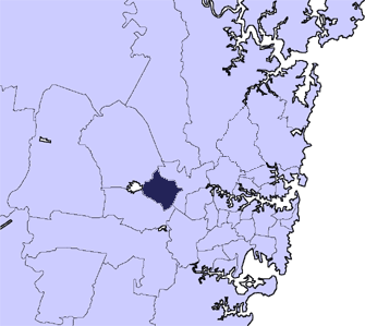
See Holroyd City Council, Merrylands, on the map
Public Transit to Holroyd City Council in Merrylands
Wondering how to get to Holroyd City Council in Merrylands, Australia? Moovit helps you find the best way to get to Holroyd City Council with step-by-step directions from the nearest public transit station.
Moovit provides free maps and live directions to help you navigate through your city. View schedules, routes, timetables, and find out how long does it take to get to Holroyd City Council in real time.
Looking for the nearest stop or station to Holroyd City Council? Check out this list of stops closest to your destination: Merrylands; Holroyd Private Hospital; Granville.
Bus:804806820916Train:T2T5T1
Want to see if there’s another route that gets you there at an earlier time? Moovit helps you find alternative routes or times. Get directions from and directions to Holroyd City Council easily from the Moovit App or Website.
We make riding to Holroyd City Council easy, which is why over 1.5 million users, including users in Merrylands, trust Moovit as the best app for public transit. You don’t need to download an individual bus app or train app, Moovit is your all-in-one transit app that helps you find the best bus time or train time available.
For information on prices of train and bus, costs and ride fares to Holroyd City Council, please check the Moovit app.
Use the app to navigate to popular places including to the airport, hospital, stadium, grocery store, mall, coffee shop, school, college, and university.
Location: Merrylands, Sydney
Attractions near Holroyd City Council
O'Connell Veronica Dr,Merrylands Library,Nemco Digital,Holroyd Community Aid Inc,Holroyd Centre Miller St,Merrylands Police Station,Merrylands Central Library,Cumberland Police Area Command,21-23 Newman St,15 Miller St,Holroyd Centre,38-40 Memorial Ave,Stand Corrected Podiatry,Merryland Top Quality Meats,B.G.B. Jewellery Pty Ltd,Mann-Hayek Alison,Merrylands RSL Club,Mr George Fattal,Sage 2160-Merrylands RSL,Taylor-Groenlund C.E, Groenlund J. & Doan S.How to get to popular attractions in Merrylands with public transportation
Lidcombe Station (Concourse), Lidcombe,Reuben Hills Coffee Roastery & Café, Surry Hills,UNSW, Kensington (NSW),The Dolphin Hotel, Surry Hills,Ivy, Sydney,Glenfield Station, Glenfield (NSW),Central, Haymarket,Cabramatta Station, Cabramatta,Ichi-ban Boshi (一番星), Sydney,Pennant Hills Station, Pennant Hills,Sutherland Station, Sutherland (NSW),The Beresford Hotel, Surry Hills,St James Station, Sydney,Adriano Zumbo Pâtissier, Pyrmont,Mortdale Station, Mortdale,Charlestown Square, Charlestown (NSW),University Of Newcastle (Callaghan Campus), Callaghan,Newcastle Airport (NTL), Williamtown,Padstow Station, Padstow,Revesby Station, RevesbyGet around Merrylands by public transport!
Travelling around Merrylands has never been so easy. See step by step directions as you travel to any attraction, street or major public transport station. View bus and train timetables, arrival times, service alerts and detailed routes on a map, so you know exactly how to get to anywhere in Merrylands.
When travelling to any destination around Merrylands use Moovit's Live Directions with Get Off Notifications to know exactly where and how far to walk, how long to wait for your line , and how many stops are left. Moovit will alert you when it’s time to get off — no need to constantly re-check whether yours is the next stop.
Wondering how to use public transport in Merrylands or how to pay for public transport in Merrylands? Moovit public transport app can help you navigate your way with public transport easily, and at minimum cost. It includes public transport fees, ticket prices, and costs. Looking for a map of Merrylands public transport lines? Moovit public transport app shows all public transport maps in Merrylands with all train or bus routes and stops on an interactive map.
Merrylands has 2 transport type(s), including: train or bus, operated by several transport agencies, including Sydney Metro, Sydney Trains, Sydney Light Rail, Sydney Ferries, Intercity Trains, Intercity Train, NSW TrainLink, CDC NSW R14, U-Go Mobility, Keolis Downer Northern Beaches, Manly Fast Ferry, Transdev John Holland Buses, Busways, Busways North West and Dysons Buslines