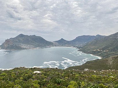
Directions to Hout Bay (Cape Town) with public transport
The following transport lines have routes that pass near Hout Bay
How to get to Hout Bay by bus?
Click on the bus route to see step by step directions with maps, line arrival times and updated time schedules.
Bus stops near Hout Bay in Cape Town
- Mariners Wharf, 4 min walk,
- Northshore, 4 min walk,
- Hout Bay, 20 min walk,
Bus lines to Hout Bay in Cape Town
- BLUE MINI PENINSULA TOUR, V&A Waterfront,
- 108, Adderley,
- 109, Adderley,
What are the nearest stations to Hout Bay?
The nearest stations to Hout Bay are:
- Mariners Wharf is 227 meters away, 4 min walk.
- Northshore is 237 meters away, 4 min walk.
- Hout Bay is 1527 meters away, 20 min walk.
Which bus lines stop near Hout Bay?
These bus lines stop near Hout Bay: 108, BLUE MINI PENINSULA TOUR.
What’s the nearest bus stop to Hout Bay in Cape Town?
The nearest bus stops to Hout Bay in Cape Town are Mariners Wharf and Northshore. The closest one is a 4 min walk away.
What time is the first bus to Hout Bay in Cape Town?
The 109 is the first bus that goes to Hout Bay in Cape Town. It stops nearby at 04:15.
What time is the last bus to Hout Bay in Cape Town?
The 108 is the last bus that goes to Hout Bay in Cape Town. It stops nearby at 20:29.
See Hout Bay, Cape Town, on the map
Public Transit to Hout Bay in Cape Town
Wondering how to get to Hout Bay in Cape Town, South Africa? Moovit helps you find the best way to get to Hout Bay with step-by-step directions from the nearest public transit station.
Moovit provides free maps and live directions to help you navigate through your city. View schedules, routes, timetables, and find out how long does it take to get to Hout Bay in real time.
Looking for the nearest stop or station to Hout Bay? Check out this list of stops closest to your destination: Mariners Wharf; Northshore; Hout Bay.
Bus: 108, BLUE MINI PENINSULA TOUR, 109.
Want to see if there’s another route that gets you there at an earlier time? Moovit helps you find alternative routes or times. Get directions from and directions to Hout Bay easily from the Moovit App or Website.
We make riding to Hout Bay easy, which is why over 1.5 million users, including users in Cape Town, trust Moovit as the best app for public transit. You don’t need to download an individual bus app or train app, Moovit is your all-in-one transit app that helps you find the best bus time or train time available.
For information on prices of bus and train, costs and ride fares to Hout Bay, please check the Moovit app.
Use the app to navigate to popular places including to the airport, hospital, stadium, grocery store, mall, coffee shop, school, college, and university.
Location: Cape Town
Attractions near Hout Bay
Mariners Wharf, Hout Bay,Lichtenstein Castle,Hout Bay,Villa de la Mer,Crazy Store Sea Point,Hout Bay Servi,Stewart Cardis,Two Oceans Sport Fishing Charters,The Ballet School,Ngonyama & Okpanum Associates,2 Oceans Maritime Academy,The Voetsek Kitchen,Sands and Hutchinson Physiotherapy,Mica,Glassmen,Hout Bay, South Africa,Tri Synergy Audio Visual,Deli Etc.,Hout Bay,Thomas ElectricalHow to get to popular attractions in Cape Town with public transportation
Koeberg,Checkers De Grendel, Bellville,Eskom Koeberg - Training Center, Malmesbury,China Town, Wynberg,Vega School Cape Town, Goodwood,Epping, Bellville,Nyanga Train Station, Mitchells Plain,85 Van Riebeeck Road, Kuils River,Fairbairn College, Bellville,Strand Beach,Brugstraat Sport Fields, Paarl,Grandwest Casino & Entertainment World, Bellville,Hazendal Wine Estate, Kuils River,N2 (Macassar Off Ramp), Somerset West,Cavendish Square, Mitchells Plain,Radeen Fashions Factory Shop, Bellville,Heathfield High School, Wynberg,Bellville South Police Station, Bellville,Simons Town Waterfront, Simon Town,MyCiti Bus Station Lagoon Beach, CapeGet around Cape Town by public transport!
Travelling around Cape Town has never been so easy. See step by step directions as you travel to any attraction, street or major public transport station. View bus and train timetables, arrival times, service alerts and detailed routes on a map, so you know exactly how to get to anywhere in Cape Town.
When travelling to any destination around Cape Town use Moovit's Live Directions with Get Off Notifications to know exactly where and how far to walk, how long to wait for your line , and how many stops are left. Moovit will alert you when it’s time to get off — no need to constantly re-check whether yours is the next stop.
Wondering how to use public transport in Cape Town or how to pay for public transport in Cape Town? Moovit public transport app can help you navigate your way with public transport easily, and at minimum cost. It includes public transport fees, ticket prices, and costs. Looking for a map of Cape Town public transport lines? Moovit public transport app shows all public transport maps in Cape Town with all Bus, Train and Funicular routes and stops on an interactive map.
Cape Town has 3 transport type(s), including: Bus, Train and Funicular, operated by several transport agencies, including Golden Arrow, MyCiTi, Metrorail Western Cape, Intercape, City Sightseeing Cpt