Directions to Indooroopilly Interchange with public transportation
The following transport lines have routes that pass near Indooroopilly Interchange
How to get to Indooroopilly Interchange by bus?
Click on the bus route to see step by step directions with maps, line arrival times and updated time schedules.
How to get to Indooroopilly Interchange by train?
Click on the train route to see step by step directions with maps, line arrival times and updated time schedules.
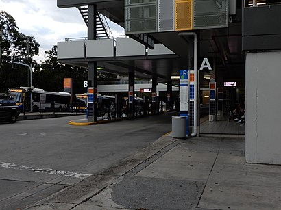
Bus stops near Indooroopilly Interchange
- Station Rd at Indooroopilly Shopping Ctr, Stop E, 1 min walk,
- Station Rd at Indooroopilly Shopping Ctr, Stop D, 1 min walk,
- Moggill Rd at Indooroopilly, Stop 25, 3 min walk,
- Moggill Rd at Rylatt Street, Stop 25, 5 min walk,
- Indooroopilly Interchange, 6 min walk,
- Indooroopilly Shopping Centre Station, Stop B, 6 min walk,
Train stations near Indooroopilly Interchange
- Chelmer Station, 12 min walk,
Bus routes to Indooroopilly Interchange
- 427, Chapel Hill - University Of Qld Express,
- 428, Chapel Hill - University Of Qld,
- 432, Kenmore - University Of Qld Express,
- 433, Kenmore South - City,
- 445, Fig Tree Pocket - City,
- 468, Oxley Station - Indooroopilly,
- 599, Great Circle Line Clockwise,
- 105, Indooroopilly Interchange,
- 106, Mt Ommaney Shopping Centre,
- 108, City, Eagle St at Riverside,
- 460, Heathwood, Parkwood Dr,
- N449, Spine St, Jamboree Heights,
- 414, Indooroopilly - University Of Qld Via Taringa,
- 415, Indooroopilly - City Via Taringa,
- 435, Brookfield - City Express,
- 598, Great Circle Line Anti-clockwise,
- 425, Chapel Hill - City Express,
- 430, Fig Tree Pocket - City Express,
- 444, Moggill - City Express,
- 450, Riverhills - City Express Via Mt Ommaney,
What are the nearest stations to Indooroopilly Interchange?
The nearest stations to Indooroopilly Interchange are:
- Station Rd at Indooroopilly Shopping Ctr, Stop E is 52 meters away, 1 min walk.
- Station Rd at Indooroopilly Shopping Ctr, Stop D is 53 meters away, 1 min walk.
- Moggill Rd at Indooroopilly, Stop 25 is 166 meters away, 3 min walk.
- Moggill Rd at Rylatt Street, Stop 25 is 342 meters away, 5 min walk.
- Indooroopilly Interchange is 425 meters away, 6 min walk.
- Indooroopilly Shopping Centre Station, Stop B is 450 meters away, 6 min walk.
- Chelmer Station is 935 meters away, 12 min walk.
Which bus line stops near Indooroopilly Interchange?
444
Which train line stops near Indooroopilly Interchange?
SPRI
What’s the nearest train station to Indooroopilly Interchange?
The nearest train station to Indooroopilly Interchange is Chelmer Station. It’s a 12 min walk away.
What’s the nearest bus stop to Indooroopilly Interchange?
The nearest bus stops to Indooroopilly Interchange are Station Rd at Indooroopilly Shopping Ctr, Stop E and Station Rd at Indooroopilly Shopping Ctr, Stop D. The closest one is a 1 min walk away.
What time is the first bus to Indooroopilly Interchange?
The N449 is the first bus that goes to Indooroopilly Interchange. It stops nearby at 03:33.
What time is the last bus to Indooroopilly Interchange?
The R599 is the last bus that goes to Indooroopilly Interchange. It stops nearby at 23:45.
See Indooroopilly Interchange on the map
Public Transportation to Indooroopilly Interchange
Wondering how to get to Indooroopilly Interchange, Australia? Moovit helps you find the best way to get to Indooroopilly Interchange with step-by-step directions from the nearest public transit station.
Moovit provides free maps and live directions to help you navigate through your city. View schedules, routes, timetables, and find out how long does it take to get to Indooroopilly Interchange in real time.
Looking for the nearest stop or station to Indooroopilly Interchange? Check out this list of stops closest to your destination: Station Rd at Indooroopilly Shopping Ctr; Station Rd at Indooroopilly Shopping Ctr; Moggill Rd at Indooroopilly; Moggill Rd at Rylatt Street; Indooroopilly Interchange; Indooroopilly Shopping Centre Station; Chelmer Station.
Bus: 444, 105, 106, 108, 427, 428, 432, 433, 445, 460, N449, 414, 415, 435, 598.Train: SPRI, CABO, IPSW, REDC, SUNS.
Want to see if there’s another route that gets you there at an earlier time? Moovit helps you find alternative routes or times. Get directions from and directions to Indooroopilly Interchange easily from the Moovit App or Website.
We make riding to Indooroopilly Interchange easy, which is why over 1.5 million users, including users in Indooroopilly, trust Moovit as the best app for public transit. You don’t need to download an individual bus app or train app, Moovit is your all-in-one transit app that helps you find the best bus time or train time available.
For information on prices of bus, train and ferry, costs and ride fares to Indooroopilly Interchange, please check the Moovit app.
Use the app to navigate to popular places including to the airport, hospital, stadium, grocery store, mall, coffee shop, school, college, and university.
Indooroopilly Interchange Address: Musgrave Rd Indooroopilly, 4068 Brisbane street in Indooroopilly
Attractions near Indooroopilly Interchange
How to get to popular places in Brisbane with public transit
Get around Indooroopilly by public transport!
Travelling around Indooroopilly has never been so easy. See step by step directions as you travel to any attraction, street or major public transport station. View bus and train timetables, arrival times, service alerts and detailed routes on a map, so you know exactly how to get to anywhere in Indooroopilly.
When travelling to any destination around Indooroopilly use Moovit's Live Directions with Get Off Notifications to know exactly where and how far to walk, how long to wait for your line , and how many stops are left. Moovit will alert you when it’s time to get off — no need to constantly re-check whether yours is the next stop.
Wondering how to use public transport in Indooroopilly or how to pay for public transport in Indooroopilly? Moovit public transport app can help you navigate your way with public transport easily, and at minimum cost. It includes public transport fees, ticket prices, and costs. Looking for a map of Indooroopilly public transport lines? Moovit public transport app shows all public transport maps in Indooroopilly with all bus, train or ferry routes and stops on an interactive map.
Indooroopilly has 3 transport type(s), including: bus, train or ferry, operated by several transport agencies, including TransLink SEQ, TransLink, TransLink, TransLink, Christensens Bus and Coach, North Stradbroke Island Buses and Griffith Uni Intercampus bus