See Ingrow, Keighley, on the map
Directions to Ingrow (Keighley) with public transport
The following transport lines have routes that pass near Ingrow
 Bus:
Bus: - Train:
How to get to Ingrow by bus?
Click on the bus route to see step by step directions with maps, line arrival times and updated time schedules.
How to get to Ingrow by train?
Click on the train route to see step by step directions with maps, line arrival times and updated time schedules.
Bus stations near Ingrow in Keighley
- Ingrow Lane South St,1 min walk,
- South Street Ingrow West Station,1 min walk,
- Halifax Rd Hainworth Lane,4 min walk,
- Ingrow Lane,4 min walk,
- Broomhill Grove,5 min walk,
Train stations near Ingrow in Keighley
- Keighley,40 min walk,
Bus lines to Ingrow in Keighley
- K16,Oldfield,
- B1,Stanbury,
- B2,Oakworth,
- B3,Oxenhope,
- 502,Halifax Town Centre,
- 67,Bradford City Centre,
- K9,Bracken Bank,
- K15,Lees,
What are the nearest stations to Ingrow?
The nearest stations to Ingrow are:
- Ingrow Lane South St is 58 meters away, 1 min walk.
- South Street Ingrow West Station is 61 meters away, 1 min walk.
- Halifax Rd Hainworth Lane is 255 meters away, 4 min walk.
- Ingrow Lane is 299 meters away, 4 min walk.
- Broomhill Grove is 369 meters away, 5 min walk.
- Keighley is 3112 meters away, 40 min walk.
Which bus lines stop near Ingrow?
These bus lines stop near Ingrow: 67, B1, B2, B3.
Which train line stops near Ingrow?
NORTHERN
What’s the nearest bus stop to Ingrow in Keighley?
The nearest bus stops to Ingrow in Keighley are Ingrow Lane South St and South Street Ingrow West Station. The closest one is a 1 min walk away.
What time is the first train to Ingrow in Keighley?
The NORTHERN is the first train that goes to Ingrow in Keighley. It stops nearby at 05:42.
What time is the last train to Ingrow in Keighley?
The NORTHERN is the last train that goes to Ingrow in Keighley. It stops nearby at 23:49.
What time is the first bus to Ingrow in Keighley?
The 67 is the first bus that goes to Ingrow in Keighley. It stops nearby at 05:56.
What time is the last bus to Ingrow in Keighley?
The B2 is the last bus that goes to Ingrow in Keighley. It stops nearby at 23:20.
How much is the train fare to Ingrow?
The train fare to Ingrow costs about £3.20 - £10.90.
See Ingrow, Keighley, on the map
Public Transit to Ingrow in Keighley
Wondering how to get to Ingrow in Keighley, United Kingdom? Moovit helps you find the best way to get to Ingrow with step-by-step directions from the nearest public transit station.
Moovit provides free maps and live directions to help you navigate through your city. View schedules, routes, timetables, and find out how long does it take to get to Ingrow in real time.
Looking for the nearest stop or station to Ingrow? Check out this list of stops closest to your destination: Ingrow Lane South St; South Street Ingrow West Station; Halifax Rd Hainworth Lane; Ingrow Lane; Broomhill Grove; Keighley.
Bus:Train:
Want to see if there’s another route that gets you there at an earlier time? Moovit helps you find alternative routes or times. Get directions from and directions to Ingrow easily from the Moovit App or Website.
We make riding to Ingrow easy, which is why over 1.5 million users, including users in Keighley, trust Moovit as the best app for public transit. You don’t need to download an individual bus app or train app, Moovit is your all-in-one transit app that helps you find the best bus time or train time available.
For information on prices of bus and train, costs and ride fares to Ingrow, please check the Moovit app.
Use the app to navigate to popular places including to the airport, hospital, stadium, grocery store, mall, coffee shop, school, college, and university.
Location: Keighley, Yorkshire
Attractions near Ingrow
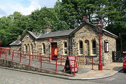
Craven & Halifax,Amazon Counter-Ingrow Bridge Minimart,Autobodyz Body Shop,MoneyGram,Ingrow West Railway Station,Canvas Style Art,Nelisaziyanda,Ingrow West Station,Howden Hall Mobility,Ingrow,AJ Renovators,Saint Joseph's Church,Supported Housing for People with Mental Health,Costa Coffee,Keighley Cleaning Services,Amazon Counter-Staveley Stores,Virgin Hair Couture,Queens Road,The Bearded Valet,Ingrow Primary SchoolHow to get to popular attractions in Keighley with public transportation
Wetherby, Wetherby,Princes Quay Shopping Centre, Hull,Castle Hill Hospital, Cottingham,Becketts Bank (Wetherspoon), Leeds,Oxley Residences, Leeds,The Bankers Draft (Wetherspoon), Sheffield,Sainsbury's Leeds Colton, Leeds,Asda, Morley,Thornbury Barracks, Leeds,The Cuthbert Broderick (Wetherspoon), Leeds,David Lloyd York, York,Hillsborough Exchange, Sheffield,Holbeck, Leeds,Notre Dame High School, Sheffield,Robin Hood Airport (DSA), Finningley,York Designer Outlet, Fulford,St James's Hospital A&E, Leeds,Calderdale Royal Hospital, Halifax,Clifton Green, York,Huddersfield Royal Infirmary, HuddersfieldGet around Keighley by public transport!
Travelling around Keighley has never been so easy. See step by step directions as you travel to any attraction, street or major public transport station. View bus and train timetables, arrival times, service alerts and detailed routes on a map, so you know exactly how to get to anywhere in Keighley.
When travelling to any destination around Keighley use Moovit's Live Directions with Get Off Notifications to know exactly where and how far to walk, how long to wait for your line , and how many stops are left. Moovit will alert you when it’s time to get off — no need to constantly re-check whether yours is the next stop.
Wondering how to use public transport in Keighley or how to pay for public transport in Keighley? Moovit public transport app can help you navigate your way with public transport easily, and at minimum cost. It includes public transport fees, ticket prices, and costs. Looking for a map of Keighley public transport lines? Moovit public transport app shows all public transport maps in Keighley with all bus or train routes and stops on an interactive map.
Keighley has 2 transport type(s), including: bus or train, operated by several transport agencies, including First Leeds, First South Yorkshire, First York, First West Yorkshire Ltd, Arriva Yorkshire, Stagecoach Yorkshire, National Rail, First Bradford, First Halifax, Calder Valley & Huddersfield, East Yorkshire, The Keighley Bus Company, South Yorkshire Future Tram, The Harrogate Bus Company, National Rail and TM Travel